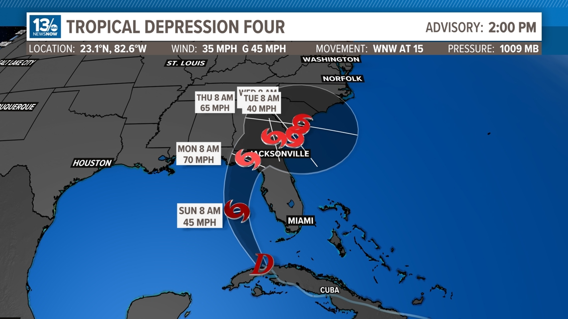
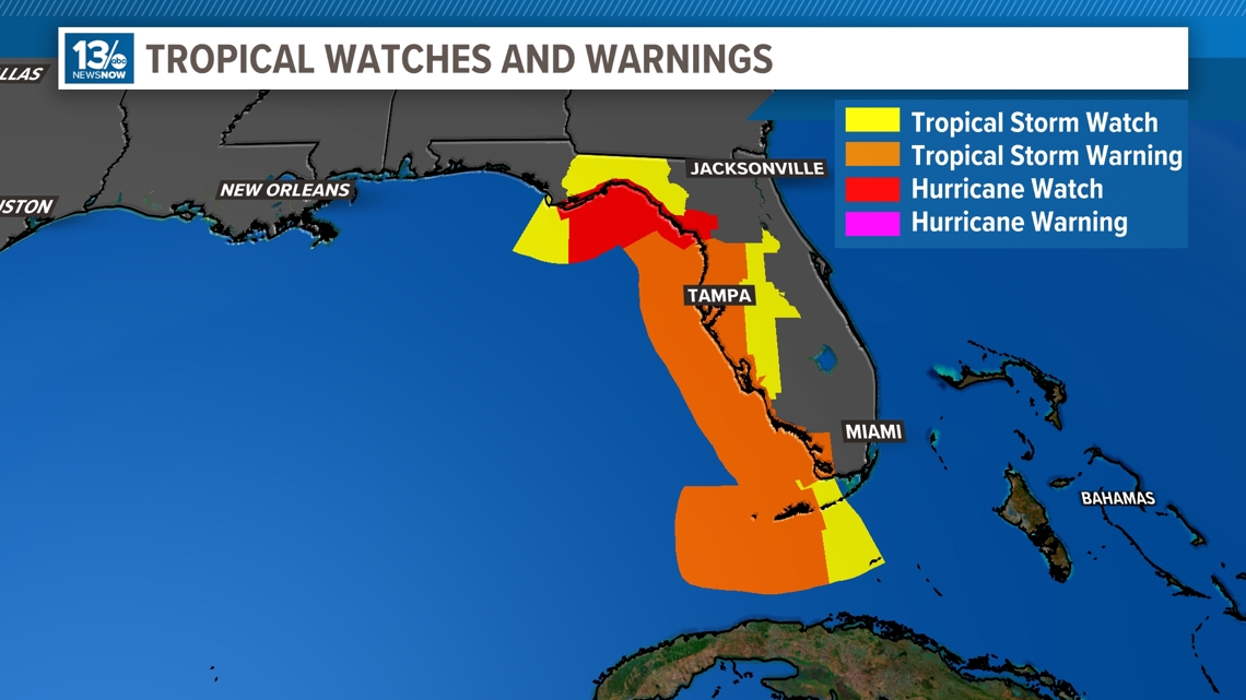
ATLANTIC BEACH, Fla. — Tropical Depression Four formed along the southern coast of Cuba Friday evening, with winds of 30 mph. As of Saturday morning, the system sits directly over Cuba and a Hurricane Watch has been issued for Florida's northern Gulf Coast.
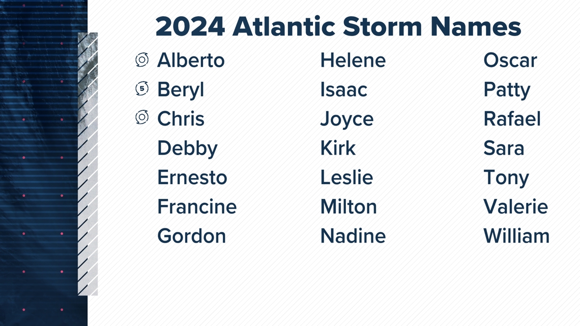
The depression will continue to strengthen, likely becoming Topical Storm Debby late Saturday as it moves into the Gulf of Mexico.
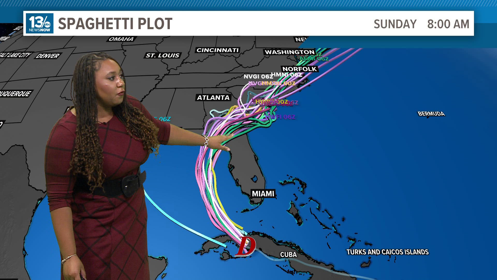
The most recent models have shifted the storms track more towards the north and west. Debby is likely to make landfall in the Big Bend area of Florida and the track takes it over the peninsula where it could either stay over land heading into Georgia, allowing it to weaken back into a depression, becoming mostly a rain maker.
On the flip side, it also has the potential to go back over the warm waters of the Gulf Stream and Atlantic Ocean, where it could strengthen into a stronger tropical storm.
The most concerning update is the possibility of the storm stalling if it gets back out off the coast of Geogia/FL/SC. This could cause an increase in rainfall for these areas, leading to flash flooding along with a potential for increased storm surge.


This is something to monitor over the next couple of days and we will continue to provide the most up to date information.
For now, tropical storm watches and warnings have been issued for eastern parts of Florida, with impacts starting within the next 24 hours. Additionally, a hurricane watch is in effect for parts of the northern Florida coastline.
The 13News Now weather team will be monitoring all of this closely. We will be frequently updating the tropical outlooks so check back over the coming days for the latest.


