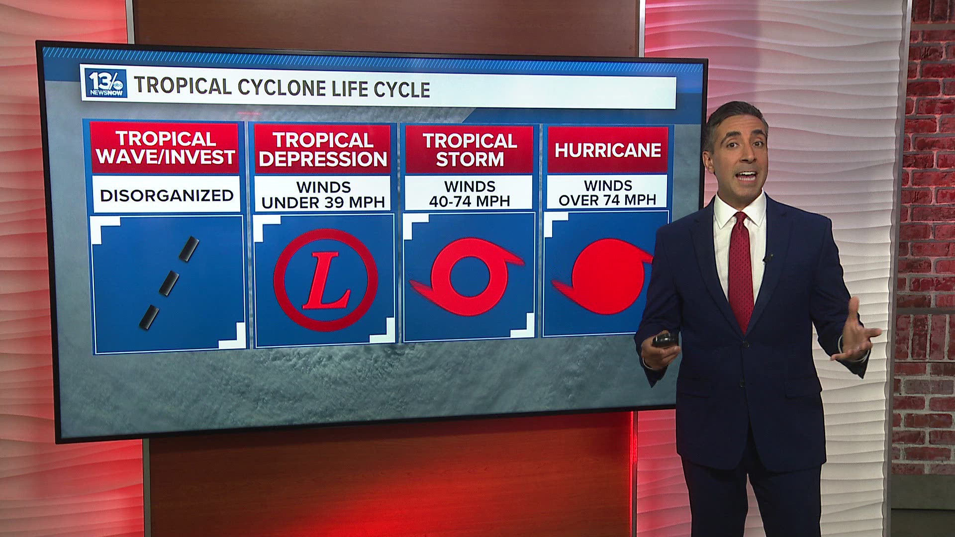
NORFOLK, Va. — Throughout every hurricane season, we hear talk about tropical waves in the Atlantic, which turn into "invests" and then "potential tropical cyclones." If they gather enough steam, they upgrade to tropical depressions, tropical storms, and then finally, hurricanes.
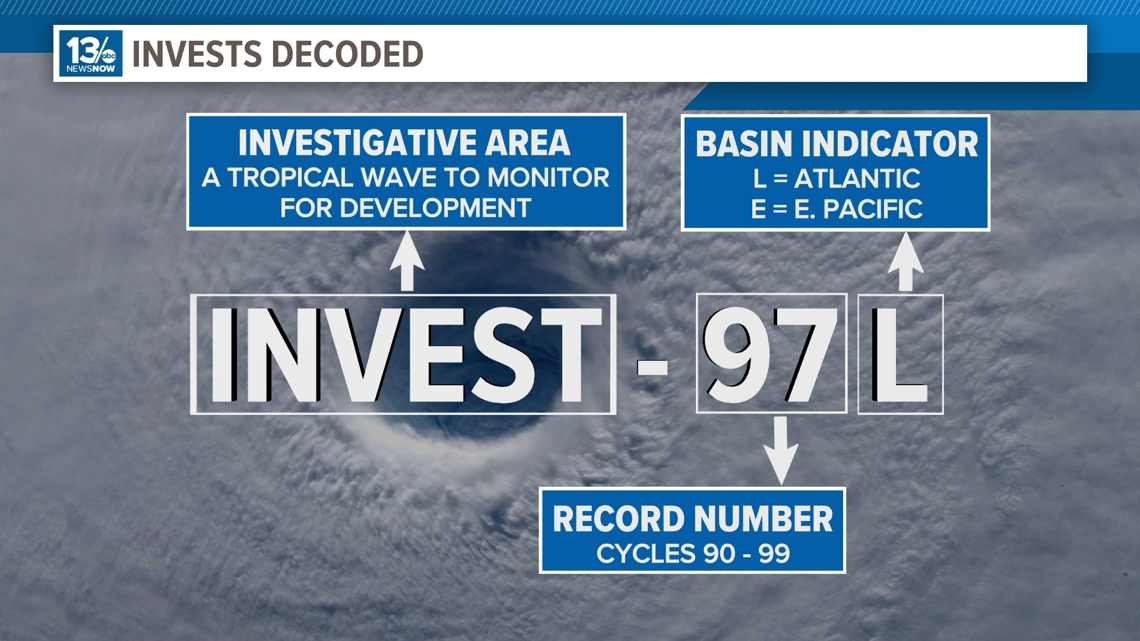
Earlier this week, we had a tropical wave way out in the Atlantic Ocean that moved its way westward into the Caribbean, where it brought some showers and storms to the islands. The National Hurricane Center slowly upticked its chances of development and dubbed it "Invest-97L."
But what actually is an invest?
Invest is short for "investigative area." That designation allows the National Hurricane Center to monitor the area of disturbed weather for further development and also prompts the hurricane hunter aircraft to fly into the area.
The numbers, cycled from 90-99, are used for record-keeping while the "L" is used to show that it's in the Atlantic Ocean; E is used for invests that form in the Pacific Ocean.

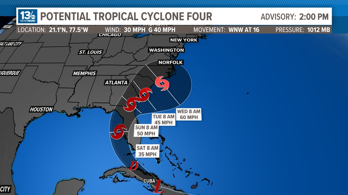
As of early Friday, the National Hurricane Center updated Invest-97L to Potential Tropical Cyclone (PTC) Four. PTC is a term used to describe a disturbance or wave that has yet to develop into a tropical cyclone but poses a threat to land within 48 hours.
This allows for the NHC to put up tropical storm watches and warnings, along with a forecast cone, even though a tropical depression still has not formed. It gives people more time to get prepared for tropical storm conditions.
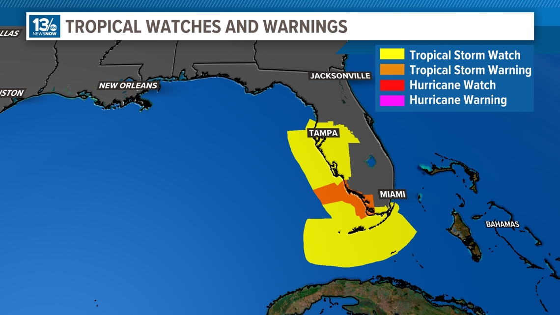
Tropical Storm watches and warnings have been issued for parts of Florida from Key West and all the way up the coast to Tampa Bay.

By Saturday morning, PTC 4 is likely to become Tropical Depression Four and by Sunday, we should have our fourth named storm in the 2024 Atlantic Hurricane Season: Tropical Storm Debby.
This is likely to bring heavy rain and gusty winds to eastern portions of Florida, before moving northeast and potentially back over the warm waters of the Gulf Stream, where it could bring potential impacts to the Outer Banks in North Carolina.