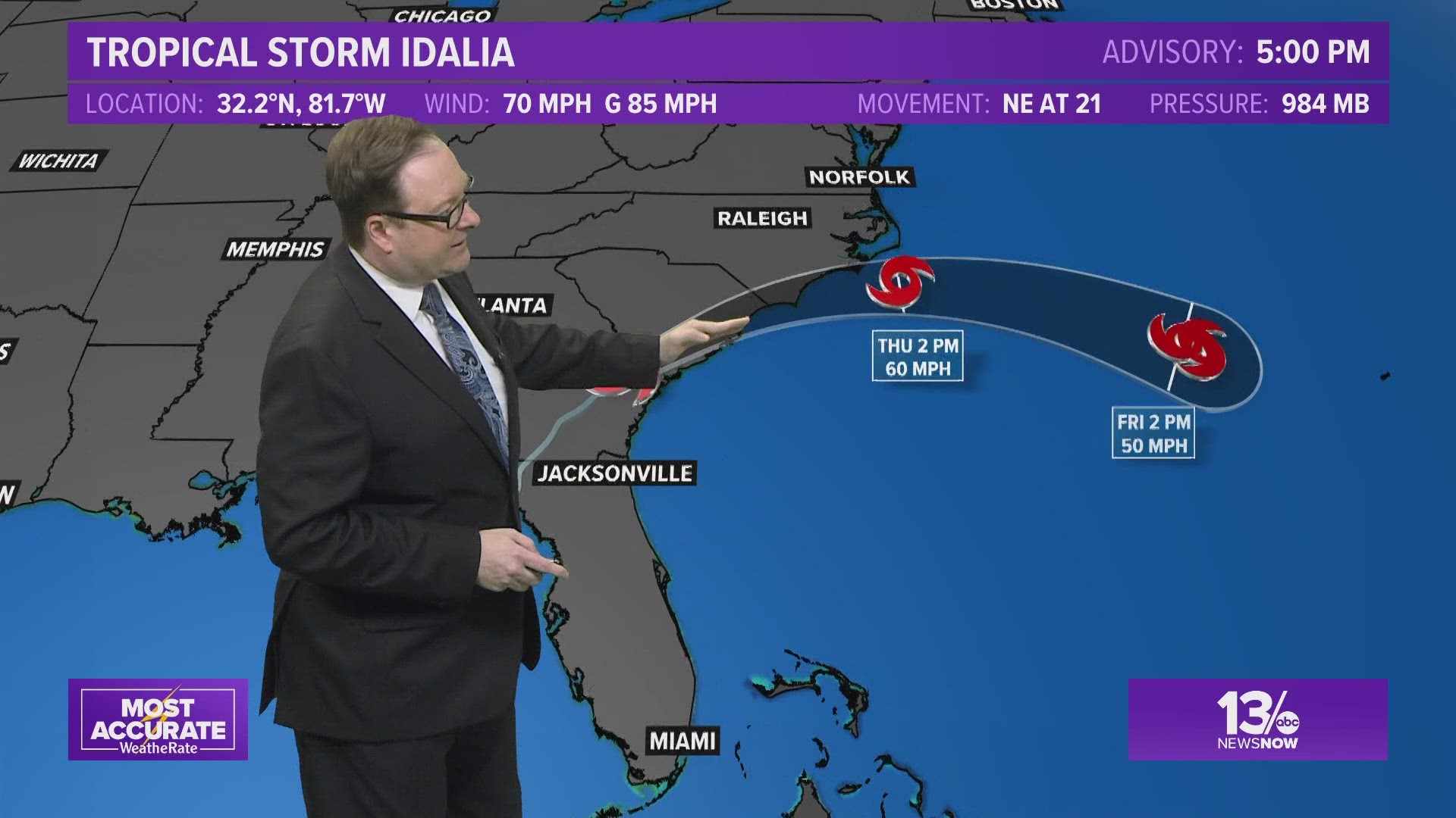
NORFOLK, Va. — Editor's note: Follow the latest updates by tapping or clicking here for the Thursday Idalia forecast.
Idalia's center is back out over water and moving quickly to the east-northeast.
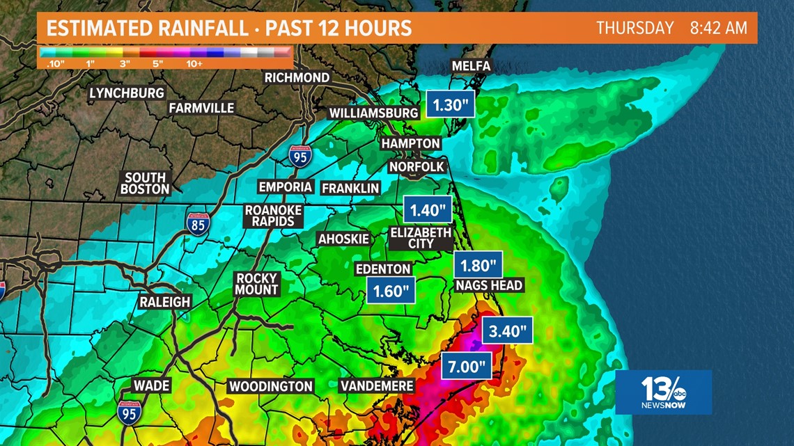
The system has produced heavy rain over portions of North Carolina and steady rain across Hampton Roads Thursday morning.
Here is a look at radar rainfall estimates over a 12-hour period ending around 8:30AM

RELATED: Tropical Storm Warning issued for Outer Banks as North Carolina prepares for Hurricane Idalia

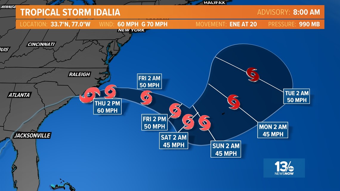
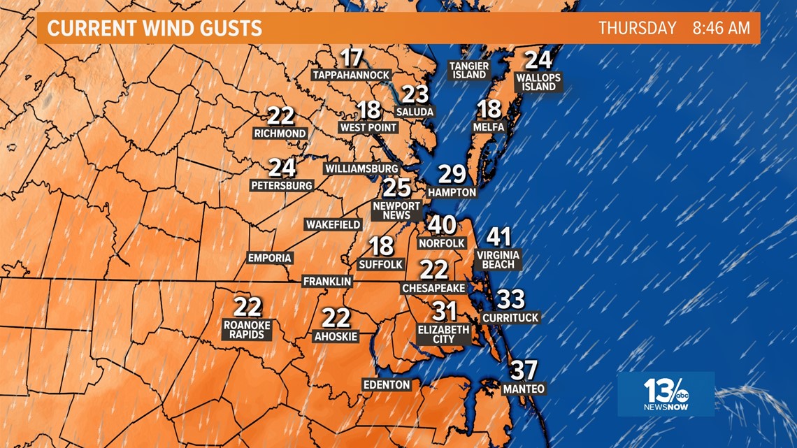
Tropical storm force winds are expected to impact much of Hampton Roads with the strongest winds occurring throughout the Outer Banks. Wind speeds of 20-30 mph are expected with wind gusts surpassing 50 mph at times.

The gusty northeast are driving tide levels well above normal and minor to moderate tidal flooding is expected for Hampton Roads.
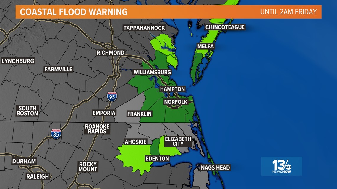
Coastal Flood Warnings (Dark Green) and Coastal Flood Advisories (Light Green) have been issued for areas around the Chesapeake Bay, Albemarle Sound and along the Atlantic.


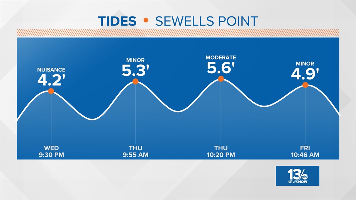

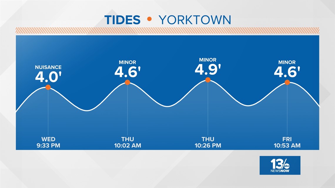

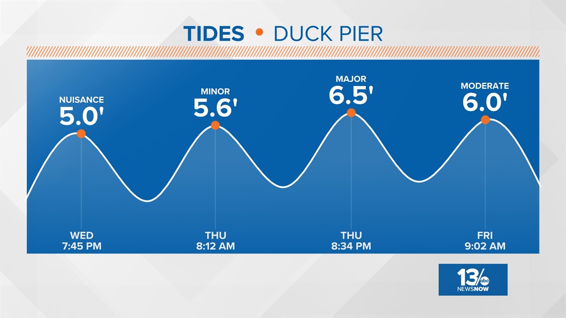
As the winds decrease Friday the tidal departures will get closer to normal and the weekend is looking much better across Hampton Roads.
So far this year, the U.S. East Coast has been spared from cyclones but in the West, Tropical Storm Hilary caused widespread flooding, mudslides, and road closures earlier this month in Mexico, California, Nevada, and points to the north.
The National Oceanic and Atmospheric Administration recently said the 2023 hurricane season would be far busier than initially forecast, partly because of extremely warm ocean temperatures. The season runs through Nov. 30, with August and September typically the peak.
The Associated Press contributed to this report.

