
NORFOLK, Va. — Our focus early next week will be on a developing area of low pressure off the southeast coast of the United States. This area of low pressure, according to the National Hurricane Center, now has a moderate chance of becoming our next named storm, Helene.
Per their latest outlook: "A non-tropical area of low pressure could form this weekend and acquire subtropical or tropical characteristics... Thereafter, a subtropical or tropical depression could form."
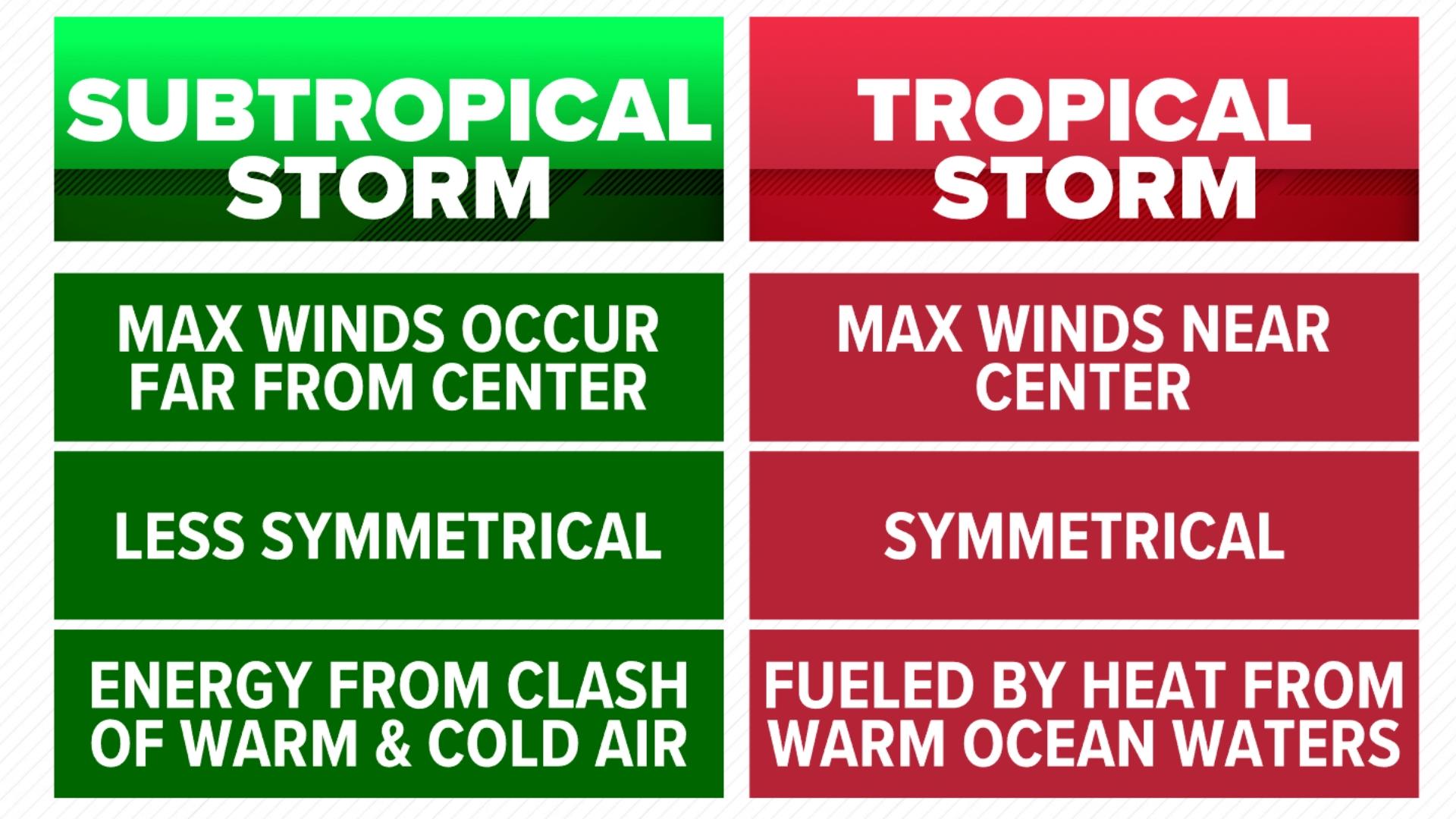
So, what is the difference between a subtropical storm (or in this case depression) and tropical storm?

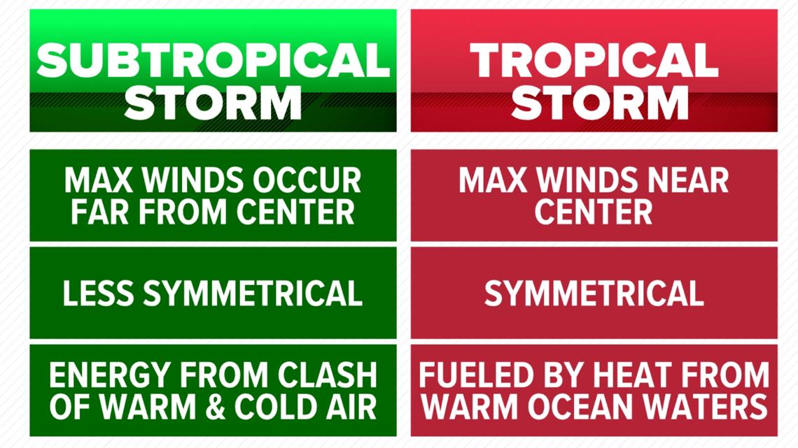
The location of the maximum winds is a big indicator of its status. A subtropical storm will register its strongest winds well displaced from the center. Meanwhile, inside a tropical storm, those max winds will be near the center.
The presentation on both satellite imagery and even radar if in range is telling, too. A subtropical storm is asymmetrical or lopsided, some correlate its look to a comma or even a shrimp.
A major differing characteristic of the two is how they gather their energy. A subtropical storm will gain strength from the clash between cold and warm air masses as well as baroclinic processes. Meanwhile, a tropical storm will solely pull energy from the warm ocean waters which is why they quickly dissipate once away from them.
Regardless of a development and gaining a name, this system will transition our area to an unsettled pattern and much of the area may see several inches of rain next week. Stay dry, Hampton Roads!