
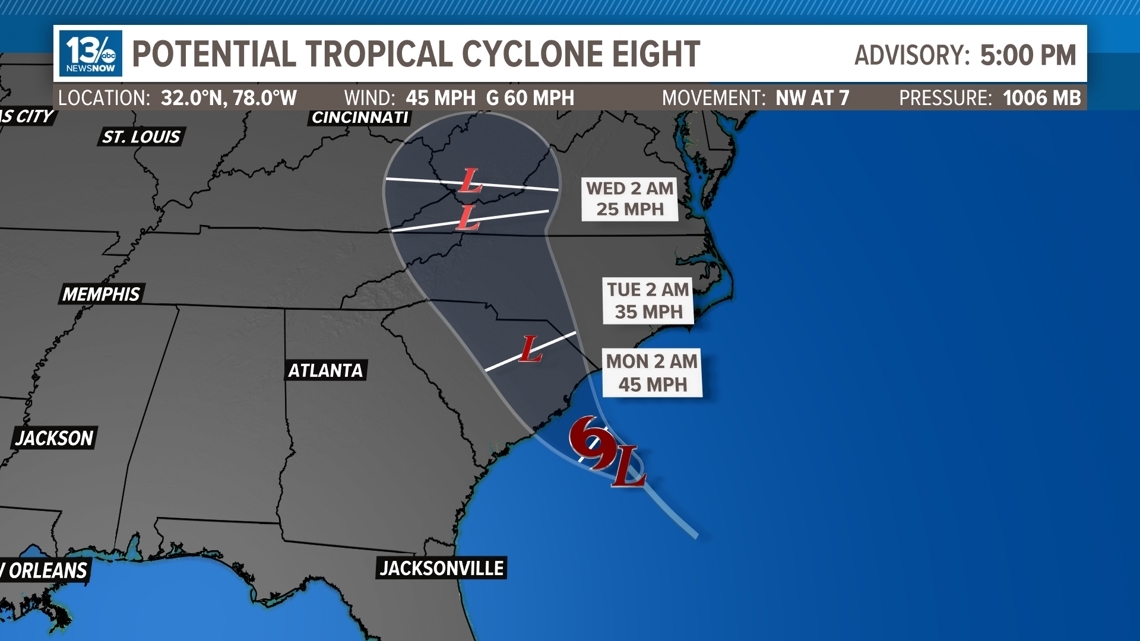
NORFOLK, Va. — The National Hurricane Center (NHC) has designated the low-pressure system off the coast of South Carolina as Potential Tropical Cyclone 8. The NHC deems a system as a PTC if there is a high likely hood of tropical development and is going to affect land within the next 48 hours.

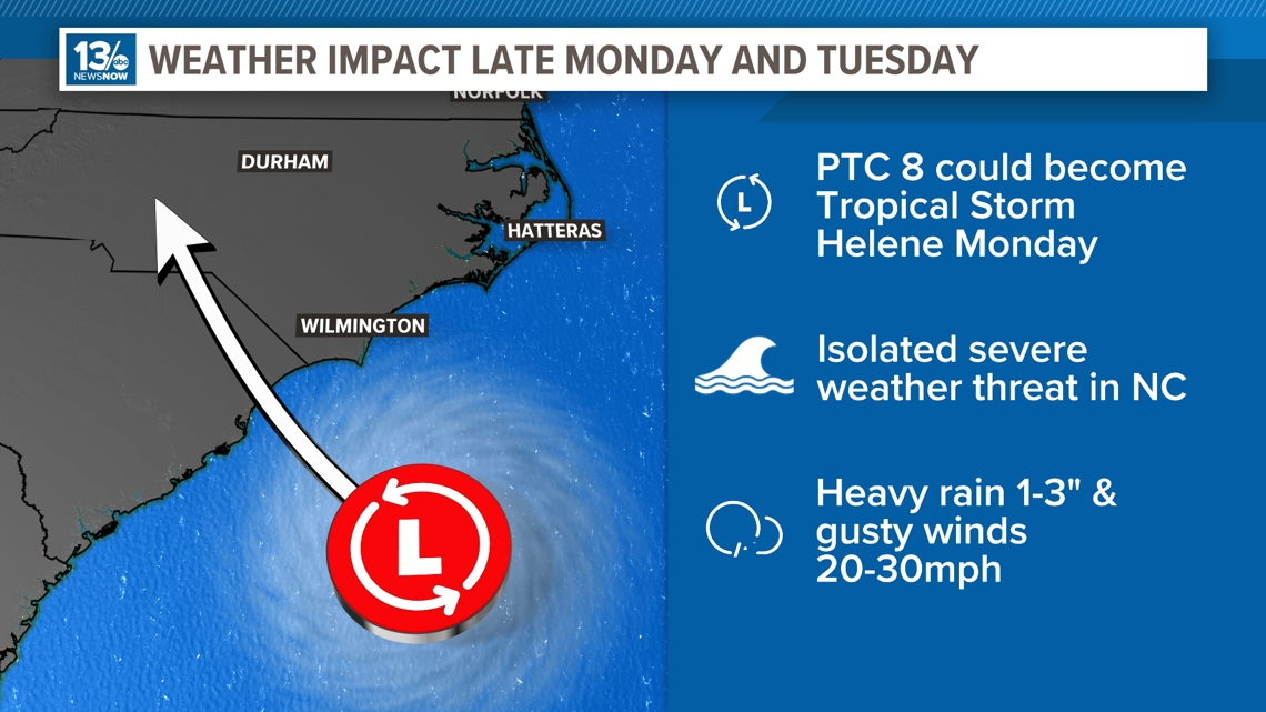
With warm ocean water temperatures, some tropical or subtropical development is possible early next week.
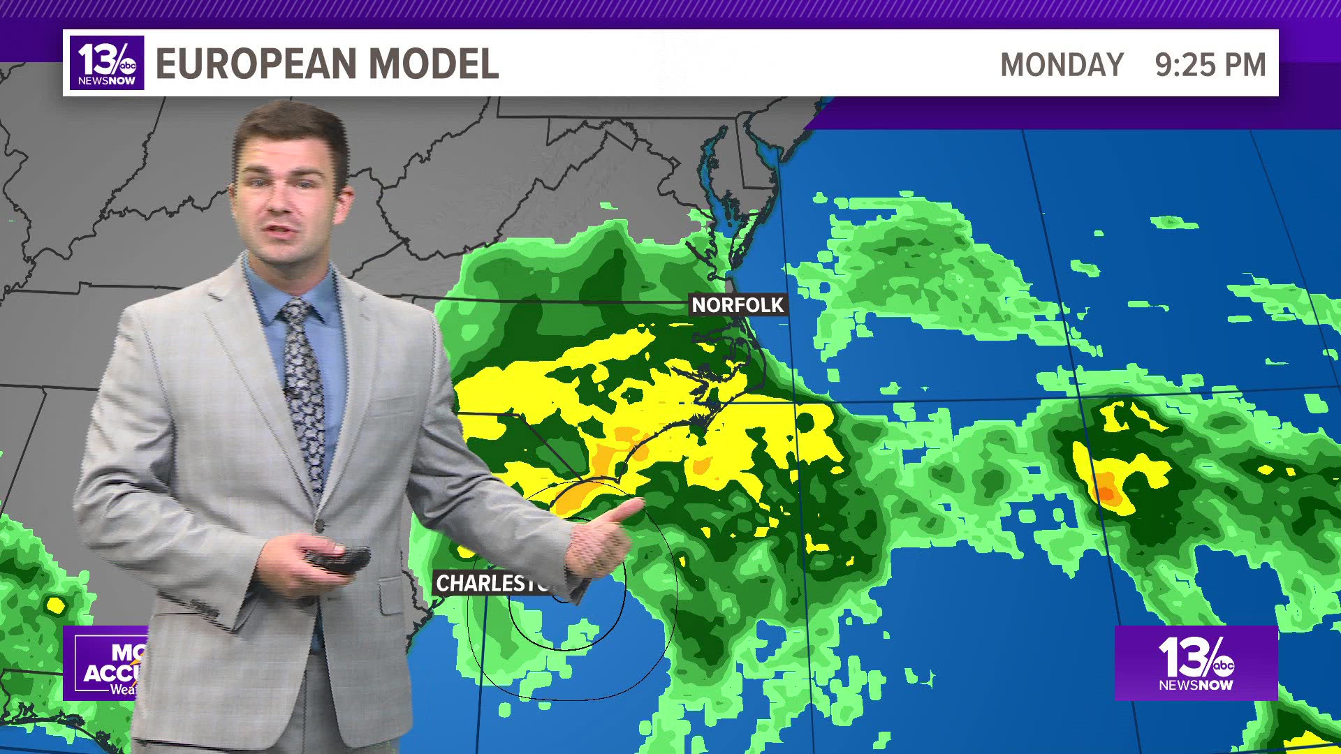
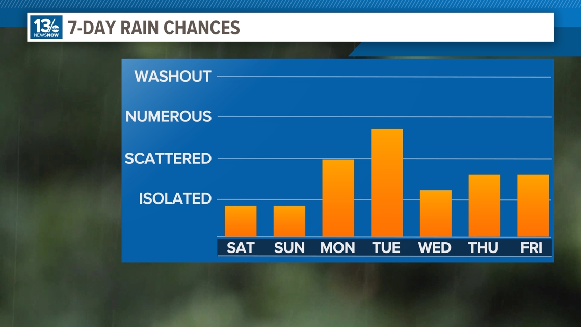
Regardless of development, it looks likely that we will see an increasing chance of locally heavy rainfall much of next week.

Right now, the National Hurricane Center gives the area about a 50% chance of development. One thing working against the system is strong winds in the upper levels of the atmosphere. These winds, combined with dry air nearby and a relatively short development window, will likely prevent the system from strengthening substantially.
For now, the forecast calls for mainly dry weather through the weekend, although east-to-northeast winds may bring a few sprinkles or light showers to coastal areas along the Southside and northeastern North Carolina. Gusty onshore winds may also bring some minor tidal flooding to coastal areas late Sunday.

Rain chances increase Monday, though the exact timing and rainfall intensity will be determined by the potential coastal low.
The forecast will likely change and is dependent on where the area of low pressure develops and where it moves.