
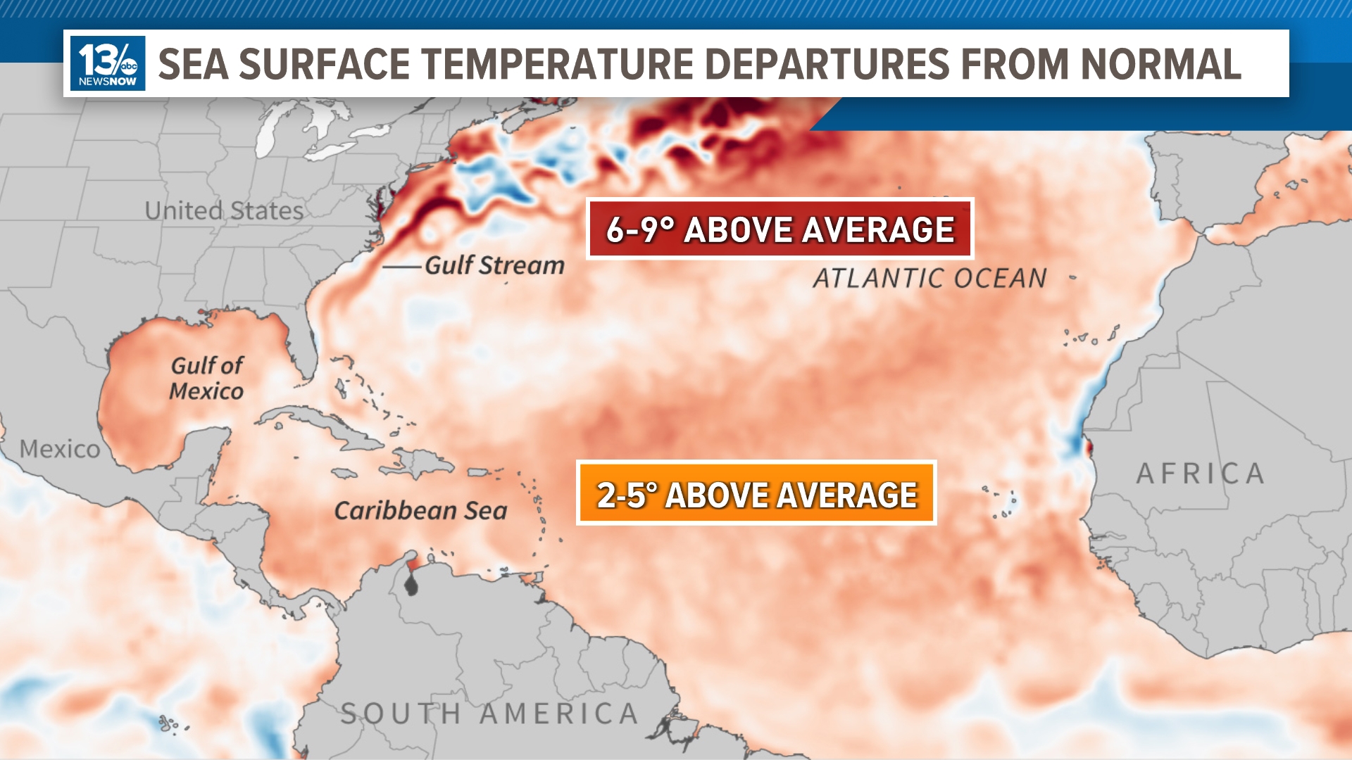
NORFOLK, Va. — The North Atlantic sea surface is warm, really warm. In fact, water surface temperatures have been record-warm since March of 2023.
Currently, water temperatures in the Caribbean Sea and Gulf of Mexico are in the lower to mid-80s and the warm waters extend through most of the Atlantic basin.
RELATED: 13News Now Hurricane Guide
This can contribute to several issues. We're already starting to see increased tropical activity, and the Cape Verde storm season may get an earlier start.
Tropical storms and hurricanes that form in the eastern Atlantic near the Cape Verde Islands and move across the ocean are more typical in late summer, around August and September, after sea surfaces have warmed.
But with the water so warm already, we are seeing some activity across the ocean that bears watching. Early Wednesday morning, a tropical wave a few hundred miles southwest of the Cabo Verde Islands was producing disorganized showers and thunderstorms.

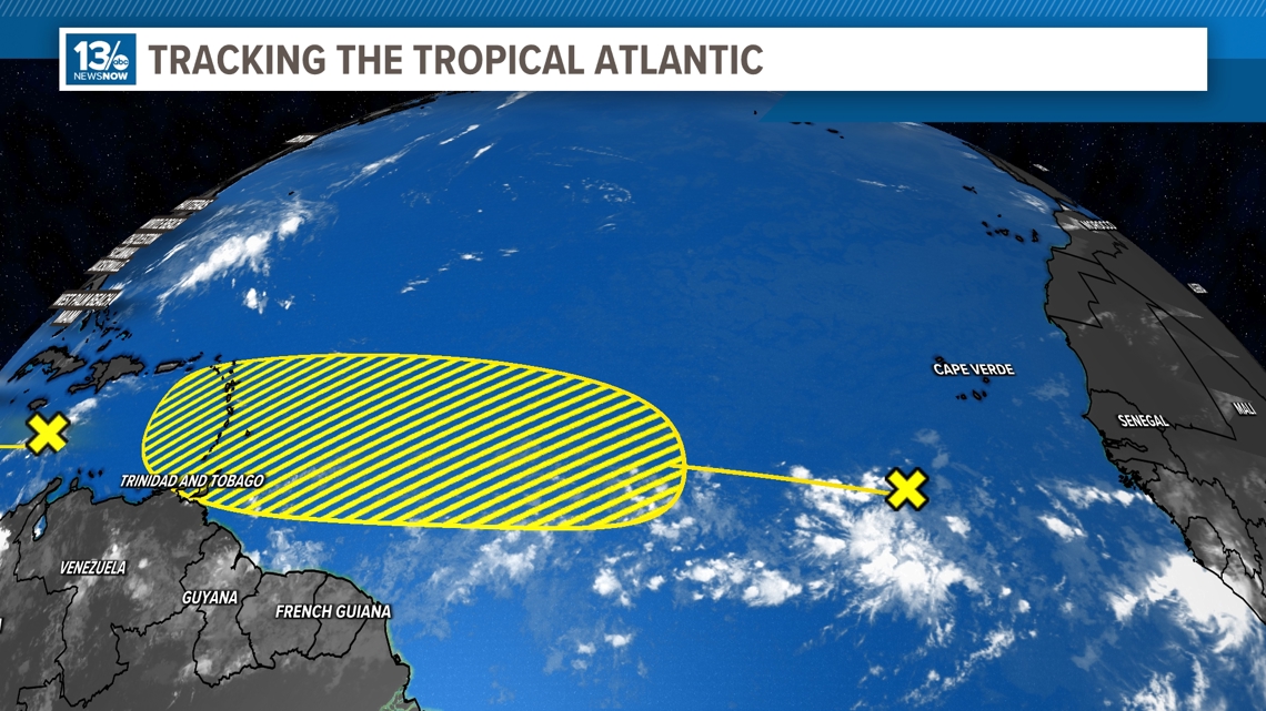
As the system moves westward over the warm central and western tropical Atlantic waters in the coming days, there is a chance for development.
According to NOAA's Climate.gov website, most of the Atlantic Basin has been 2-5°F above the 30-year average (1971-2000). But a few areas indicate even higher warmth, 6-9° above the average. This includes areas along the Gulf Stream, coastal waters along the northeast United States, and some of the Atlantic in the northern latitudes.


13News Now will continue to monitor all the potential impacts as well as developments throughout the Atlantic Hurricane Season, so keep checking back for updates.