
NORFOLK, Va. — Every year, we see tropical systems churning through the Atlantic Ocean either staying out to sea, heading towards the eastern seaboard or into the Caribbean and the Gulf of Mexico. But what is actually causing these systems to move in one direction from the other? The Bermuda High.
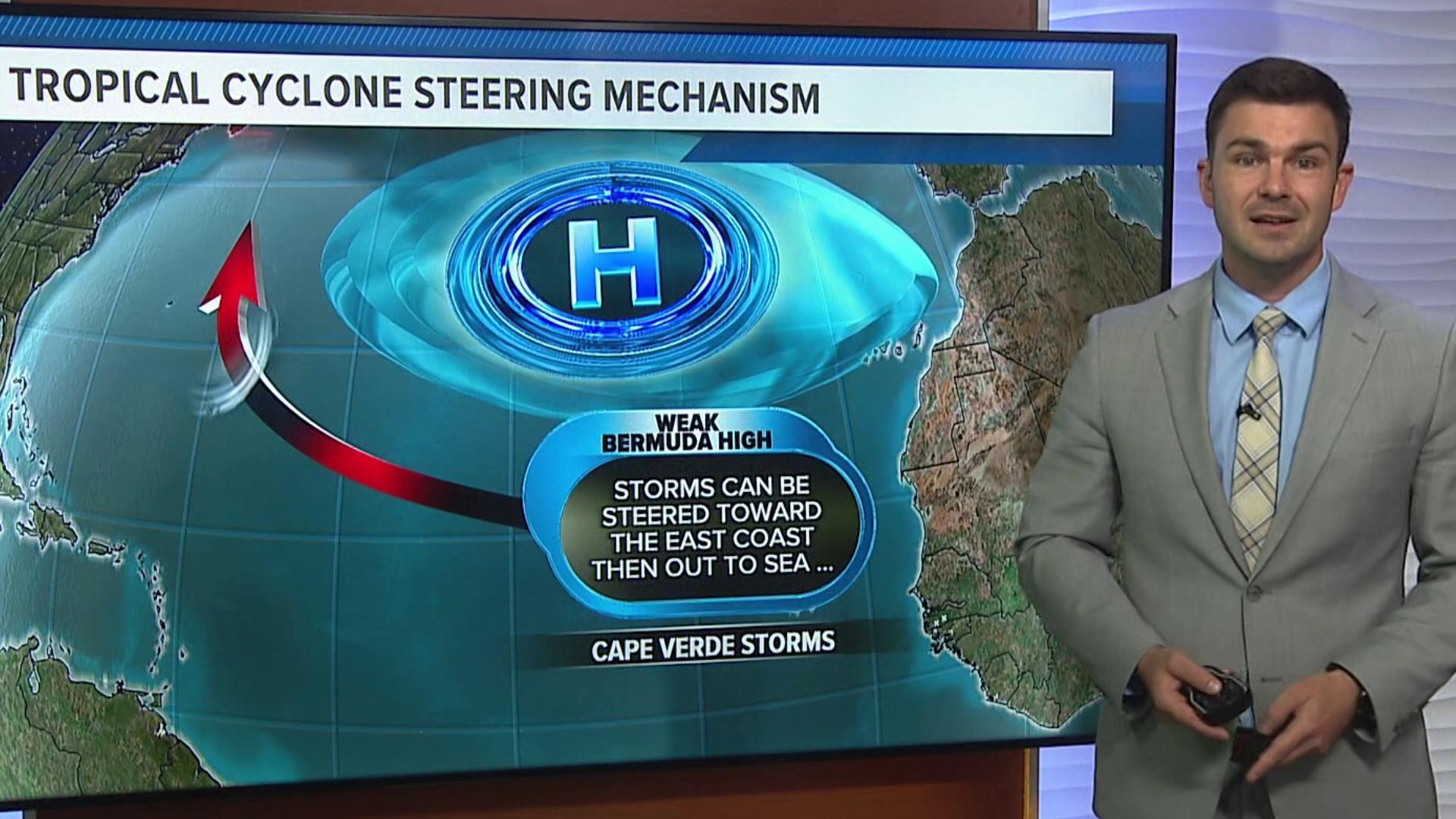
The Bermuda High, also known as the Azores High (depending on where in the Atlantic it's located), is a semi-permanent high-pressure system located in the Atlantic Ocean. This weather system plays a crucial role in steering hurricanes in the Atlantic.

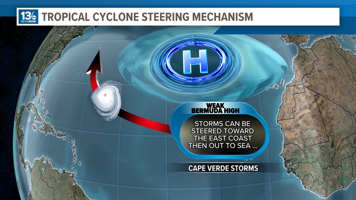
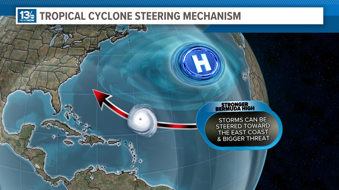
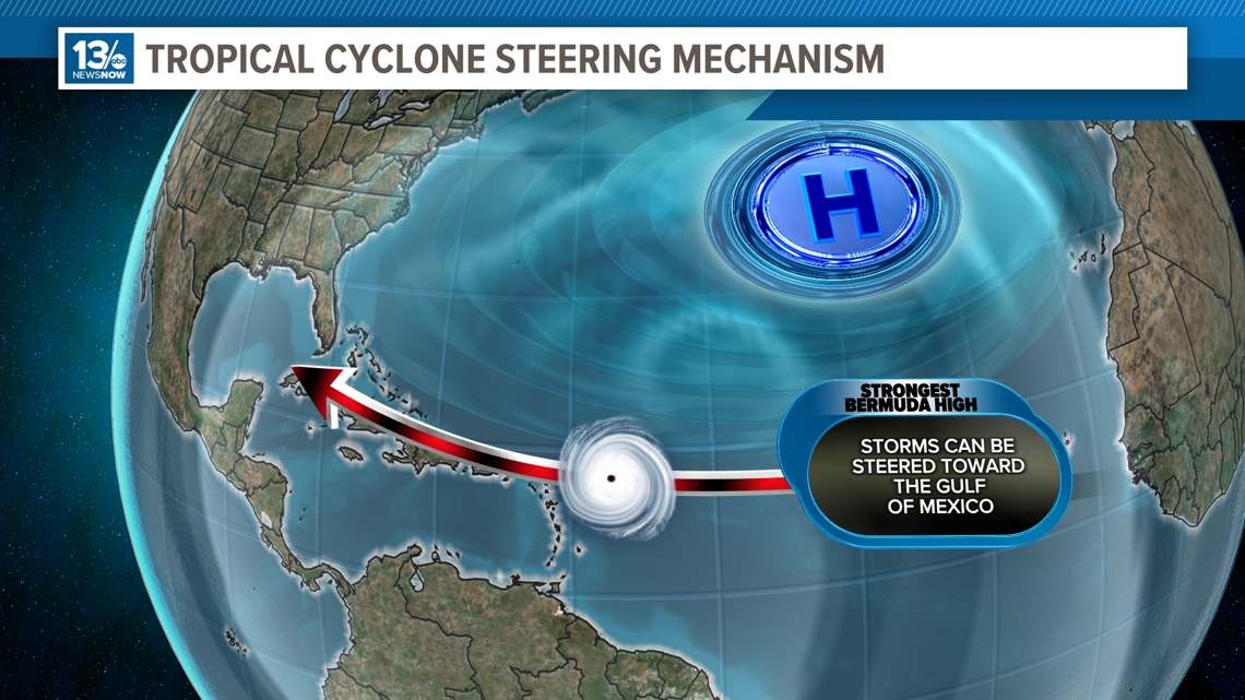
The position and strength of the Bermuda High influence the paths that hurricanes can take. When the Bermuda High is strong and extends westward, it can act as a barrier forcing hurricanes to move northward or westward around it. If the Bermuda High weakens or shifts towards the east, it can allow hurricanes to track more poleward or out to sea.
During the summer and fall months, the Bermuda High tends to be stronger, which results in hurricanes moving westward across the Atlantic towards the Caribbean, Gulf of Mexico or the East Coast. In the later part of hurricane season, the Bermuda High can be weaker, allowing hurricanes to track more toward the north and out to sea.

The strength of the Bermuda High can vary on a few factors such as the sea surface temperatures and the contrast between land and ocean temperatures. If the ocean temperatures are very warm, it can strengthen the high and vice versa.
During the summer, when the land heats up, the temperature contrast between the warm land and cooler ocean waters can intensify the high-pressure system, allowing it to grow stronger. Warm air rising over the land creates a low-pressure area in which the cooler air over the ocean sinks, forming a high-pressure system.
Overall, a combination of land-sea temperature contrasts, atmospheric dynamics and ocean temperatures all contribute to whether the Bermuda High will be weak or strong.

The interaction between the Bermuda High and other weather systems such as troughs or fronts can further complicate hurricane steering. These dynamics can cause hurricanes to meander, stall or accelerate along their paths.
For example, if a hurricane is moving north along the eastern seaboard and a cold front is moving in from the west, it can push the hurricane away from the coast and take it back east out into sea or, if there is another "blocking high" pressure system over Nova Scotia, it can turn the tropical cyclone back towards the eastern seaboard.
The Bermuda High's position and strength significantly impact how hurricanes are steered in the Atlantic. Understanding the behavior of this high-pressure system is crucial for meteorologists to accurately predict the track of hurricanes.
RELATED: