
NORFOLK, Va. — We have another tropical wave for the 2024 Atlantic hurricane season.
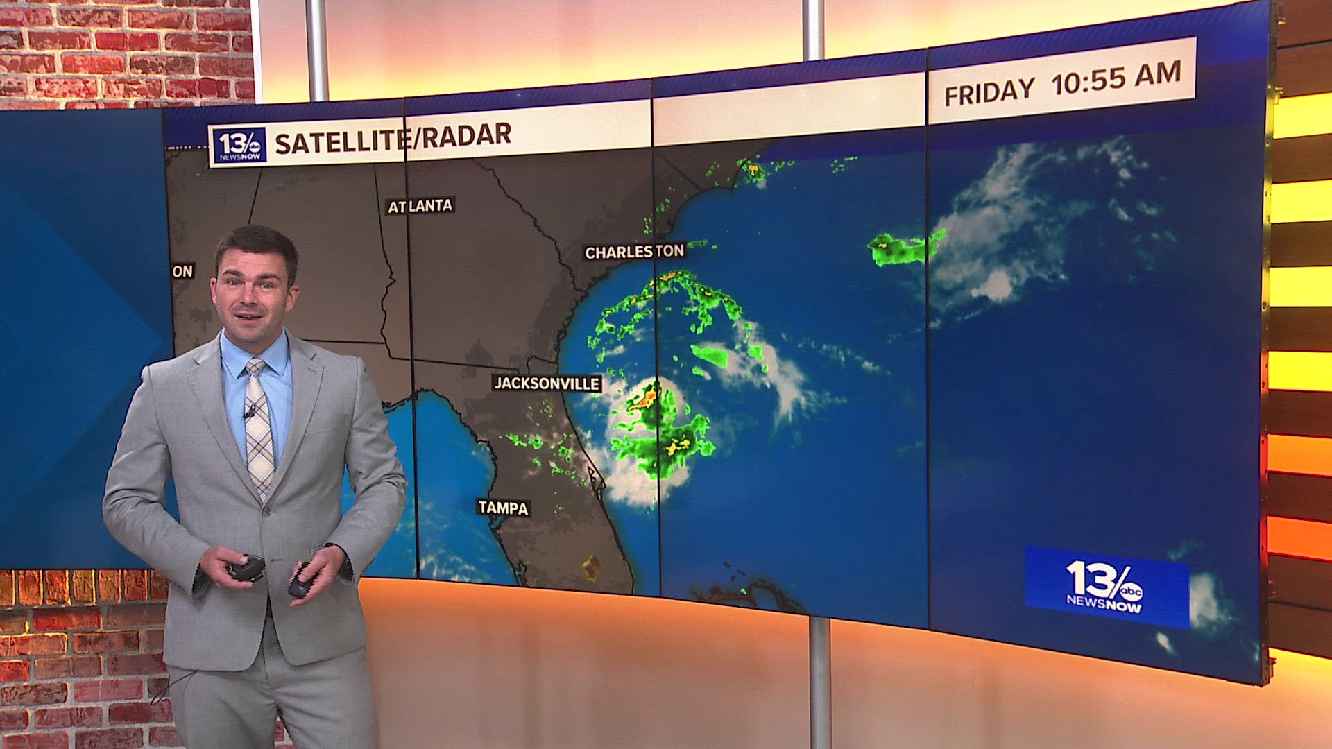
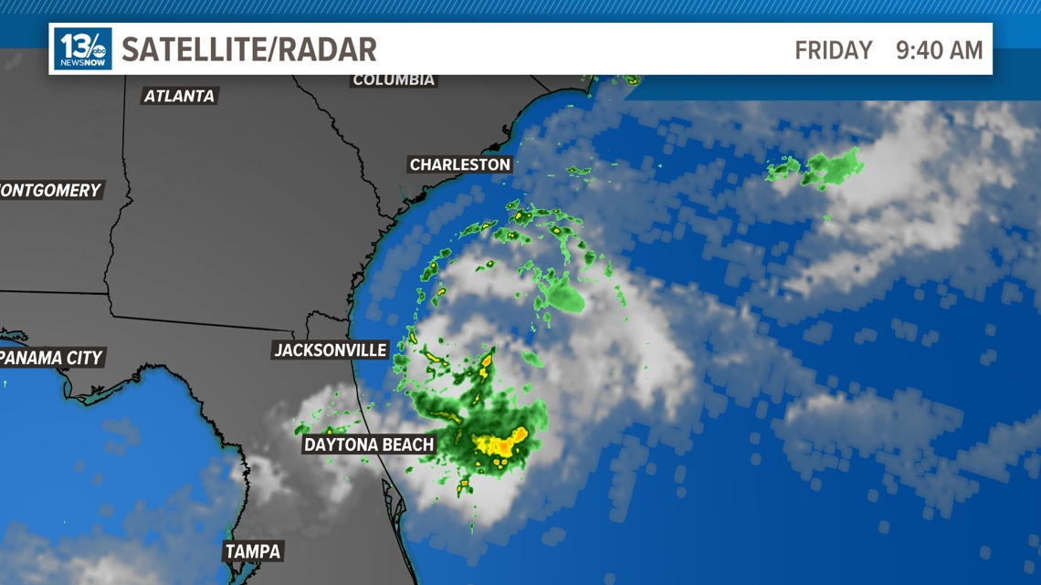
Invest-92 L is circulating 150 miles southeast of Jacksonville, Florida and is being monitored by the National Hurricane Center for tropical development. Right now, it's a low-pressure system with showers and thunderstorms.
RELATED: What is a tropical wave?
When the National Hurricane Center designates a system as an invest, this allows the hurricane hunters to fly into the area and determine if the low-pressure system has a well-defined and closed surface circulation.

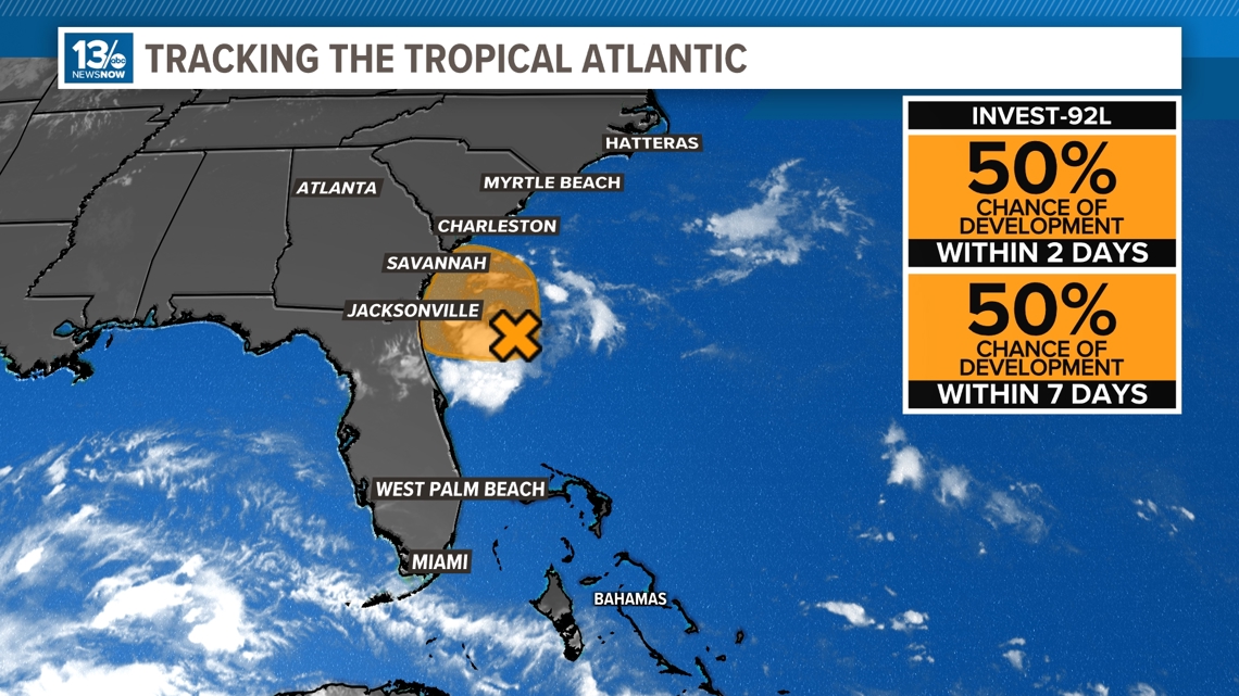
The National Hurricane Center is giving this a 50% chance of development within the next 2 days, though this system is expected to reach land by later tonight which would not allow for any further developments.

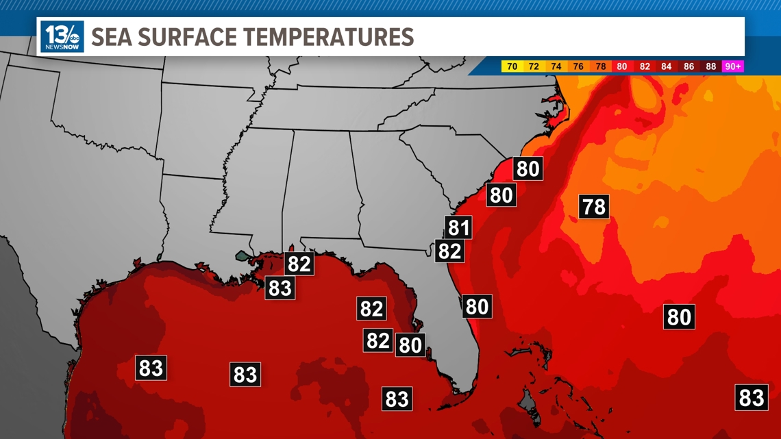
This area of low pressure is currently moving over the Gulf Stream, which brings up extremely warm waters from the Gulf of Mexico and Caribbean. The water temperatures in the Gulf Stream are sitting at about 83.8 degrees, allowing for favorable conditions and the possibility for additional development, so there is a shot of this system becoming a short-lived tropical depression.

Invest-92 L is moving WNW at 10 to 15 miles per hour with sustained winds of 35 miles per hour and is expected to reach the coast of northeastern Florida or Georgia by tonight.
Whether or not this develops into a tropical depression or not, the main threat with this system will be periods of heavy rain and thunderstorms in parts of north Florida and Georgia and no impacts here in Hampton Roads.
RELATED: