
NORFOLK, Va. —
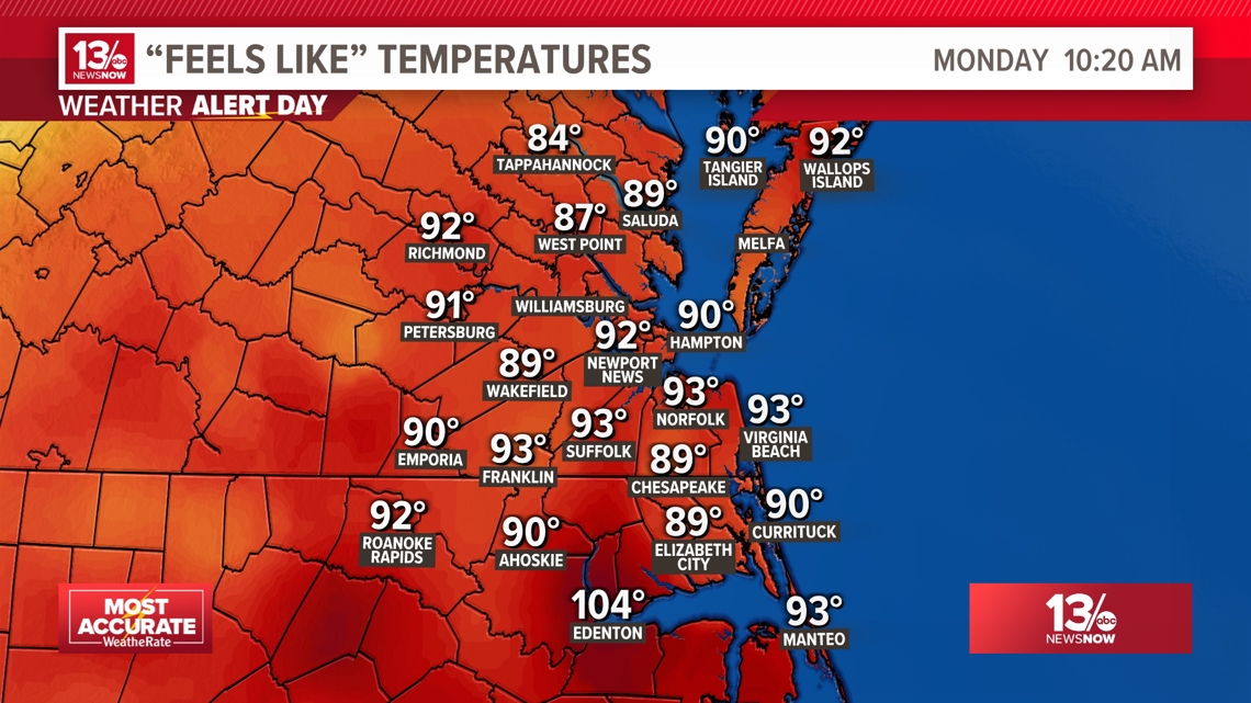
Monday 10:20 a.m. - Hot and humid. Radar still relatively quiet... for now.


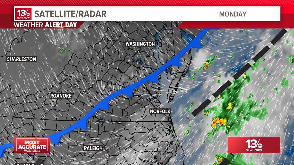
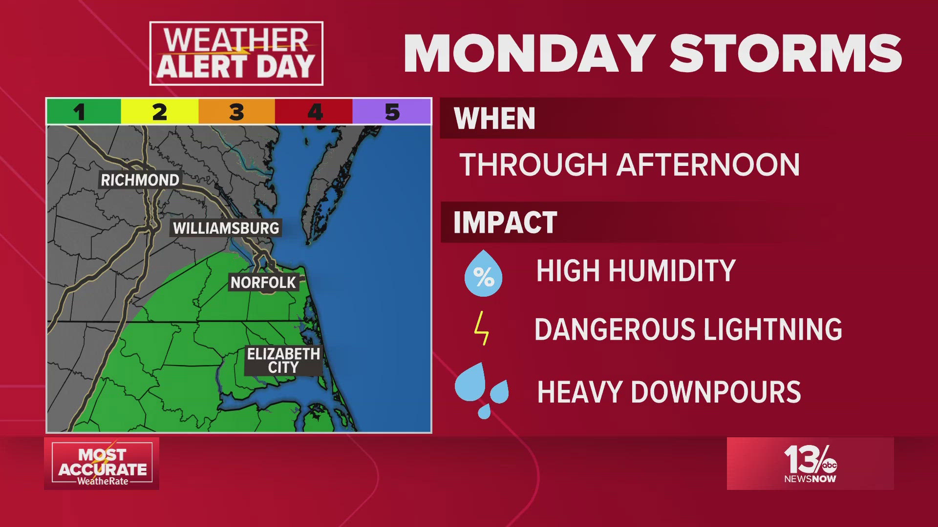
The approaching cold front is getting closer to Hampton Roads this morning. It will plow into warm and muggy air producing showers and heavier storms from late morning through the mid-late afternoon. Some of the storms could produce locally heavy rain with some potential runoff concerns.
Monday 6:30 a.m. - Storms this morning and into the afternoon

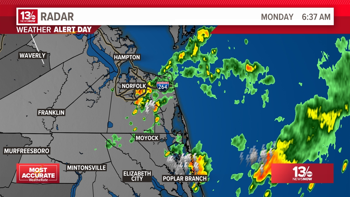
It's been a stormy early Monday morning for parts of the region. Still a very warm and muggy start to the day. We will allow the Weather Alert Day to continue until a cold front passes this afternoon. As the cold front plows into warm and humid air later this morning and early afternoon, there will be chances for more heavy downpours and a few stronger storms.

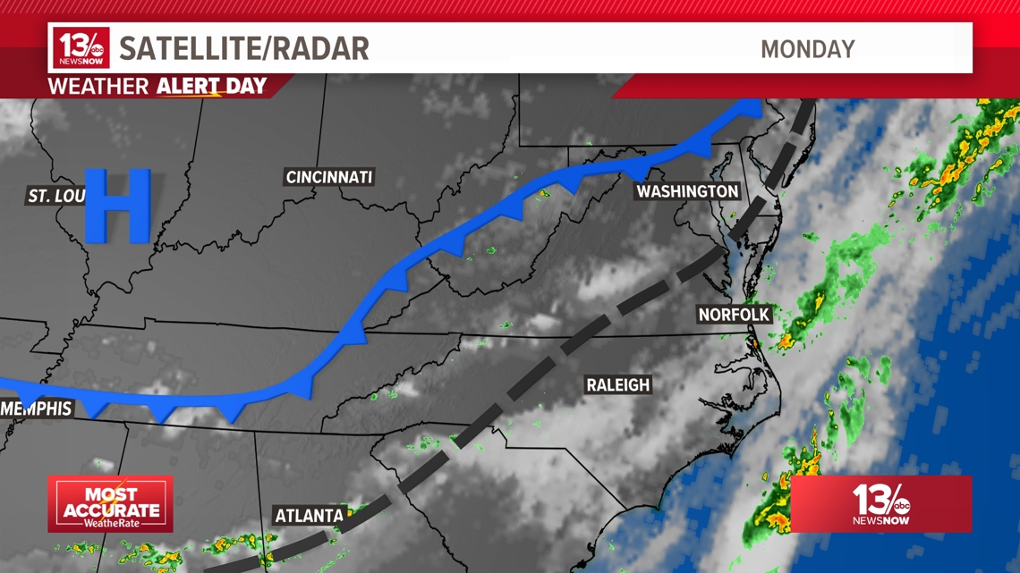
Once the front clears the region, the threat of storms and high humidity will go away. Look for BIG improvements to our weather this evening!
You've heard us talking about it all week. The heat dome has been building across our region.
Thursday's high was 87° in Norfolk.
Friday's high reached 90 and as winds shift south to southwest this weekend the temperatures will climb higher.


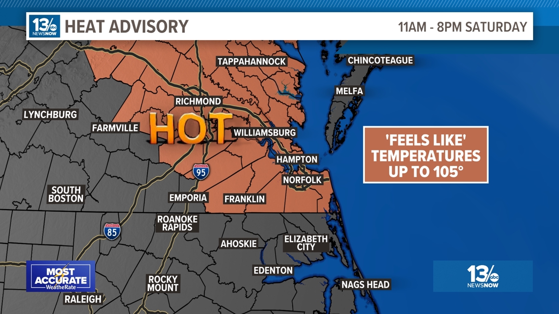
Starting Saturday afternoon, the mercury will be near 95° for the metro area. Humidity will make it feel like it is closer to 100°. Some areas may be even hotter! The National Weather Service is expected to issue Heat Advisories for much of the region this weekend.
Sunday 8 p.m.— Sunday's heat advisory expires
The heat advisory for Hampton Roads expired at 8 p.m.
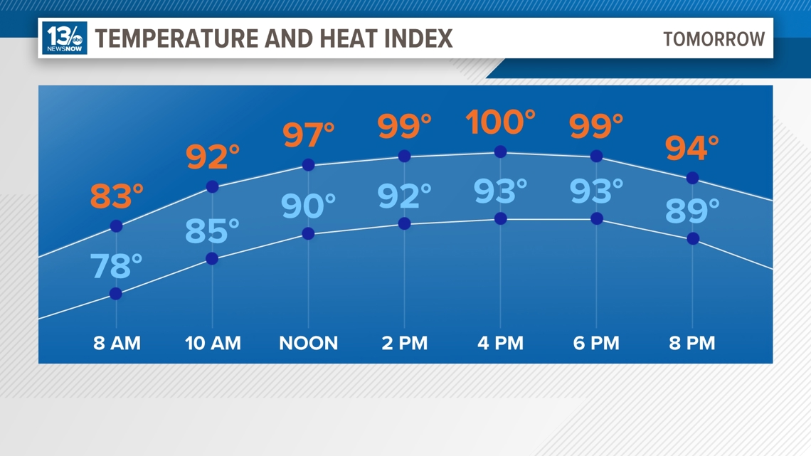
No heat advisory has been called for Monday, but temperatures will still remain high in the mid-80s and 90s.
Sunday 5:30 a.m. — Widespread heat indices to reach triple digits
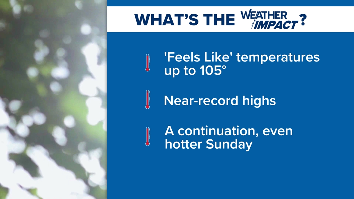
The National Weather Service (NWS) Wakefield is warning residents in much of Virginia and North Carolina that the widespread heat indices will be near 105 degrees — making it feel like the hottest day so far this year.
In the afternoon and evening hours, officials said there would be an unstable airmass due to the heat and humidity. Despite this, the NWS says storms are unlikely for many. Northern Virginia counties have the highest chances of severe weather developing.
Saturday 8 p.m. — Saturday's heat advisory expires
The heat advisory issued for Saturday ended at 8 p.m.
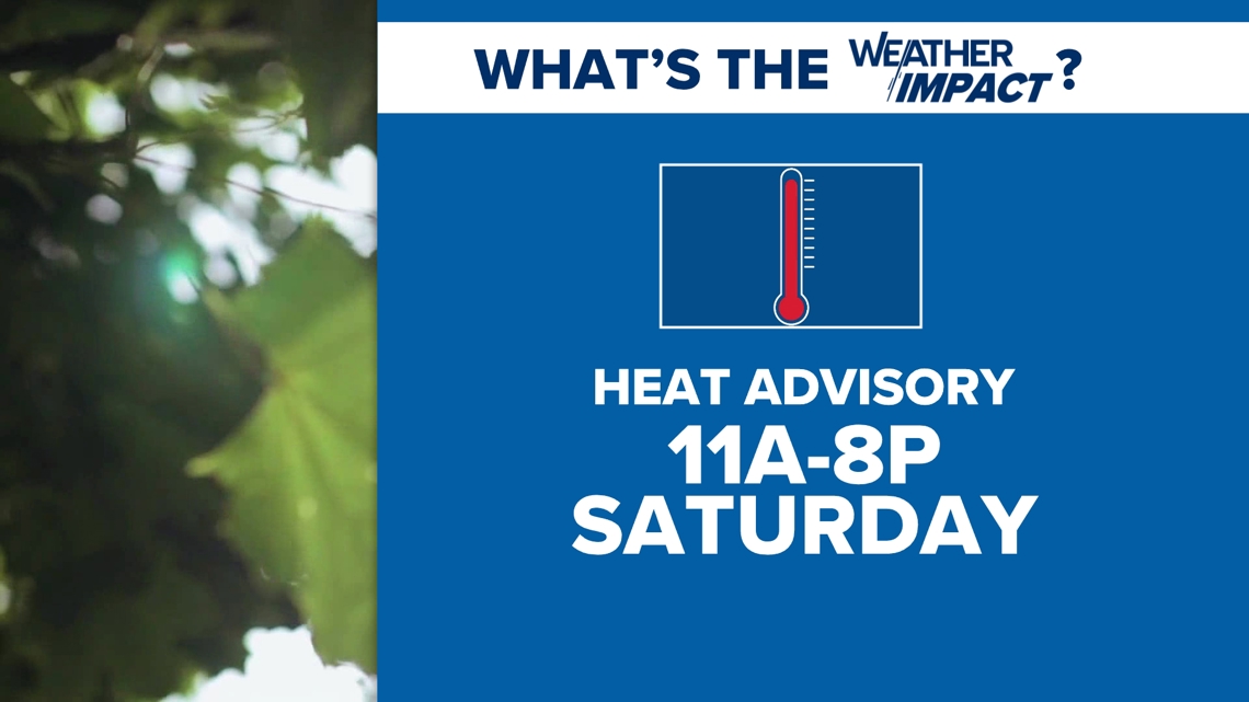
Another heat advisory has been called for Sunday, however. It will be in effect from 11 a.m. to 8 p.m.
6:40 p.m. — Dominion Energy shares updates on preparing for the heat
Cherise Newsome, a spokesperson for Dominion Energy, says that crews are on standby in case heat conditions affect power. Newsome also says that ground and helicopter crews are performing infrared heat scans on substations and transmission to ensure equipment is operating normally.
2:30 p.m. — Heat Advisory issued for much of Sunday
A heat advisory for coastal Virginia has been issued for Sunday when feels-like temps are expected to reach 105 degrees. It is in effect from 11 a.m. to 8 p.m.
5:45 a.m. — Heat Advisory may extend into Sunday
The NWS warns the heat advisory will likely be in effect through Sunday. with the heat index forecasted to climb throughout the weekend.
On Saturday, heat index values are expected to reach 100 to 105 degrees. Then, Sunday is forecasted to be even warmer — with heat indices expected to reach 105 to 110 degrees and higher humidity.
"Take it easy if spending extended times outdoors and remember to drink plenty of water!" the NWS said.
Friday 6 p.m. — Heat advisory in place for Saturday across Virginia
The National Weather Service office in Wakefield has placed all Virginia cities and counties under a Heat Advisory that goes into effect at 11 a.m. Saturday morning and lasts through at least 8 p.m. Saturday.


RELATED: FORECAST: Here comes the heat!
Virginia heat forecast for this weekend
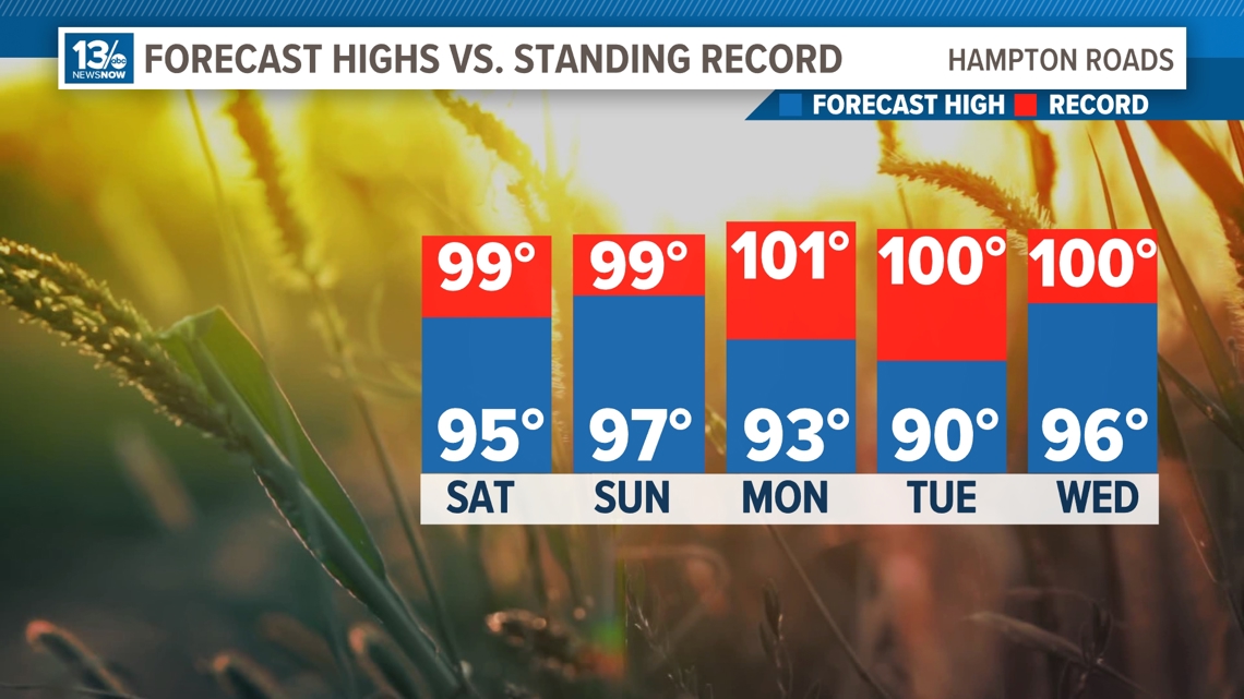
Sunday will be hotter. While it may be not as hot on the beaches, highs will generally reach the upper 90s on Sunday. Heat indices should be closer to 105°. Highs will be in the mid-90s on Monday before a cold front provides a temporary break from the heat on Tuesday.
In addition to the sweltering afternoon temperatures, it will be fairly warm overnight. Lows Sunday morning will be in the mid-70s, and Monday morning lows will be in the upper 70s.
People who don't have access to air conditioning may have physical difficulties during this heat wave.
Additionally, the elderly, the very young, and people with health conditions and heat sensitivity should be extra cautious while navigating this hot stretch of weather.
Stay tuned to 13News Now for updates to the forecast!

RELATED: