NORFOLK, Va. — A flood watch was in effect until late Saturday evening for a number of flood-prone areas across Hampton Roads and the northeast North Carolina region.
The National Weather Service issued the alert just before 9 a.m. and said it would be in effect until 10 p.m. due to excessive rainfall.
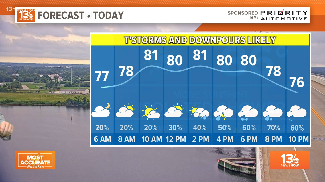
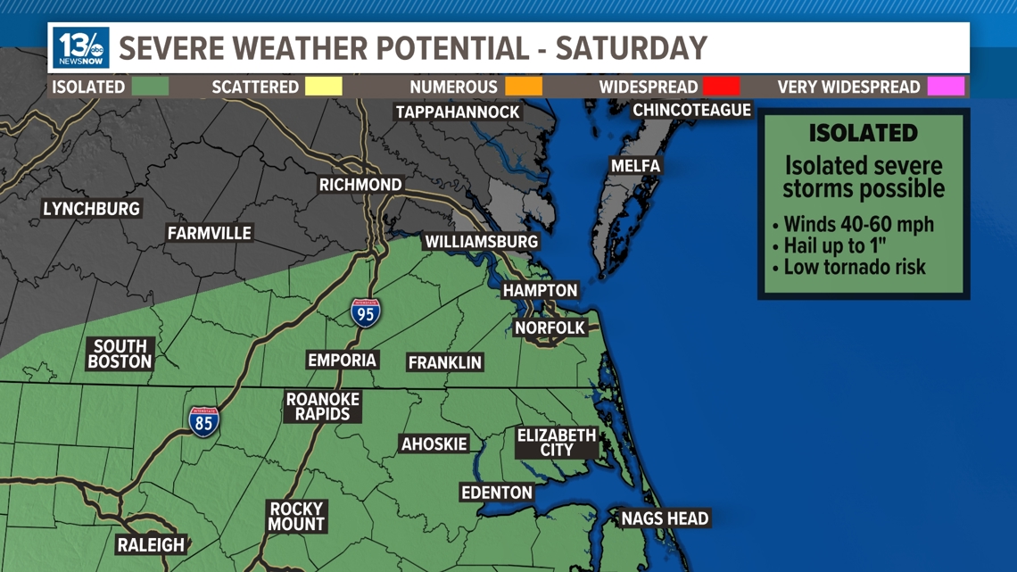
Heavy rainfall from slow-moving showers and thunderstorms was expected throughout the day and evening, with a risk of severe storms in the afternoon and evening.
6:45 p.m. — Severe thunderstorm warning expires for parts of Hampton Roads
A severe thunderstorm warning has expired for Norfolk, Chesapeake, Portsmouth and Virginia Beach.
6:00 p.m.— Parts of Hampton Roads under Severe Thunderstorm Warning
A severe thunderstorm watch issued for Norfolk, Chesapeake, Portsmouth and Virginia Beach is in effect until 6:45 p.m.
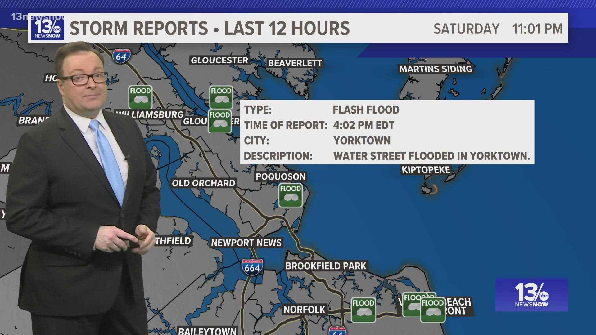
5:45 p.m. — Flood warning issued for part of Hampton Roads
A flood warning issued for Chesapeake, Norfolk, Portsmouth and Virginia Beach is in effect until 9 p.m.
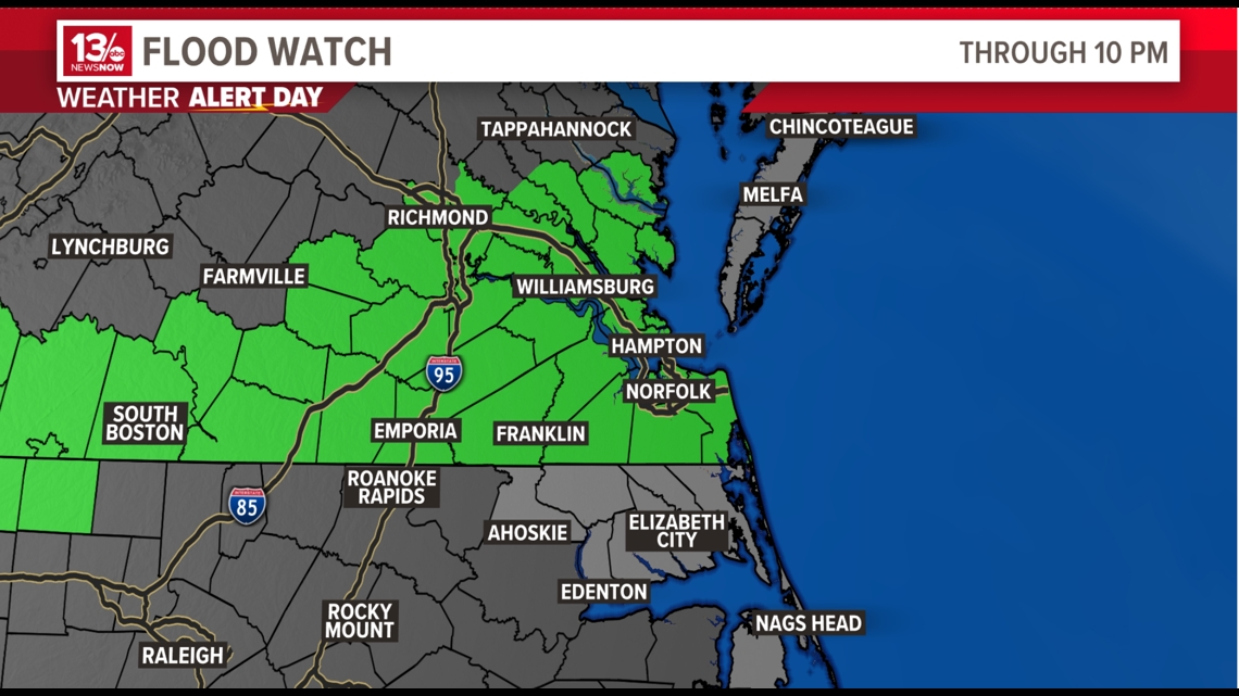
9:00 a.m. — Flood watch issued for parts of Hampton Roads
Areas included in the flood watch are as follows:
In southeast Virginia: Chesapeake, Gloucester, Greensville, Hampton/Poquoson, Isle of Wight, James City, Newport News, Norfolk/Portsmouth, Southampton, Suffolk, Surry, Sussex, Virginia Beach and York.
In east central Virginia: Charles City, Eastern King William, Eastern King and Queen and New Kent.
In south central Virginia: Brunswick, Dinwiddie, Lunenburg, Mecklenburg, Nottoway and Prince George.
In Central Virginia: Amelia, Eastern Chesterfield (Including Col. Heights), Eastern Hanover, Eastern Henrico, Western Chesterfield and Western Henrico (Including the City of Richmond)
In eastern Virginia: Lancaster, Mathews and Middlesex.
Meteorologists predict heavy rainfall from slow-moving showers and thunderstorms throughout the day and evening Saturday. That in addition to the region having received a good amount of rain over the past week could lead to flash flooding, especially in urban or flood-prone areas.
Rainfall amounts of 2 to 4” are possible with slow-moving thunderstorms.
NSW meteorologists are advising people to monitor forecasts throughout the day and be alert for possible flood warnings. Those living in areas prone to flooding should be prepared to take action should flooding develop.