
NORFOLK, Va. — High pressure off the southeast coast will drift farther out to sea this evening as a cold front begins to approach from the northwest. This will give us a mild evening with an increase in clouds overnight. Low temperatures will be in the lower to middle 60s.
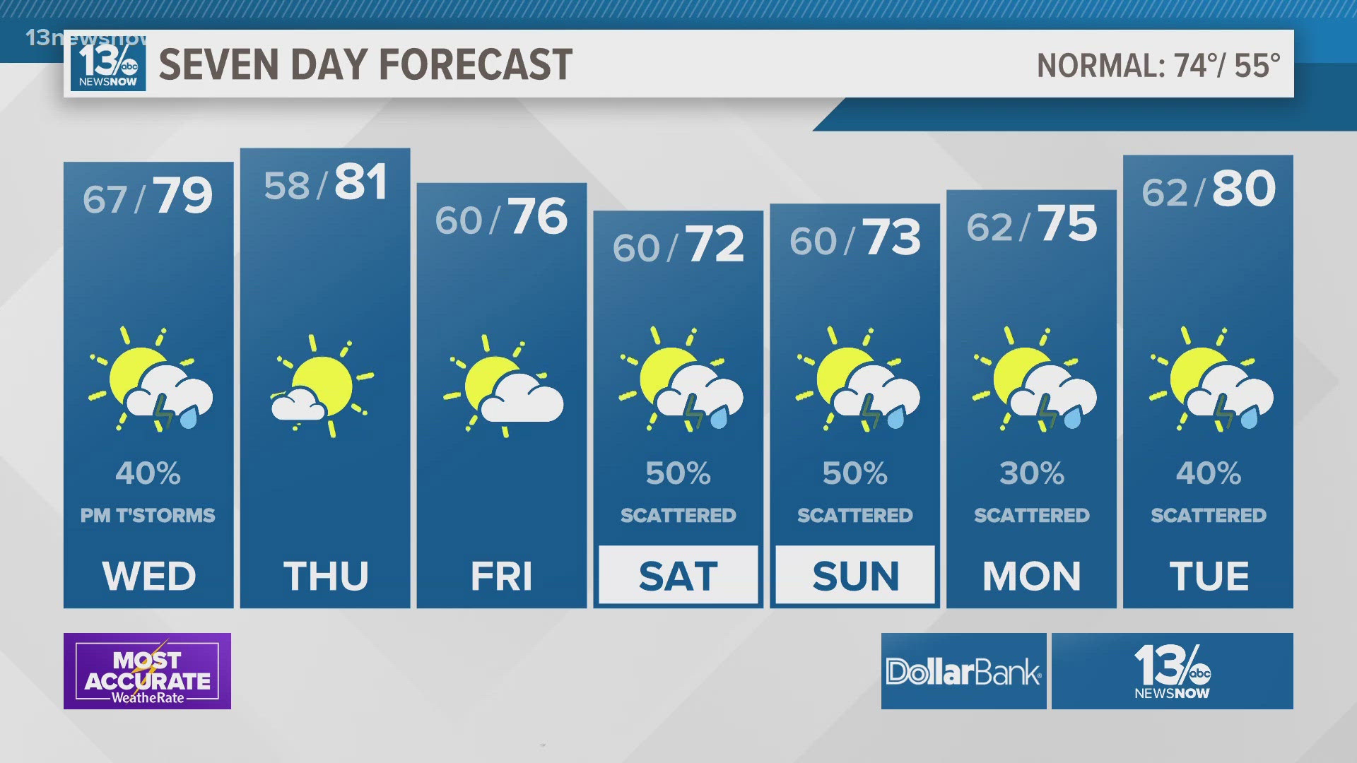
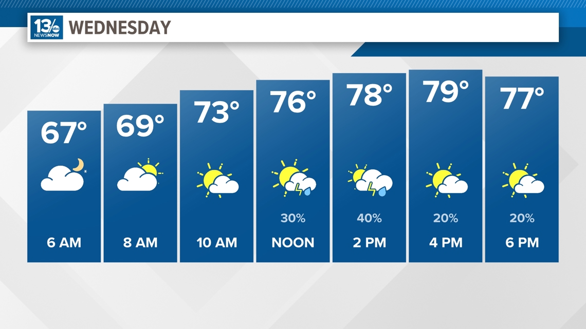
The cold front will be fairly weak and falling apart as it moves into Hampton Roads during the day Wednesday. Shower and thunderstorm chances increase into the afternoon, especially across the Southside and northeastern North Carolina. The showers and thunderstorms will be somewhat spotty in nature and rainfall will generally be around ¼" or so, with higher amounts with and thunderstorms that develop. High temperatures will be slightly cooler than the last few days, with inland areas in the lower 80s. Along the coast, an onshore breeze will keep temperatures in the upper 70s. Showers and thunderstorms will come to an end after sunset, with drier air moving in. Some patchy fog will be possible Wednesday night.

Warm, dry weather returns for Thursday and Friday as high pressure builds back into the region. High temperatures will be in the middle 80s inland and upper 70s to lower 80s closer to the coast.
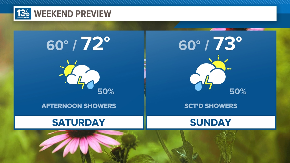
Another cold front will approach the region Saturday, pushing through and falling apart across the area Sunday into Monday. This means rain chances return Saturday, with the best chance for rain Saturday evening and night. A combination of the clouds, rain, and an onshore wind will keep temperatures cooler on Saturday, with highs in the lower 70s.
The unsettled weather continues Sunday into Monday as the front slowly washes out over the region.

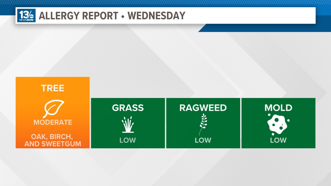
Allergy Report
Pollen levels will be moderate Wednesday with oak, birch, and sweetgum pollen as the predominant allergens. Pollen levels will rise again later this week.

Stay connected 24/7 via 13News Now