NORFOLK, Va. —
3:30 p.m. — Weather Alert Day ends
13News Now Chief Meteorologist Tim Pandajis said the threat for flooding Tuesday has passed, and that the Weather Alert Day has ended.
12:05 p.m. —Flash Flood Warning from NWS
The National Weather Service has issued a flash flood warning until 3:15 p.m. on Tuesday for Chesapeake, Hampton, Newport News, Norfolk, Portsmouth, Virginia Beach and Poquoson in Virginia and Currituck County in North Carolina.
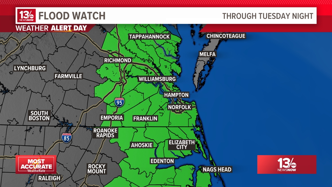
Weather Alert Day Tuesday for heavy rainfall, gusty winds and potential flooding
The 13News Now Weather Team issued a Weather Alert Day continuing through Tuesday for heavy rainfall, which can lead to potential flooding; an isolated severe weather threat; gusty winds; and minor coastal flooding.

The low pressure center once deemed "Potential Tropical Cyclone 8" is now over northwest South Carolina. The National Hurricane Center issued it's final advisory on PTC8 at 5pm Monday. The system continues to weaken, but is drawing significant moisture into the mid-Atlantic region.
Here are the impacts:
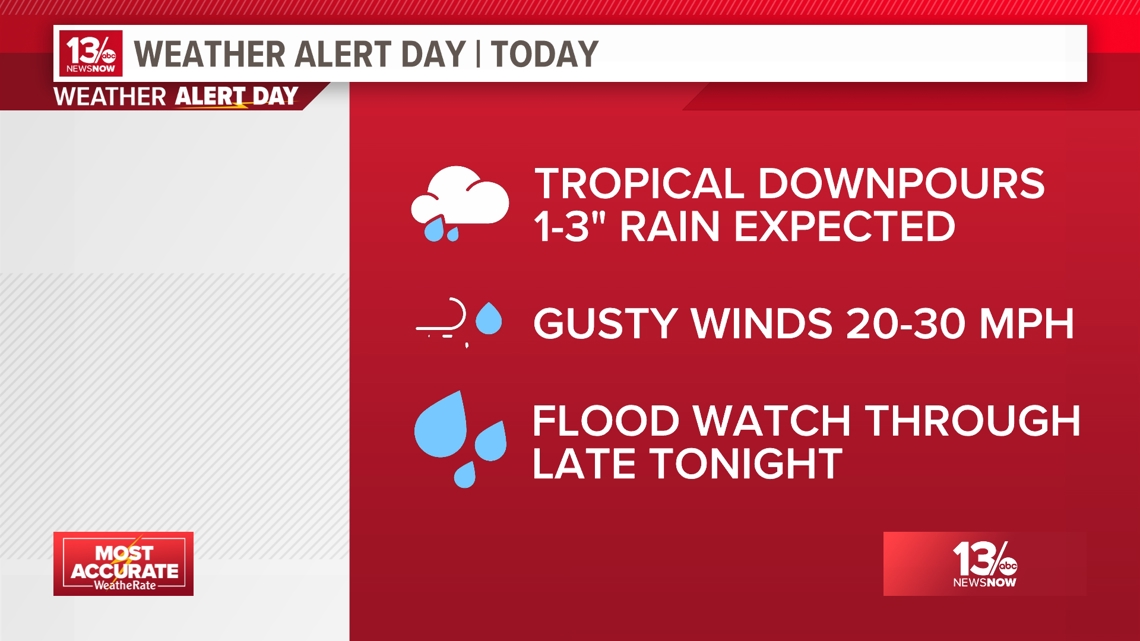
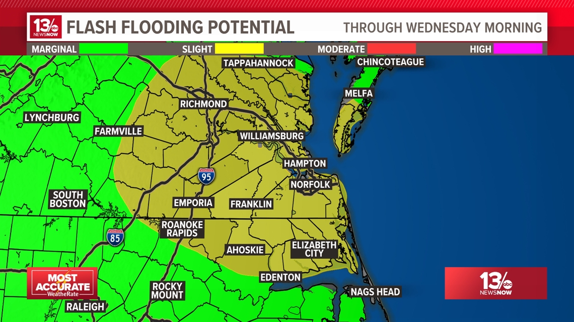
FLOODING RISK
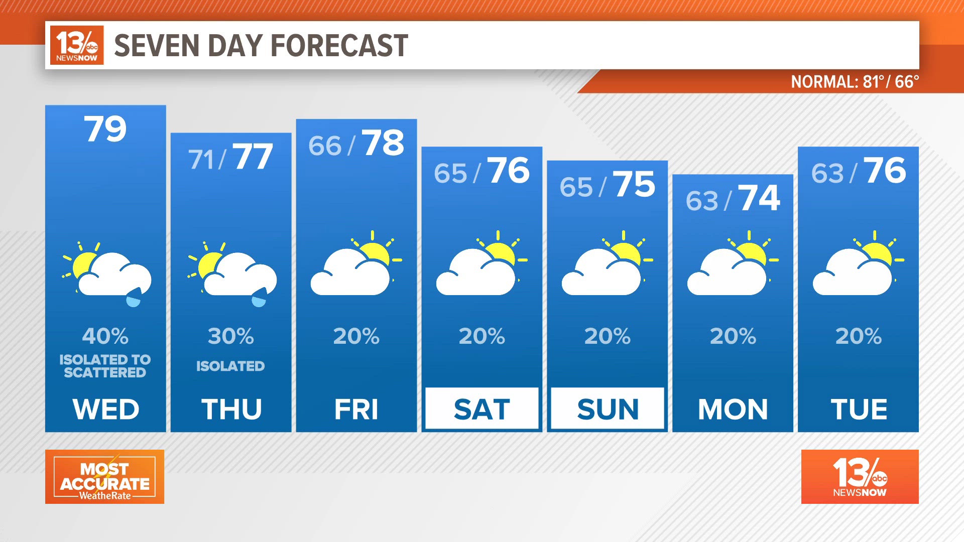
Rain will be on and off throughout the day on Tuesday. Any area could get stuck under a torrential downpour which could lead to a flash flooding risk. We can see anywhere up to 1-3" of rainfall and isolated higher amounts leading into Tuesday night.
The Weather Prediction Center has placed areas in the light green in the lower, 'marginal' risk for flash flooding, but the areas in yellow have the chance to see higher rainfall amounts and are under a 'slight' risk of flash flooding.


TIDAL FLOODING
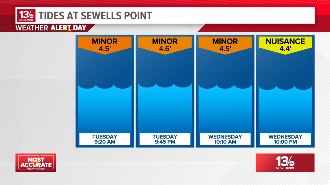
East and northeast winds will keep the tides elevated over the next several high tides. At Sewells Point (the official station for Hampton Roads) the tides should reach around 4.5 feet above the average of the lower low tides. That level is the threshold between nuisance and minor tidal flooding. The water levels should lower on Thursday.

GUSTY WINDS
Winds are still coming in from the east and northeast today. Gusts have been ranging from 20-30 mph. While winds are keeping tides above average, they are also keeping things choppy for our coastal waters. There is a high surf advisory and a high threat of rip currents. Waves in the surf zone are 6-8 feet, occasionally reaching 10 feet.