NORFOLK, Va. —
9:45 p.m. — Flood Watch expires, Weather Alert Day ends
The Flood Watch that was originally set to expire at midnight was ended early for most of the region, the National Weather Service said.
With no active watches or warnings for Hampton Roads or most of northeast North Carolina, 13News Now has ended its Weather Alert Day.
Counties south of the Albemarle Sound, including Dare and Tyrrell counties, are still under a Flood Watch until midnight.
8:15 p.m. — Last active Flash Flood Warnings expire
The last remaining Flash Flood Warnings in the area -- for Pasquotank, Camden, and Currituck Counties in North Carolina -- expired at 8:15 p.m.
While there are no active warnings, a Flood Watch remains in effect for the region until 12:00 a.m. Sunday.
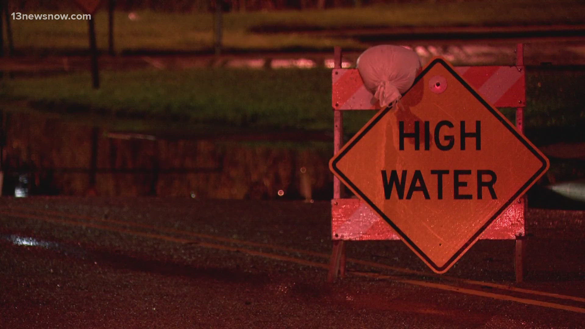
The National Weather Service says that area creeks and streams are already running high and could easily overflow their banks during times of excessive rainfall. Other low-lying and flood-prone areas are also at a higher risk.
5:30 p.m. — New warning issued, others expire
The Severe Thunderstorm Warning for Camden and Currituck Counties and the Flash Flood Warning for Virginia Beach and Chesapeake all expired at 5:30 p.m.
Meanwhile, a new Flash Flood Warning was issued for Pasquotank, Camden, and Currituck Counties. This warning is set to last until 8:15 p.m.
The National Weather Service said up to three inches have fallen in those counties, and an additional one to two inches is possible.
4:45 p.m. — Flash Flood, Tornado Warnings for parts of North Carolina
A Flash Flood Warning has been issued for Chowan and Perquimans Counties in North Carolina until 7:45 p.m. Up to two inches of heavy rain have already fallen and an additional 1.5 inches are possible.
Some locations that will experience flash flooding include Hertford, Snug Harbor, Cape Colony, Burgess, Valhalla, Yeopim Station, Light Nixon Fork, Saint Johns, Somerset, Drummond Point, Hancock, Holiday Island and Macedonia.
Additionally, a Severe Thunderstorm Warning has been issued for Camden and Currituck counties until 5:30 p.m.
The National Weather Service said at 4:51 p.m., severe thunderstorms were located along a line extending from near Corolla to seven miles southeast of Currituck to near Indiantown, moving southeast at 10 mph.
The storms could bring 60 mph wind gusts, which could damage trees and power lines.
Other locations impacted by these severe thunderstorms include Jarvisburg, Barco, Coinjock, Powells Point, Riddle, Poplar Branch, Aydlett, Waterlily, Bertha, and Mamie.
4:30 p.m. — Flash Flood Warning expires for Norfolk and Portsmouth
The Flash Flood Warning for Norfolk and Portsmouth expired at 4:30. Meanwhile, the Flash Flood Warning will remain in place for at least another hour for Chesapeake and Virginia Beach.
3:00 p.m. — Flash Flood Warning issued for Chesapeake, Virginia Beach
A Flash Flood Warning has been issued for Chesapeake and Virginia Beach until 5:30 p.m.
The National Weather Service said some locations that will experience flash flooding include Great Bridge, Regent University, Fentress, Hickory, Herberts Corner, Chesapeake Airport, Greenbrier, Mount Pleasant, and Gallups Corner.
2:17 p.m. — Flash Flood Warning issued for Norfolk, Portsmouth
A Flash Flood Warning is in effect until 4:30 p.m. for Norfolk and Portsmouth, after Doppler radar indicated thunderstorms producing heavy rain across those areas.
The National Weather Service says that between 0.5 and 1 inch of rain has fallen there already, and the expected rainfall rate is 0.5 to 1 inch in 15 minutes.
Flash flooding is ongoing or expected to begin shortly in those areas, according to the NWS.
Some areas expected to see flooding include Old Dominion University, Downtown Norfolk, Downtown Portsmouth, Norfolk State University, Churchland, Ghent, Norview, Norfolk International Airport, Wards Corner.
The National Weather Service also says Virginia Beach, Chesapeake and Suffolk could very likely see flooding under this warning.
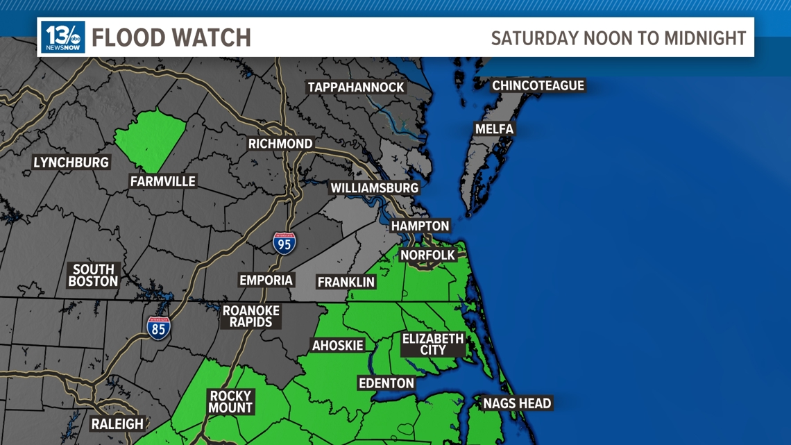
4 a.m. — Flood Watch issued for Southside Hampton Roads, northeast North Carolina
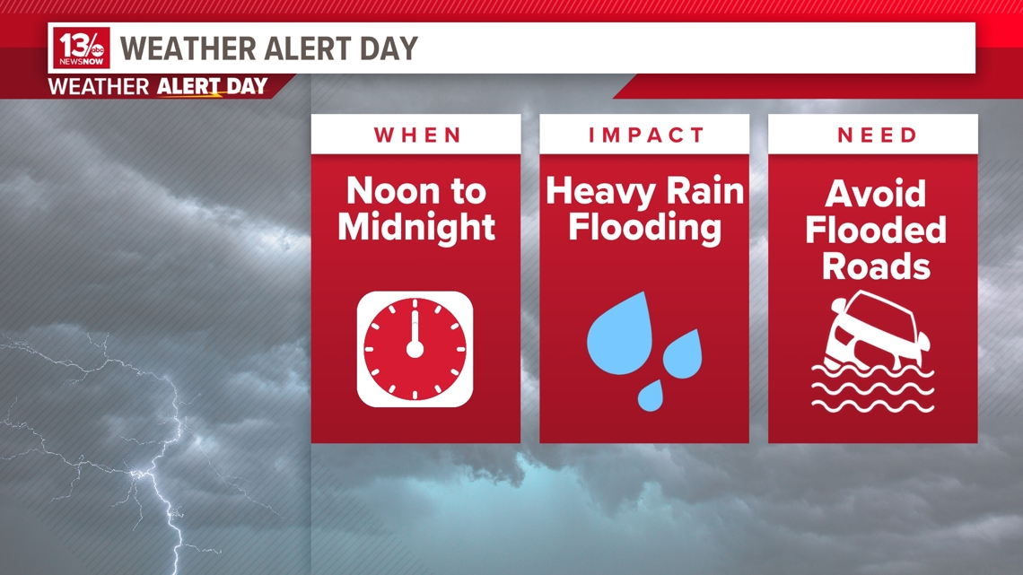
The 13 News Now Weather Team has declared Saturday as a Weather Alert Day for potential flash flooding across Southside Hampton Roads and northeast North Carolina this afternoon and evening.
While we can officially say goodbye to Tropical Cyclone Debby, the excessive rainfall she brought the region on Thursday and Friday has left the ground saturated — and less able to absorb heavy rainfall expected later in the day Saturday.
That means localized or flash flooding is very possible.
Showers and thunderstorms are expected to start around 2 p.m. and last through 9 p.m. Heavy downpours are possible, particularly on the Southside, the Outer Banks and surrounding areas.
In light of this, the National Weather Service in Wakefield has issued a Flash Flood Watch from noon Saturday until midnight for the following areas.
Southeast Virginia: Chesapeake, Norfolk, Portsmouth, Suffolk and Virginia Beach.
Northeast North Carolina: Bertie, Camden, Chowan, Currituck, Gates, Hertford, Pasquotank and Perquimans counties in North Carolina.
The NWS says that area creeks and streams are already running high and could easily overflow their banks during times of excessive rainfall. Other low-lying and flood-prone areas are also at a higher risk.