
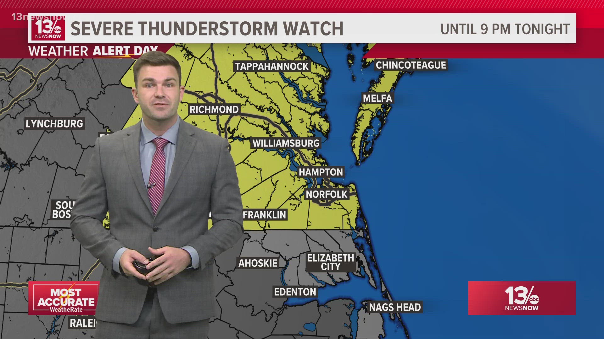
NORFOLK, Va. — The 13News Now Weather Team has declared Thursday evening as a "Weather Alert Day".
What is a Weather Alert Day? This is issued by the weather team when there is high confidence that forecast inclement weather will bring impacts to the Hampton Roads community.
What the team is watching: a strong cold front will be arriving from the northwest later this evening and during the first portion of the overnight. A suitable atmosphere out ahead of it is supportive of strong to severe thunderstorms.

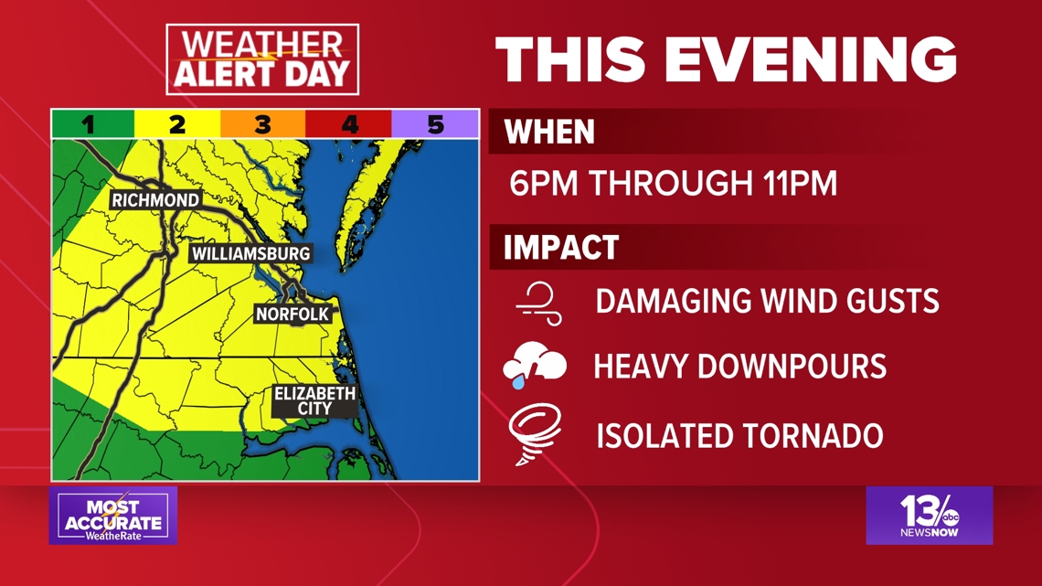
We expect the main impacts to be gusty, damaging winds possibly in excess of 55 mph. Accompanying the strong winds will be heavy downpours, frequent lightning, and the potential of an isolated tornado.
The timeframe we will be watching for the potential of severe weather will be from 6 p.m. Thursday evening (from the west) through about 11 p.m. (to the southeast). This system will be progressive and will not linger, therefore the threat for any widespread flooding is low.
However, low-lying, vulnerable areas could very well see drainage basins becoming overwhelmed.