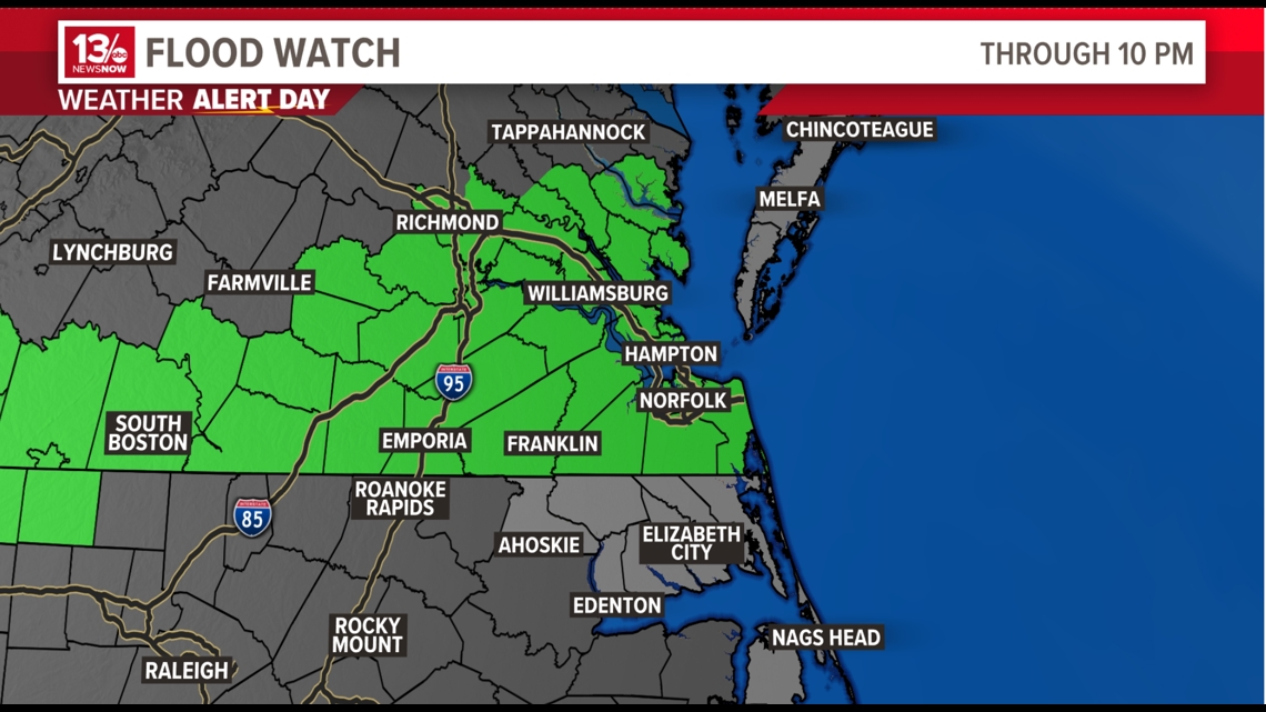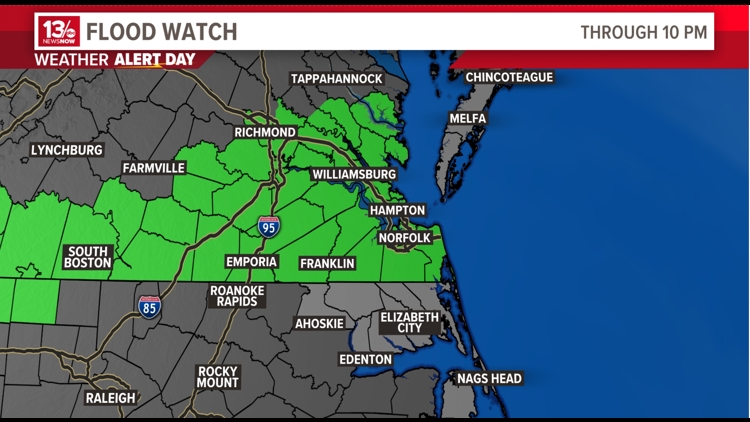
NORFOLK, Va. — A flood watch was in effect until late Saturday evening for a number of flood-prone areas across Hampton Roads and the northeast North Carolina region.
The National Weather Service issued the alert just before 9 a.m. and said it would be in effect until 10 p.m. due to excessive rainfall.
"Excessive runoff may result in flooding of rivers, creeks, streams, and other low-lying and flood-prone locations," the alert stated.
8:15 p.m. — Flood warnings expire for Hampton Roads
The flood warnings issued for Hampton Roads have expired.
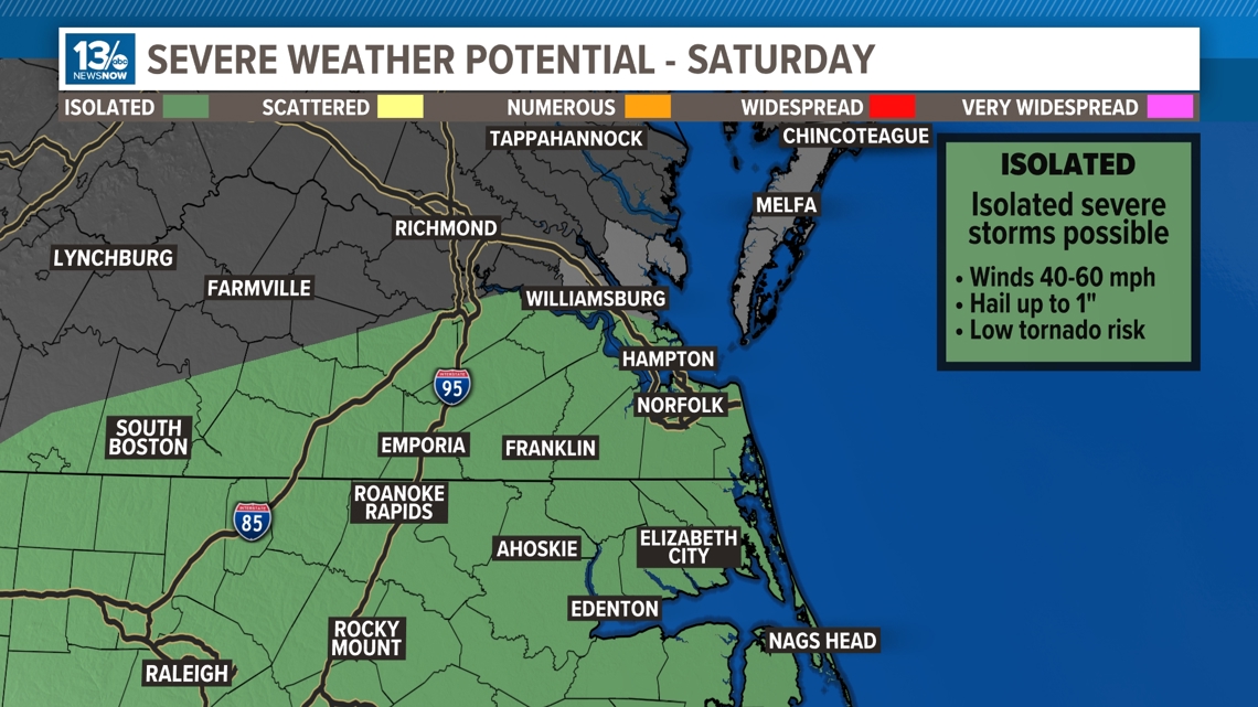
6:00 p.m.— Parts of Hampton Roads under Severe Thunderstorm Watch
A severe thunderstorm watch issued for Norfolk, Chesapeake, Portsmouth and Virginia Beach was in effect until 6:45 p.m.
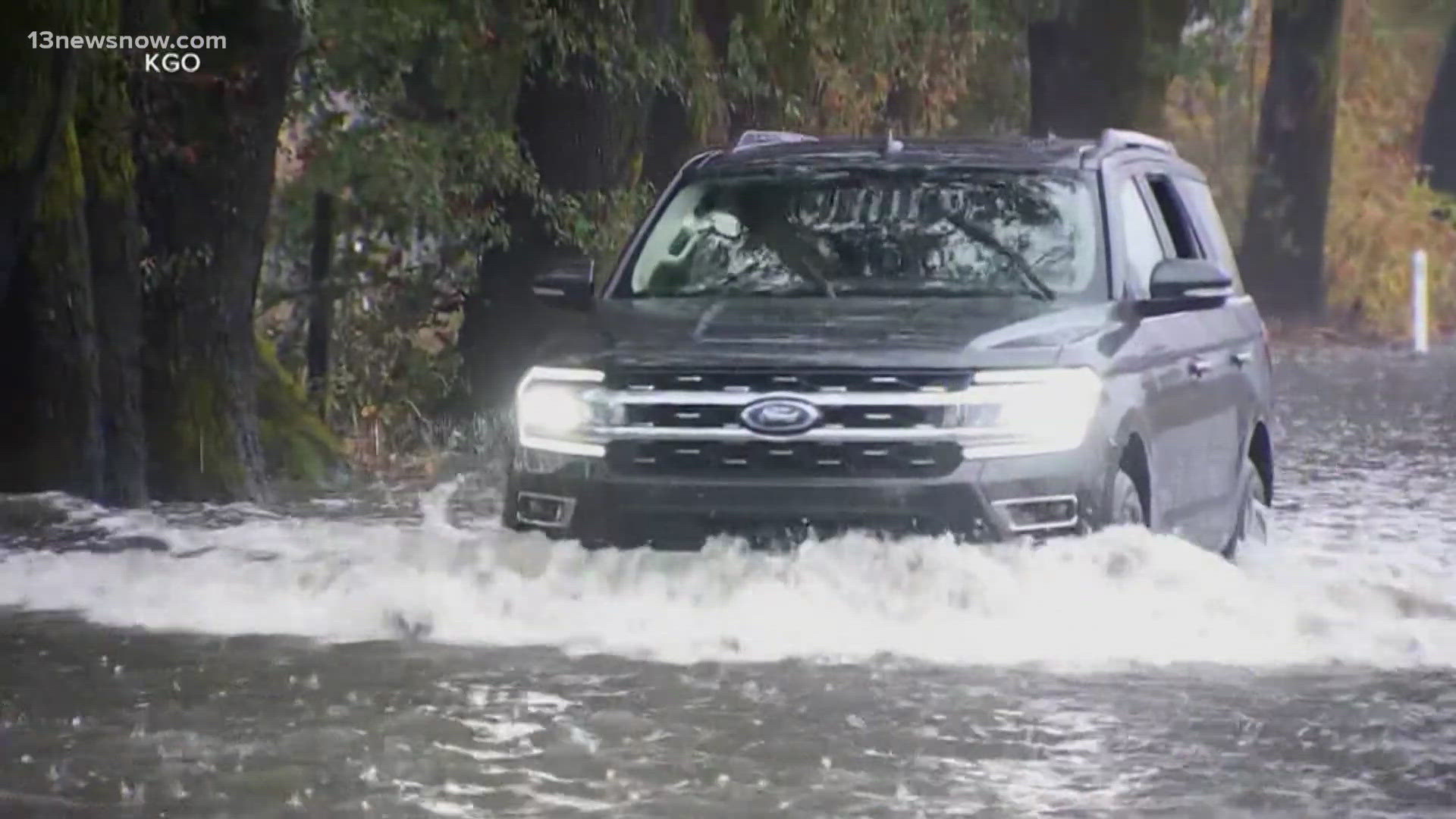
5:45 p.m. — Flood warning issued for part of Hampton Roads
A flood warning issued for Chesapeake, Norfolk, Portsmouth and Virginia Beach was in effect until 9 p.m.
Areas included in the flood watch are as follows:
In southeast Virginia: Chesapeake, Gloucester, Greensville, Hampton/Poquoson, Isle of Wight, James City, Newport News, Norfolk/Portsmouth, Southampton, Suffolk, Surry, Sussex, Virginia Beach and York.
In east central Virginia: Charles City, Eastern King William, Eastern King and Queen and New Kent.
In south central Virginia: Brunswick, Dinwiddie, Lunenburg, Mecklenburg, Nottoway and Prince George.
In Central Virginia: Amelia, Eastern Chesterfield (Including Col. Heights), Eastern Hanover, Eastern Henrico, Western Chesterfield and Western Henrico (Including the City of Richmond)
In eastern Virginia: Lancaster, Mathews and Middlesex.
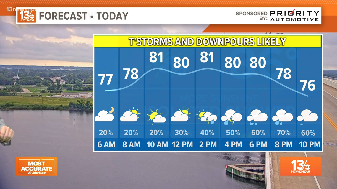
Meteorologists predicted heavy rainfall from slow-moving showers and thunderstorms throughout the day and evening Saturday. That in addition to the region having received a good amount of rain over the past week could lead to flash flooding, especially in urban or flood-prone areas.
Rainfall amounts of 2 to 4” were possible with slow-moving thunderstorms.
NSW meteorologists advised people to monitor forecasts throughout the day and be alert for possible flood warnings.