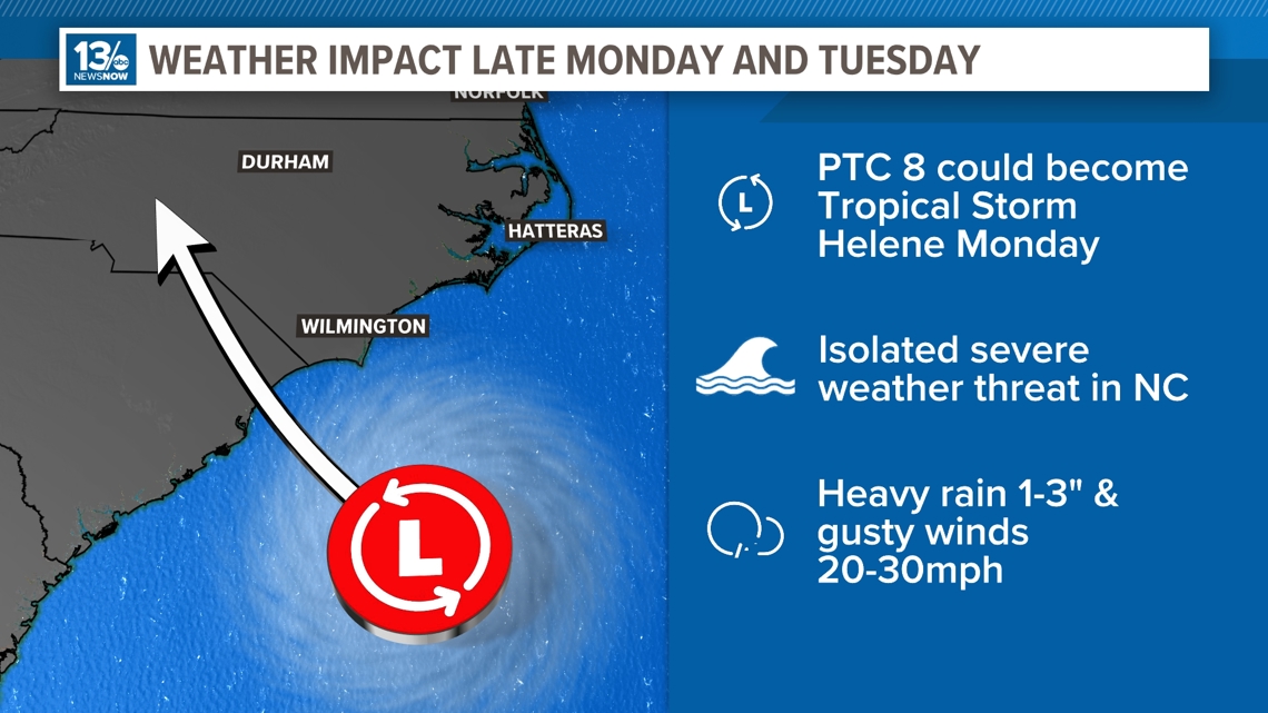
NORFOLK, Va. — The National Hurricane Center (NHC) has designated the low-pressure system off the coast of South Carolina as Potential Tropical Cyclone 8. The NHC deems a system as a PTC if there is a high likely hood of tropical development and is going to affect land within the next 48 hours.

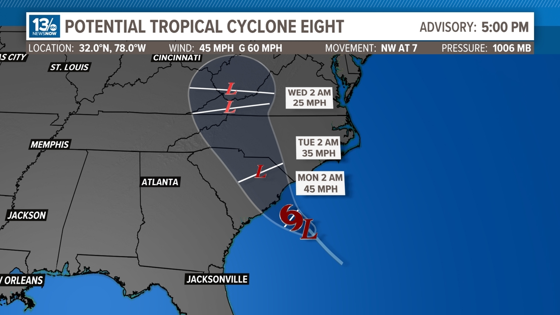
If PTC 8 does develop into a tropical storm, the next name on the list will be Helene. The good news is that time is not on this storms side and is not expected to strengthen very much. PTC 8 is expected to come ashore into South Carolina on Monday evening, making it weaken rapidly.
Whether or not this does become a name storm, the impacts here will be the same.
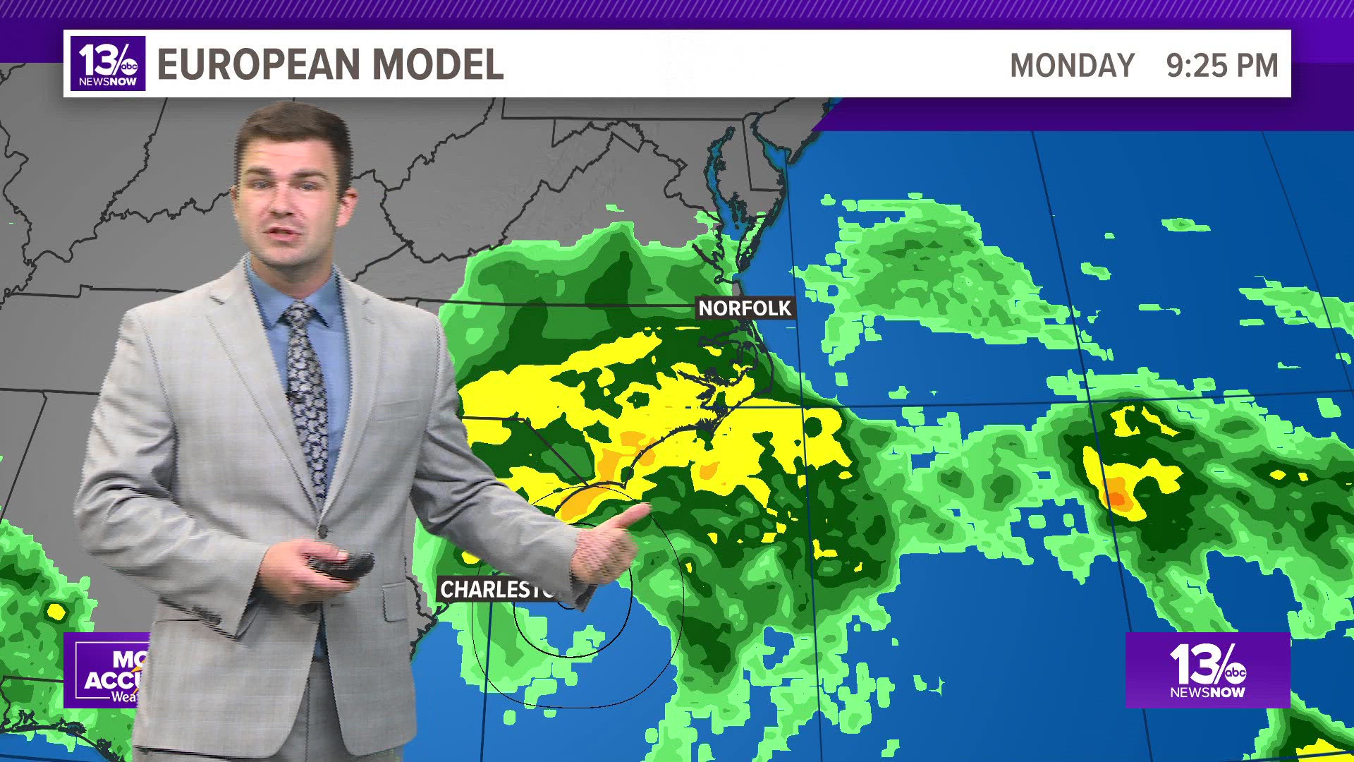
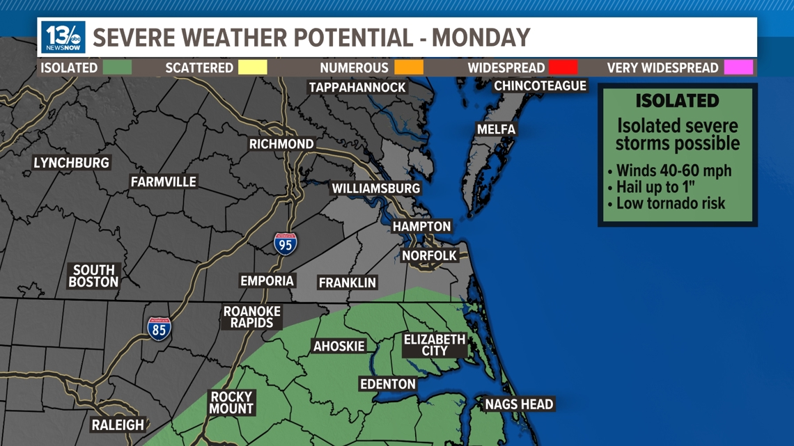
Starting out Monday, we will see cloudy skies and a chance to see a shower or two throughout the day. Once we head into Monday evening, that's when we will see the showers and storms starting to pick up. There is also a level 1 severe weather risk for very southern portions of the South Side and Eastern North Carolina, and we cannot rule out an isolated tornado.

Rain will be on and off throughout Monday night and throughout the day on Tuesday, and areas could get stuck under a torrential downpour which could lead to a flash flooding risk. We can see anywhere up to 2" of rainfall and isolated higher amounts leading into Tuesday night.
Winds will also be gusty, seeing gusts anywhere from 20-30mph with locally higher gusts especially along the shore.