NORFOLK, Va. — Records are made to be broken, and broken they were Thursday as the mercury climbed to spring-like levels across the region.
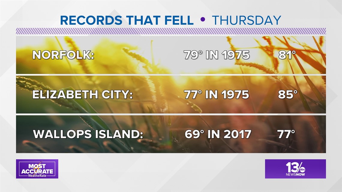
Thursday, the temperature at Norfolk International Airport reached 81°, breaking the old record of 79° set in 1975 for the warmest February 23rd.
At the Elizabeth City Coast Guard Air Station/Regional Airport, highs hit 85°, shattering the old record of 77°, also set in 1975. At the Wallops Flight Facility Airport on Wallops Island, the record of 69°, set in 2017, was also shattered when temperatures hit 77°.


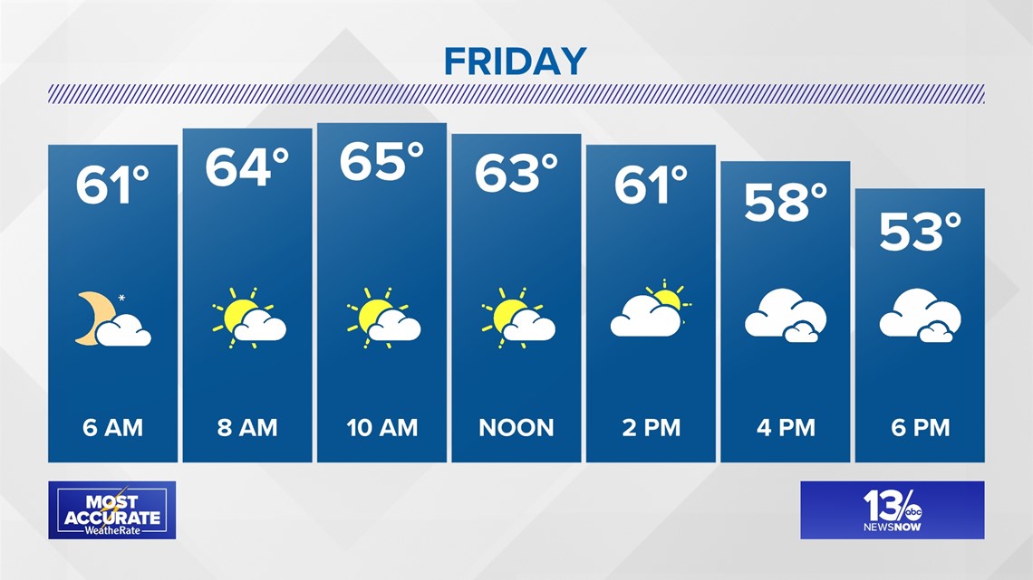
But all good things must come to an end, and that will happen as a cold front slowly pushes through the region Friday. It will be a day of transition with partly sunny skies.
Temperatures will start out in the lower 60s and climb into the middle 60s around midday. The mercury will then fall during the afternoon, setting the stage for a cold start to the weekend.


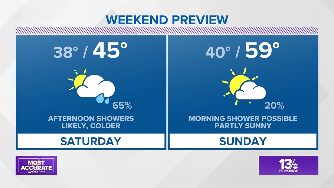
As you make your weekend plans, Saturday will likely be an “indoor” day while Sunday looks to be a decent late-February “outdoor” day.
Showers will develop Saturday afternoon and it will be cold. It’s even possible areas of the Northern Neck or Eastern Shore could see the precipitation start out as a little sleet or snow. Afternoon temperatures will struggle to reach the middle 40s. By Sunday, any early-morning showers will clear out as temperatures rebound to a seasonable 59°.
Looking ahead to next week, isolated showers will be possible Monday and Tuesday with highs in the 60s.


