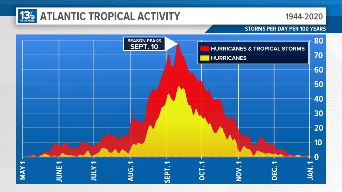
Tuesday, Sept. 10, marks the peak of the Atlantic hurricane season. This is the day of the year when, statistically, the Atlantic Basin has had the most hurricanes and named storms throughout history.
Looking back over almost eight decades of daily tropical data, Sept. 10 is the day that most frequently had a tropical system in the Atlantic, Caribbean, or Gulf of Mexico, collectively known as the “Atlantic Basin.”


It’s also the time of year when all the conditions are most favorable for tropical development.
Those factors include warmer tropical water temperatures and weaker wind shear.
While the first half of the hurricane season has been relatively quiet, in some respects, things are only ramping up.
Tropical Storm Francine is forecast to become a hurricane before making landfall Wednesday in Louisiana while a trough of low pressure near the Cabo Verde Islands could become our next named storm, Gordon, within the next week.
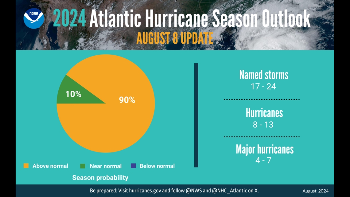
The forecast from the National Hurricane Center (NHC) calls for an “extremely active” season. The National Oceanic and Atmospheric Administration (NOAA) said this season could rank among the busiest on record.
In their mid-season outlook, updated Aug. 8, the NHC forecasted 17-24 named storms.
In order for a storm to reach tropical storm status and earn a name, winds would need to reach at least 39 mph. Of those 17-24 named storms, 8-13 are expected to become hurricanes with winds of 74 mph or greater and 4-7 are expected to become major hurricanes with winds of 111 mph or greater. According to NOAA, the probability of an above-average hurricane season is 90%.


And, the season is only half over. Historically, the tropics have produced six named storms, including four hurricanes, after Sept. 10.

