NORFOLK, Va. — As we dive into the cooler months, there's always that chance we can see rain, snow, sleet or even freezing rain as the days start to get colder.
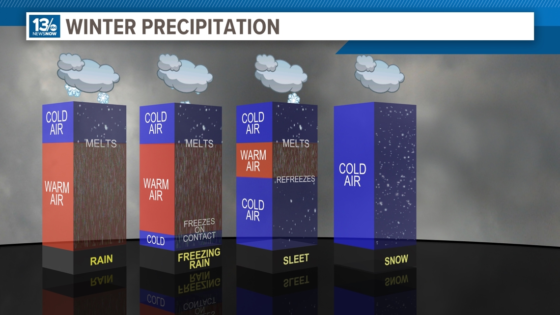
But there's a reason why we could end up with different types of winter precipitation. Within the atmosphere, there are layers of different air temperatures, which can determine the type of precipitation you'll see.
In most areas, precipitation starts as snow way up into the atmosphere and when there's a large layer of warm air that reaches all the way down to the surface, it falls as rain.
Freezing rain is a bit more complex. It starts as rain as it falls through the column of warm air, but as it falls, it passes through a small layer of cold air just above the ground. This causes the raindrops to become cooled very rapidly, and when they hit surfaces like roads or trees, they freeze on contact, creating a layer of ice.
Sleet forms when raindrops fall through a larger layer of freezing air, allowing the rain to refreeze into small ice pellets before reaching the ground.
But for snow, there can't be any warm layers within the atmosphere; the entire column has to be below freezing from the clouds to the ground in order for us to see snow.
We haven't seen measurable snow here in Hampton Roads in over 1,000 days, so if you are Team Snow for this upcoming winter, you should hope for a below-freezing layer throughout the atmosphere!


