
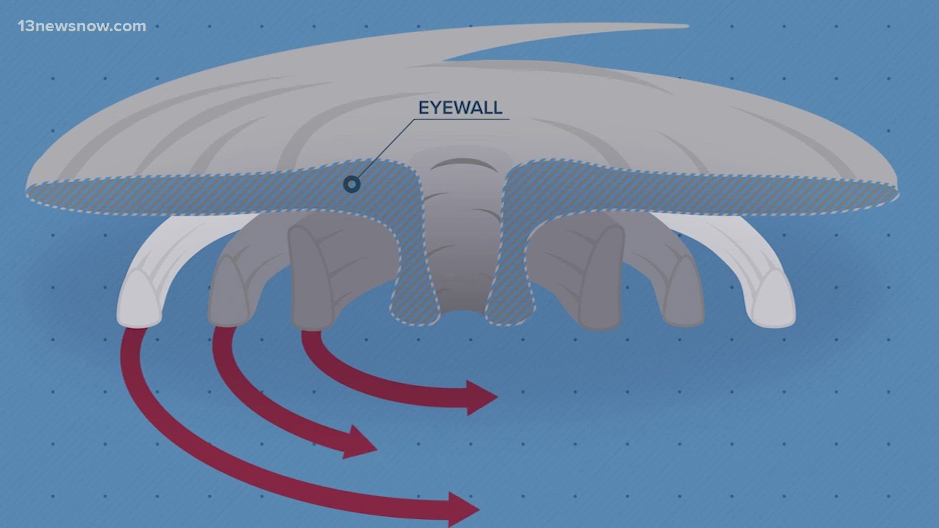
NORFOLK, Va. — Most people are familiar with the calm center of a hurricane called the eye. But that calm area is surrounded by the most dangerous part of the hurricane, the eyewall.
A hurricane can have strong, gusty winds in any of its outer rain bands, but the strongest winds are typically found in a narrow band surrounding the calm eye.
Why is this the case? It's because of the structure and dynamics of tropical cyclones.
Hurricanes are like giant heat engines in the atmosphere, using warm, unstable air as fuel.
To grow, they need to take in more and more warm, moist air. Sea surface temperatures need to be at least 80° F to fuel a hurricane. And the warmer the ocean water, the stronger a hurricane can potentially get.
As the air is pulled into the hurricane, it spirals towards the center, getting faster and faster, eventually rising to create the giant cumulonimbus clouds that encircle the calm eye.
This unbroken, vertical wall of clouds is the eyewall. These clouds produce the most damaging winds and intense rain anywhere in a hurricane.
In the strongest storms, these winds can be over 150 miles per hour, making the eyewall so dangerous.
The strongest hurricane on record in the Atlantic Basin is Hurricane Allen. In 1980, Allen had peak winds of 190 mph. In the Eastern Pacific Basin, Hurricane Patricia, in 2015, had peak winds of 215 mph. The strongest typhoon was Typhoon Tip in 1979, with maximum winds of 160 mph.