NORFOLK, Va. — Hurricanes need evaporation from a warm sea surface to survive. When a tropical system moves over water that is less than 80°F, it typically struggles to maintain strength. When a tropical system moves over land, it rapidly starts to decay.
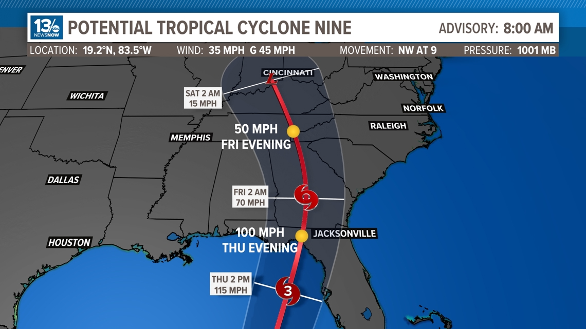
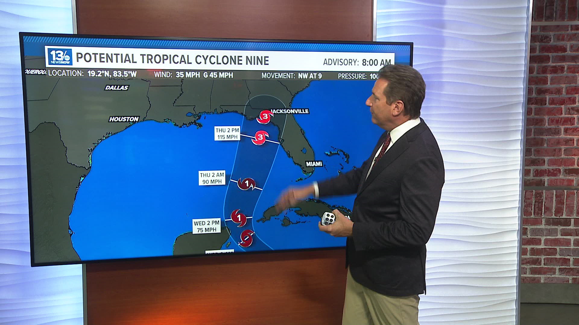
Check out the 8:00 AM Tuesday morning forecast track for what was PTC 9 (anticipated to become Hurricane Helene.)
After an expected landfall around the Big Bend region of Florida, it is forecast to move into southern Georgia Thursday night into Friday. There is an expected steep decline in intensity.


That's because once the system comes ashore, it is separated from its energy source.
Air masses over land are also drier and often contain more aerosol particles than ocean air masses. Cloud cover decreases and there is less convection or storm development near the center.
The storm's winds also encounter more friction from the relative roughness of land. This increased friction also contributes to the slowing of the winds and reduces the surface circulation.
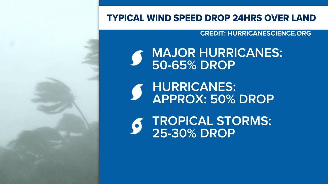
Following landfall, sustained winds in a hurricane usually decrease at a fairly constant rate. Normally a hurricane loses approximately half the wind speed in the first 24 hours it spins over land.
Major hurricanes can lose a little over half of the maximum wind speed.
And weaker tropical storms see about a 25-30% drop in maximum wind speed.


In all cases, the faster the forward speed of a landfalling hurricane, the further inland the stronger winds may reach. While faster-moving systems produce less tropical rain as they cross a region, the area suffering potentially damaging winds can extend much farther than with slower-moving storms.
While tropical systems do weaken considerably over land, remember... they can still be dangerous! Not only can strong gusty winds persist inland for a stretch, there is also the likelihood of tornados within the circulation. Even weaker tropical systems are capable of producing small, short-lived spin-up tornadoes as the circulation interacts with land.

