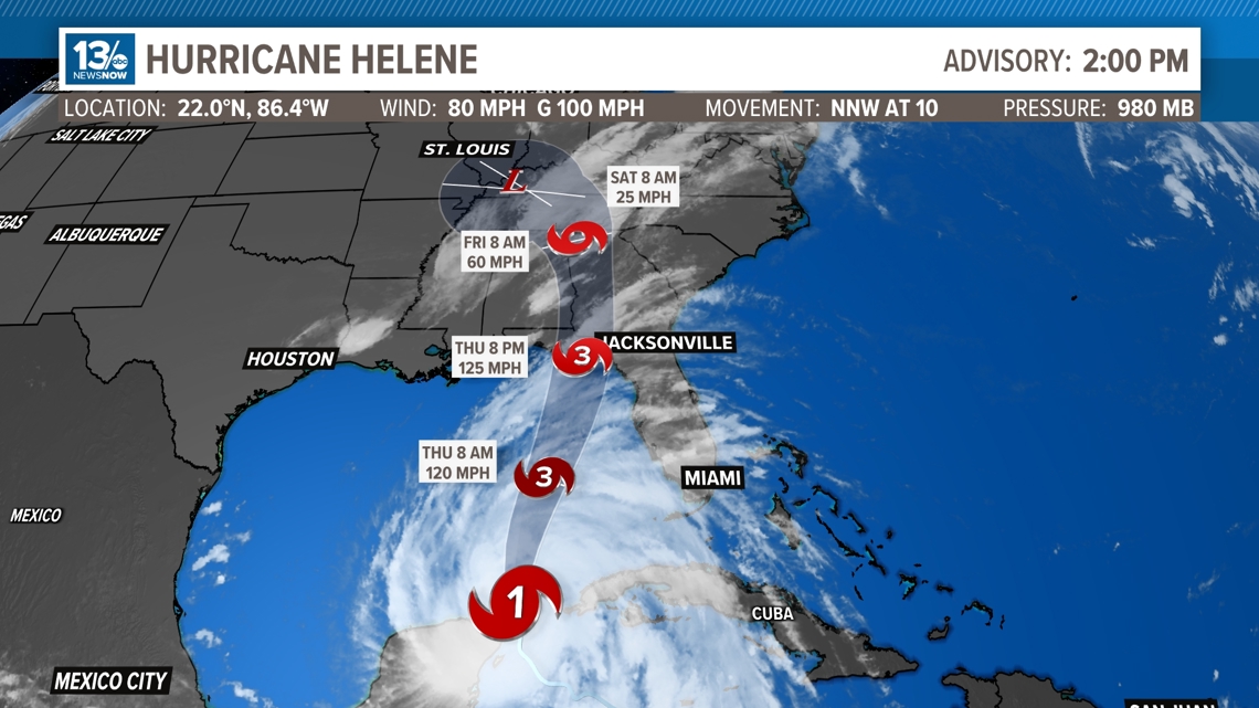
NORFOLK, Va. — As of 2 p.m. Wednesday, Helene is a Category 1 hurricane in the Gulf of Mexico, making it the fifth hurricane of the 2024 Atlantic Hurricane Season.
Helene now has sustained winds of 80 mph with gusts up to 100 mph, located in the very warm waters near the Yucatan Peninsula and will continue to make its way into the Gulf of Mexico today.
The pressure has actually come up from 979 mb to 980 mb from the 11 a.m. to the 2 p.m. update due to Helenes interaction with the Yucatán, slowing down it's opportunity to strengthen further but once it gets back into the Gulf, there is not much to stop this from continuing to strengthen.
The storm is currently located in an ideal environment for rapid intensification and is forecast to become a major hurricane (at least a Category 3) before approaching the Big Bend area of Florida later this week.
The National Hurricane Center believes that this storm will make landfall late Thursday.

Helene storm threats in Florida, Georgia
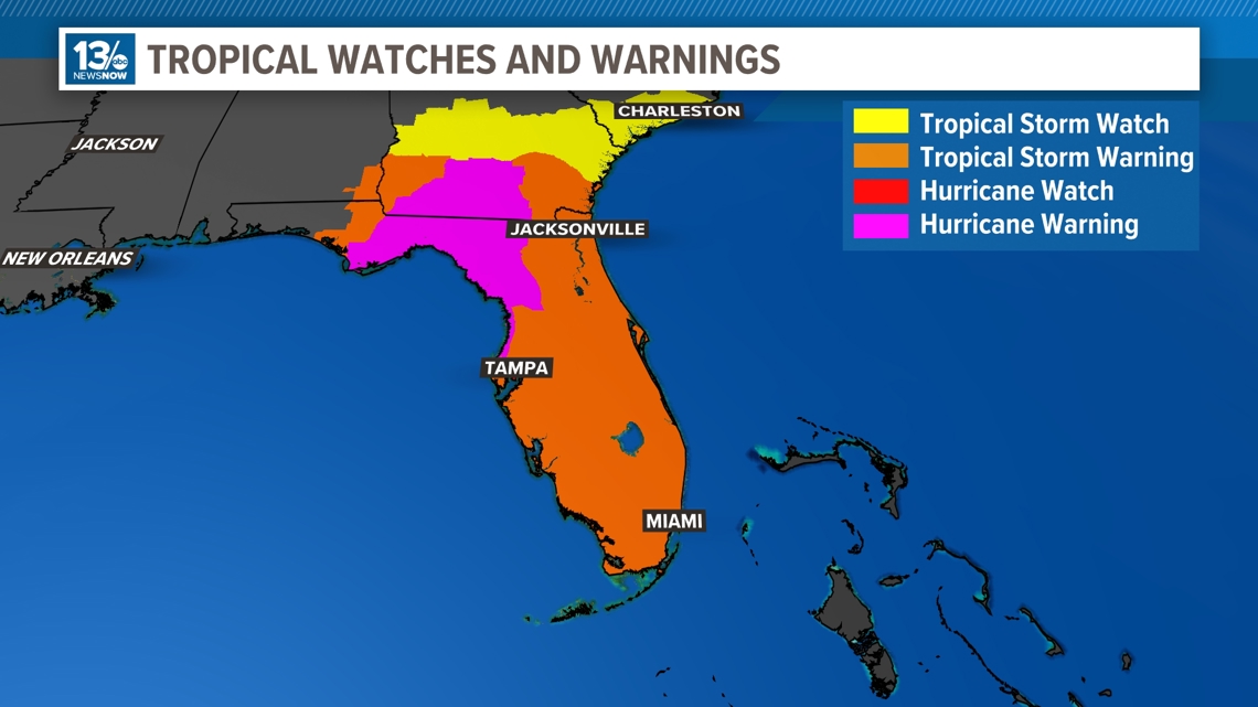
Storm surge is a major threat with Helene, and some areas along the Big Bend area of Florida could see up to 10-12ft of storm surge, inundating houses, cars and businesses.
Residents in the Deep South, especially Florida and Georgia, should continue to keep a close eye on this system, as life-threatening storm surge, hurricane-force winds, and spin-up tornadoes are possible starting on Wednesday.
That said, Hurricane Warnings are now in effect for the Yucatan Peninsula, the Big Bend and the Panhandle of Florida, reaching all the way into South Georgia. Topical Storm Warnings are in effect for the entire Florida Peninsula.

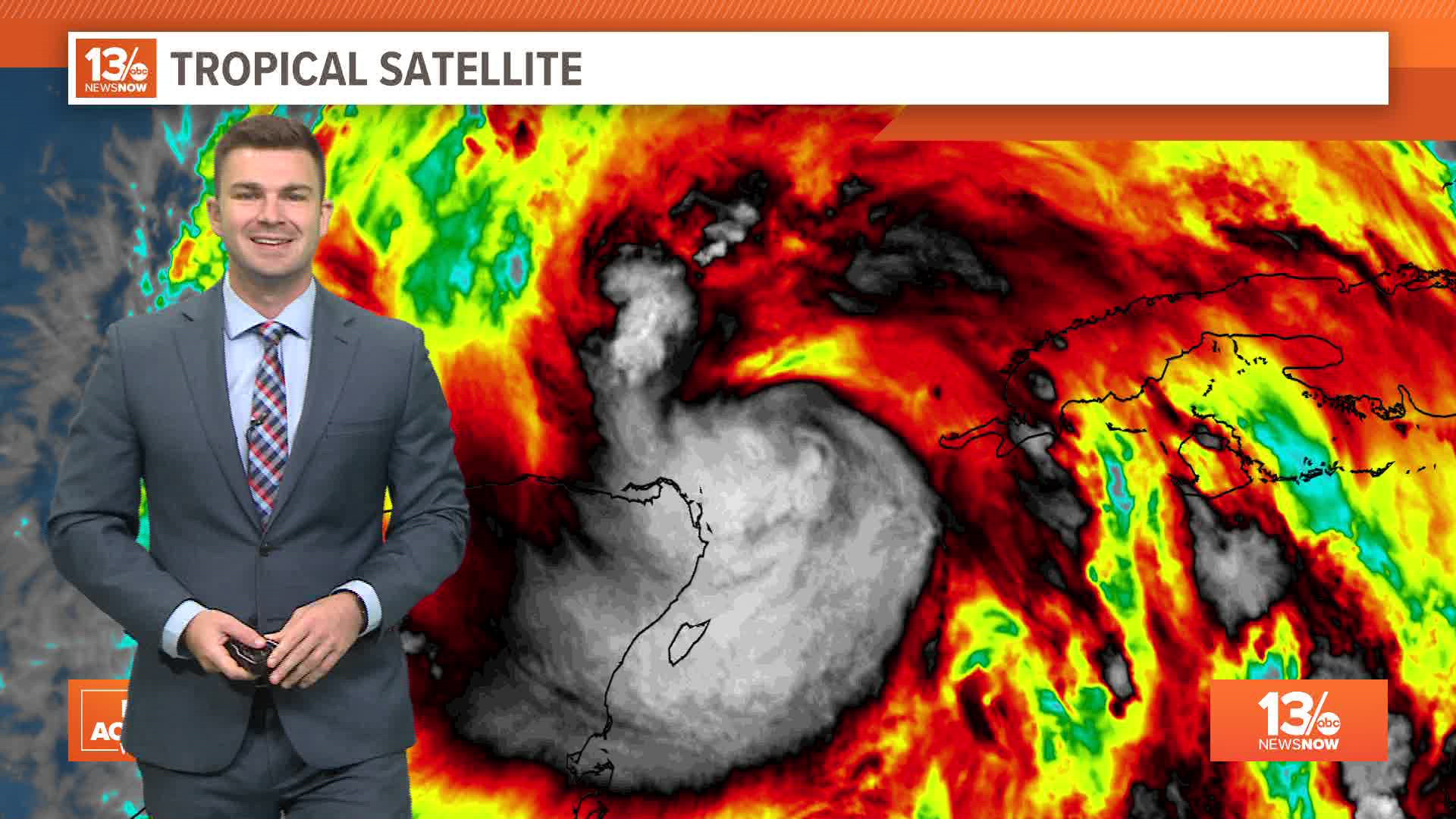
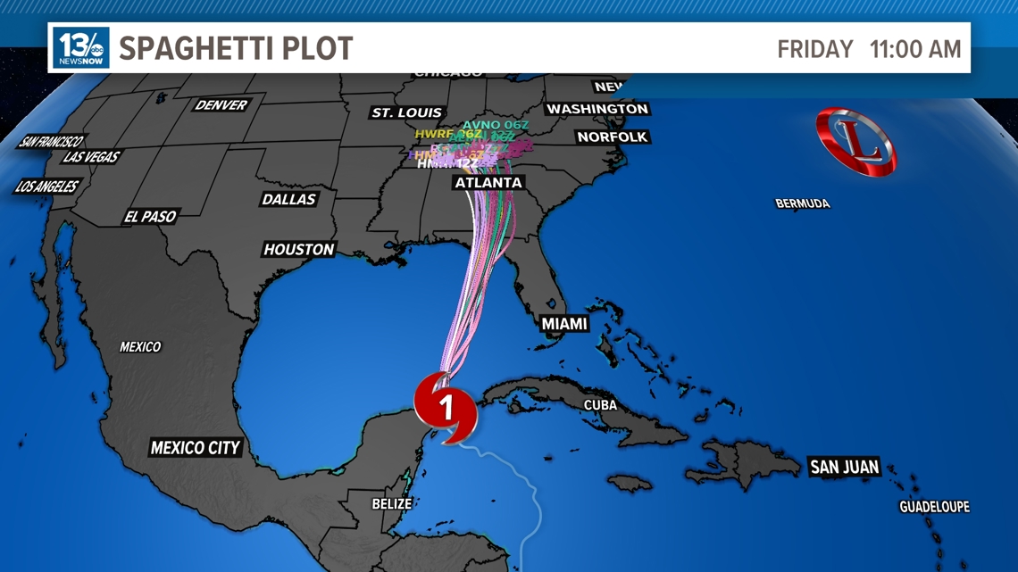
Hurricane Helene spaghetti models
Global models, as well as higher-resolution hurricane models, are in fairly close agreement about the intensity and timing of Hurricane Helene.
Below are the most recent spaghetti plots, where each line represents a different computer model. Take note of the remarkable agreement throughout almost the entire forecast period.
After the system makes landfall, the models carry the center into the southeast US, and suggest a trough of low pressure will actually draw the system north/northwestward and into the Tennessee River Valley.
Flooding rain will be possible far inland, and southern parts of the Blue Ridge and Smokey Mountains could see heavy rain depending on how the system tracks.

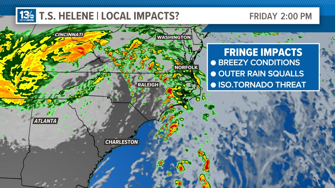
Hampton Roads impacts from Helene
For Hampton Roads, we're expecting increased rain chances for Friday and Saturday from the outermost bands of Helene and the abundance of moisture the system will pull in from the Atlantic. Breezy conditions are also possible with wind gusts up to 25 mph on Friday, and rain totals are looking to be anywhere form 1-2" with locally higher amounts.
Some models suggest that we may have an isolated severe weather threat if those bands reach our area. That threat would be the chance for a brief, spin-up tornado.