
NORFOLK, Va. —
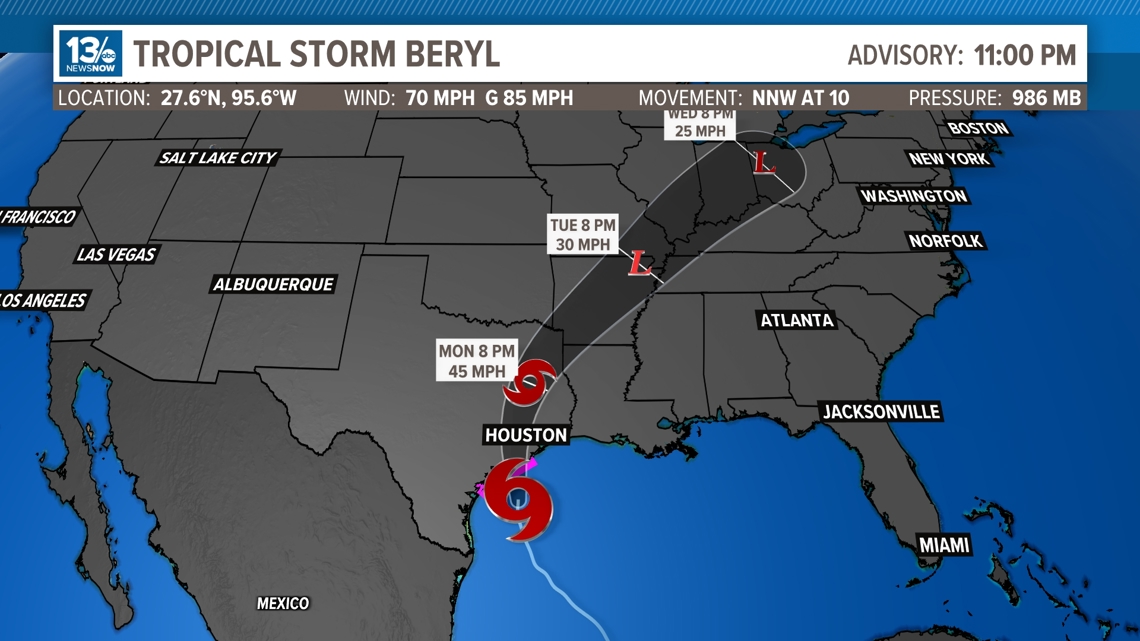
Tropical Storm Beryl
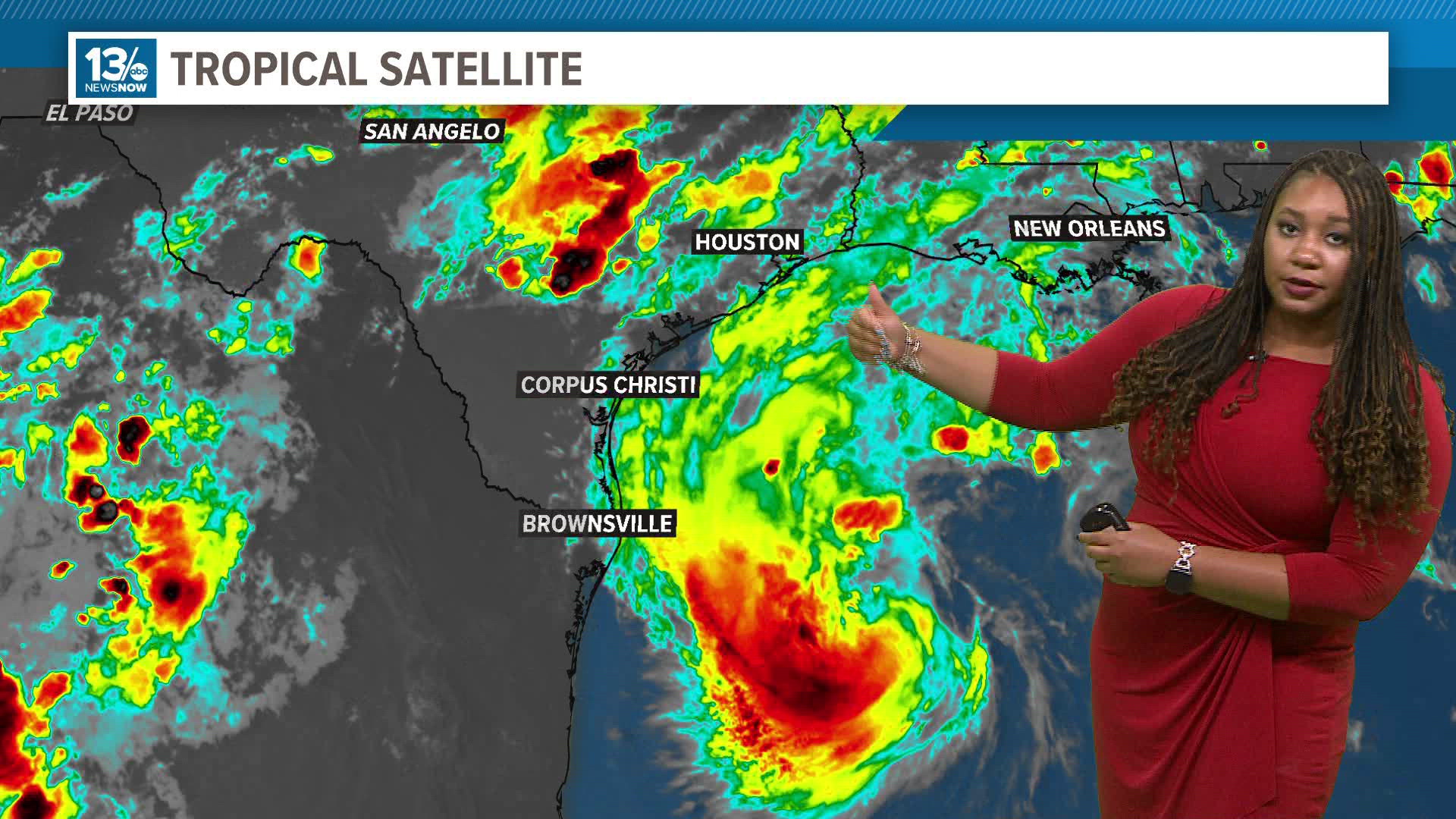
Beryl continues to churn in the Gulf of Mexico, eyeing down another landfall, but this time in Texas.
Beryl is still a tropical storm with winds of 70 mph. As Beryl moves over the warm waters of the Gulf of Mexico, it will likely re-strengthen into a Category 1 hurricane right before landfall. There is a risk of damaging hurricane-force winds and life-threatening storm surge in portions of northeastern Mexico and the lower and middle Texas Coast late Sunday and Monday, where Hurricane and Storm Surge Warnings are in effect. Flash and urban flooding are possible across portions of the Texas Gulf Coast and eastern Texas from Sunday through the middle of next week.

Beyond Beryl, there most likely won't be much in the way of development for at least a week or so due to an influx in Saharan dust entering over the Atlantic, making it much harder for tropical development.
We are keeping close tabs on all the developments in the tropics, so continue to check back with us on 13News Now for updates.