
NORFOLK, Va. — There has yet to be much significant change over the past 24 hours.
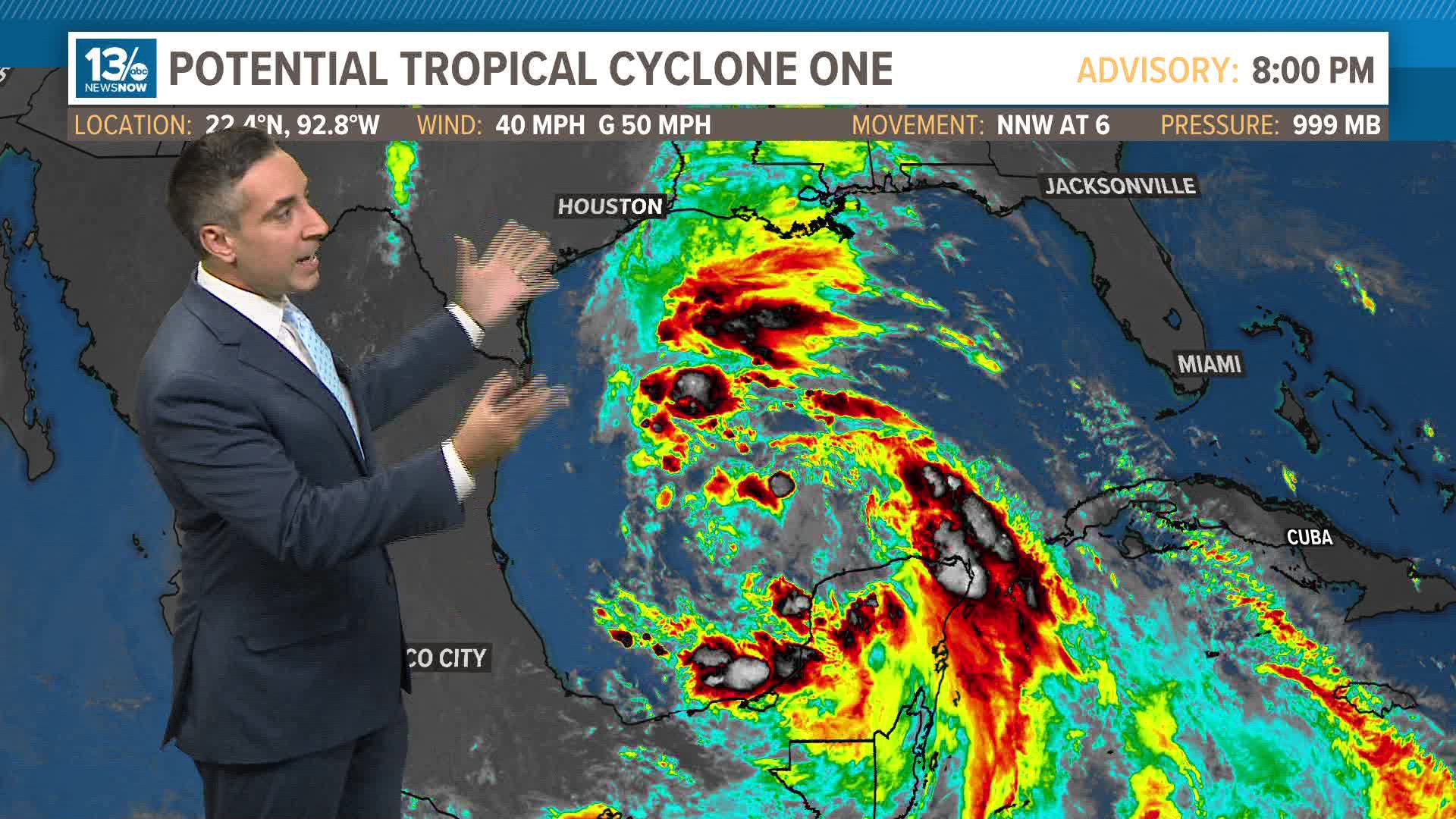
Alberto is expected to develop from what is still Potential Tropical Cyclone (PTC) 1 in the Gulf of Mexico.
PTC1 had winds Wednesday morning of 40 miles per hour. The National Hurricane Center believes PTC1 will become a tropical system later Wednesday, possibly in the afternoon.
The system has mad a turn westward. Right now, the National Hurricane Center forecast is that it will make landfall in Mexico Thursday.
Even though the maximum sustained winds are not projected to be all that strong (45 miles per hour), this is still a potentially dangerous system as it will likely produce heavy, flooding rains over parts of Mexico and south Texas.
While the center of the storm is forecast to move into Mexico, parts of south Texas could still see six to nine inches of rain.
Surf will likely get rough along the coast, and some storm surge is possible, too.
Another area far east of the Bahamas is worth keeping an eye on. The development chances are still pretty low, only 20% over the next seven days. Still, with a westward movement anticipated, it may eventually bring some rain to the southeast US and the Carolinas later in the weekend.
Speaking of later… another potential area of interest over the next seven days will be in the southern Gulf of Mexico. Days after dealing with whatever becomes of PTC1, the same region in the gulf could have another system. Development chances are up to 30% over the weekend.
Activity is clearing and picking up in the tropics!