NORFOLK, Va. — Hurricane Ian weakened to a tropical storm overnight Wednesday and is expected to continue toward the Carolinas and Virginia, where remnants of the storm will bring rain, wind, and possible minor to moderate tidal flooding to Hampton Roads this weekend.
The eye of Hurricane Ian made landfall Wednesday afternoon near Cayo Costa, Florida as a Category 4 storm with winds of 150 mph, bringing storm surge flooding to the Florida gulf coast.
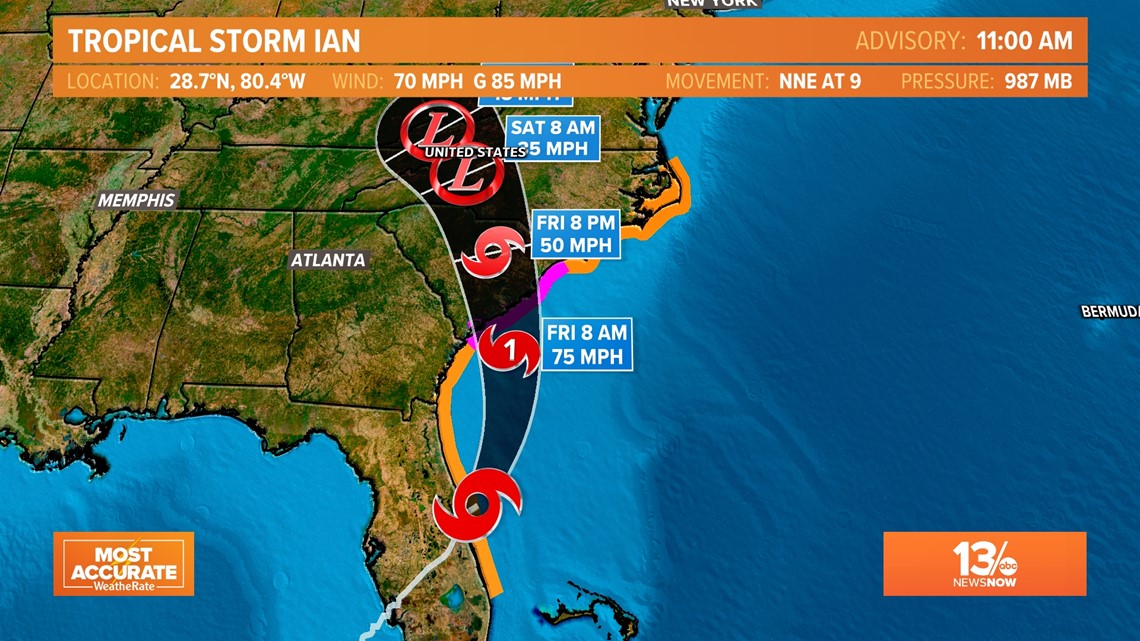
Overnight and early this morning, Ian weakened to a tropical storm as the center of the system tracked over land.
Where is Tropical Storm Ian now?
As of Thursday morning, Ian was tracking northeast at 9 mph. Its winds are down to 70 mph with gusts to 85 mph.
As the storm's center moves back out over water later Thursday it may have an uptick in intensity before making another landfall along the South Carolina coast.
Ian will weaken to a depression and eventually a remnant low later Friday and into Saturday.


How will Ian impact Virginia?
After making a second US landfall, the *remnants* of Ian will move north-northwest and bring moisture through parts of the Appalachian Mountains.
Hampton Roads will not see a "direct hit" from Ian, but we will see rain and wind this weekend as the storm gets absorbed by a cold front and stalls over western Virginia.
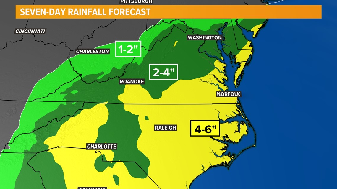
Look for showers to develop early Friday with a wet and windy day both Saturday and Sunday. Four to eight inches of rain is possible across the area through Tuesday, with some locations picking up even more. Heavy rainfall could cause freshwater urban flooding in some areas.


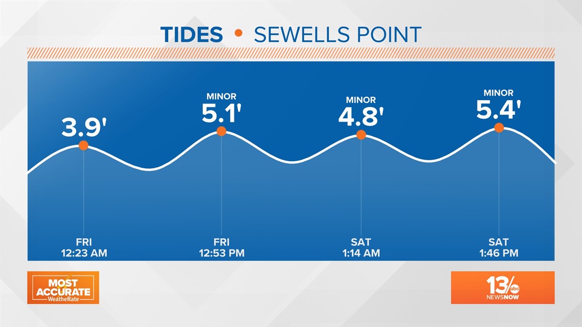
In addition, several days of onshore winds will likely cause higher-than-normal tides through the weekend.
Minor tidal flooding is expected with each high tide, starting Friday afternoon. Moderate tidal flooding, meaning water levels over 5.5', is possible on Sunday.


Hurricane Ian Tracker:
Find live radar and the latest forecast cone for Tropical Storm Ian's path in the video player below.

