NORFOLK, Va. —
Update on Invest 90-L
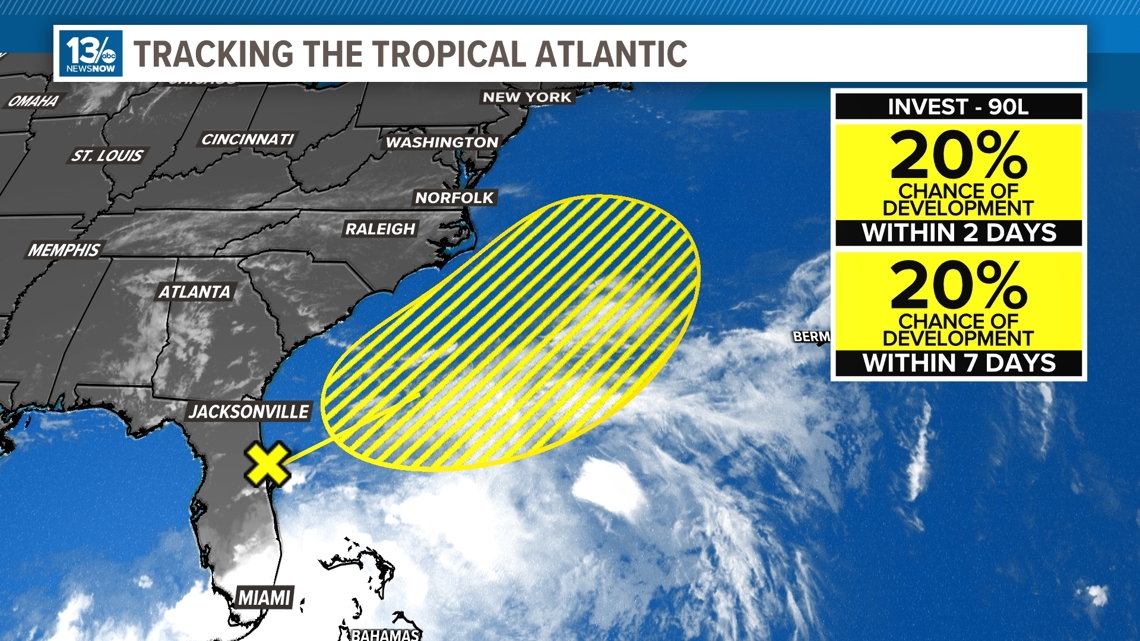
The National Hurricane Center identified "Invest-90L" earlier this week when it was centered as a broad area of low pressure over the eastern Gulf of Mexico. Over the past couple of days the area has tracked eastward across Florida producing flooding rain for much of the "Sunshine State."
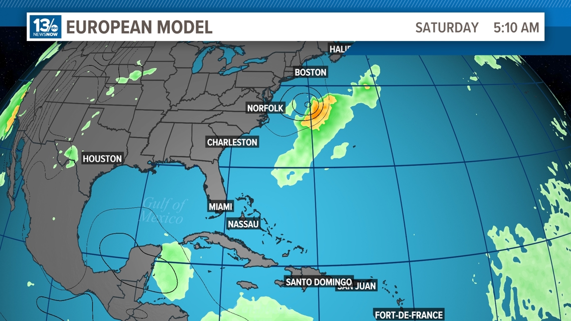
This system is now expected to move northeastward over the coming days and stay offshore, well south and east of the Mid-Atlantic.
Invest-90L is the first of the season in the basin and doesn't have a high probability of developing, only 20% over the next seven days.
But even if it does develop out over the Atlantic, a cold front will push through Hampton Roads and clear the Mid-Atlantic seaboard early Saturday morning. That front will usher the system farther east and away from the coast.

RELATED: FORECAST: Warm Thursday, hot Friday

And there's this...
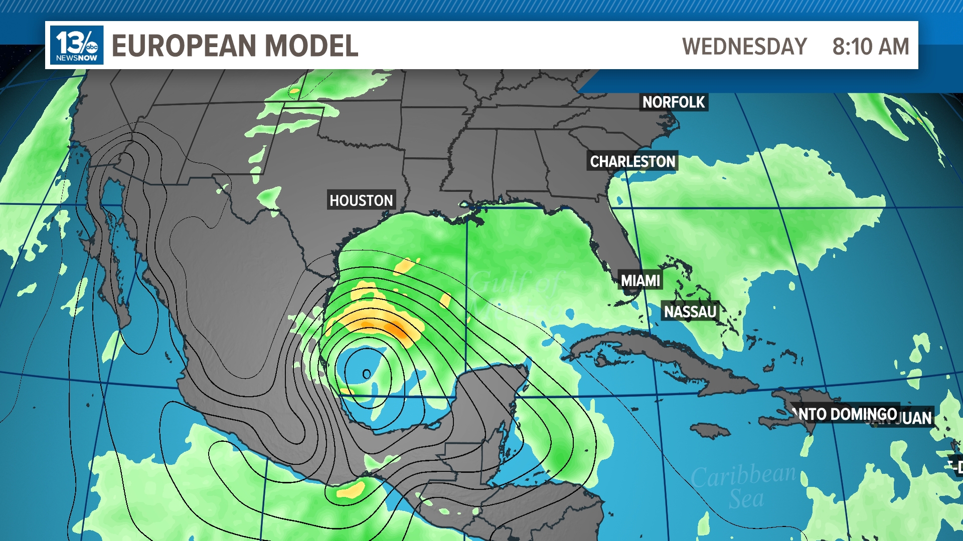
A second broad area of low pressure also has the potential to develop in the coming week. The National Hurricane Center will look for potential development over the next two to seven days over the southern Gulf of Mexico.

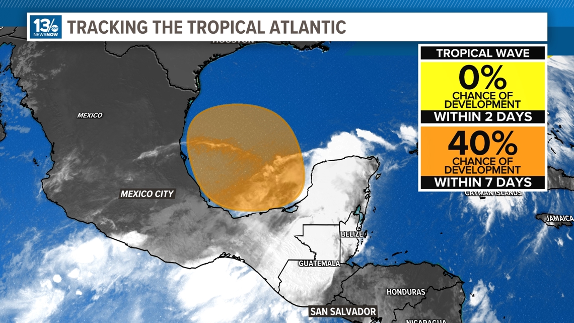
The official outlook from NHC is calling for a 40% chance of development through the next week. A few models, including the Euro, show a developing system approaching the Mexican coastline by the middle of next week.


This area will be closely monitored and we will keep you updated. Keep checking back with 13News Now for the latest.
What is a tropical wave?
Tropical waves are sometimes called "invests" or "investigative area." These are areas of unsettled weather that we want to monitor for the potential of tropical development in the short term, over the next two to seven days.
You'll see some other letters and numbers that are tacked onto the right side of an Invest.

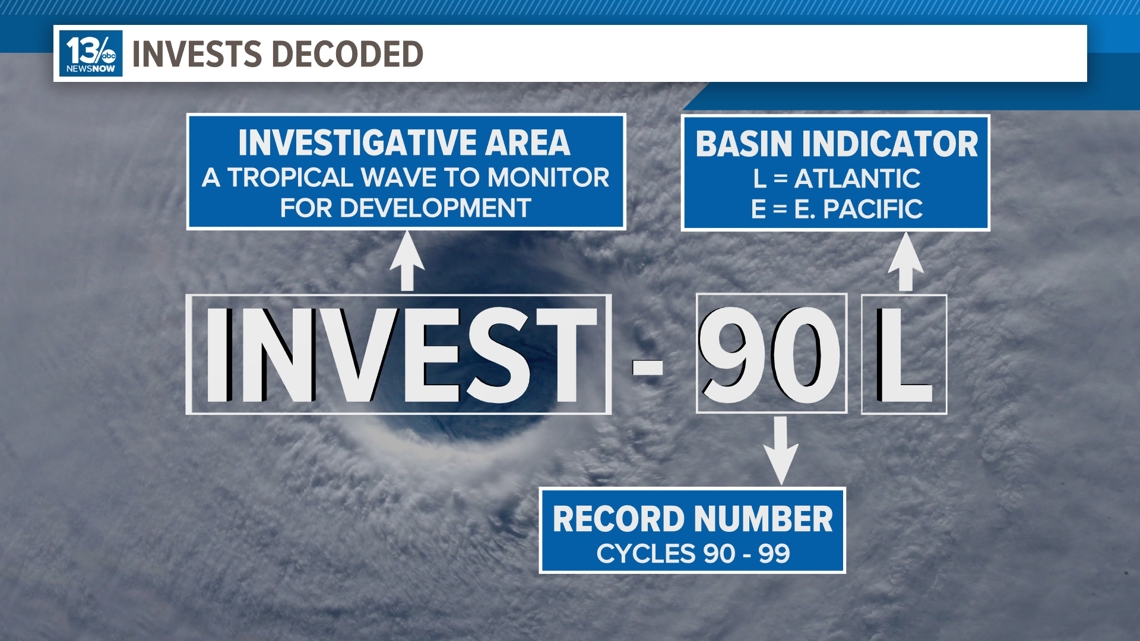
In this case, we are monitoring "Invest-90L": The number is a record number that cycles from 90 through 99. The letter "L" in this case is a basin indicator, signaling that this investigative area is located in the Atlantic basin. Other letters you may see in other basins include "E" for eastern Pacific, or "C" for central Pacific.
I know what you may be asking, "Why don't they use 'A' for a system in the Atlantic basin?" Well, that makes sense however "A" is actually used for tropical systems in the Arabian Sea.
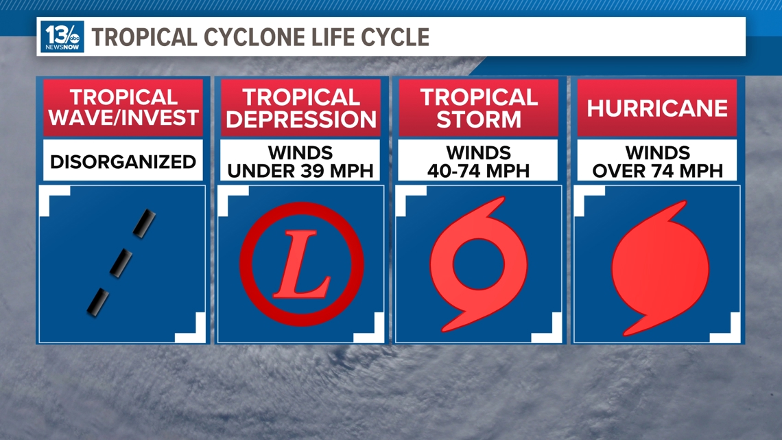
Tropical waves or "invests" are the first terms used to define tropical threats in all basins across the world. As a system begins to organize and strengthen other terms are used to define it. After a tropical wave or "invest," systems may strengthen enough to be called a tropical depression.
These are areas of low pressure with winds that are sustained below 39 miles per hour. Once winds cross that threshold it becomes a tropical storm, this is where a storm will be named. Further strengthening of winds to over 74 miles per hour gives us a hurricane.

RELATED:

