
NORFOLK, Va. — As far as hurricane activity and development go in the Atlantic basin, it looks like it's taking a breather over the coming seven days as the National Hurricane Center is not currently watching any single area for the possibility of development.
This is good news after such an early occurrence of a major hurricane, Beryl, just last week. Overall, the current conditions in the basin are rather unfavorable for tropical development with more sinking motion rather than rising motion, which would be needed to initiate storm development.
RELATED: Beryl leaves hot misery in the Houston area. It still threatens flooding on its path northward
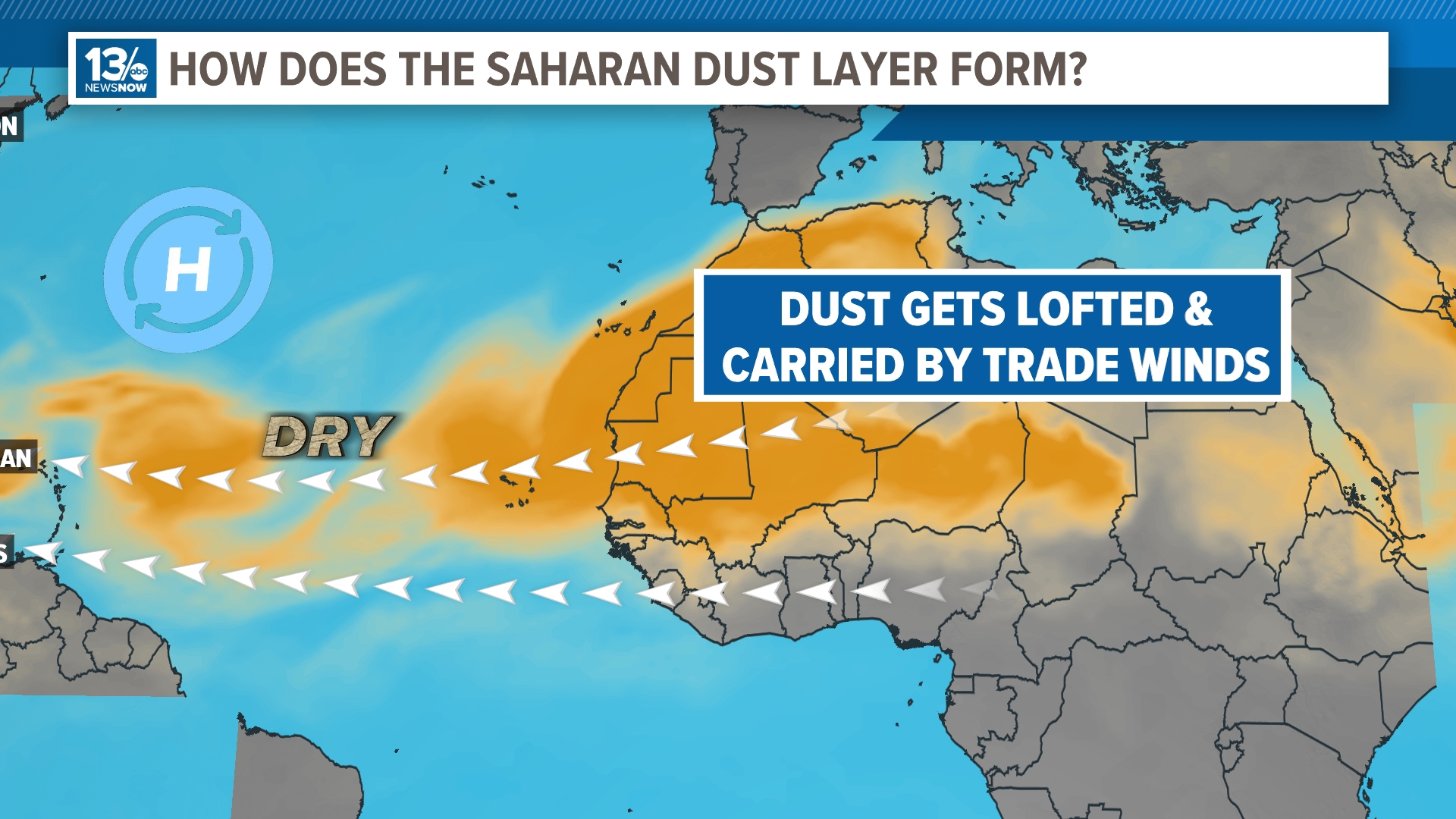
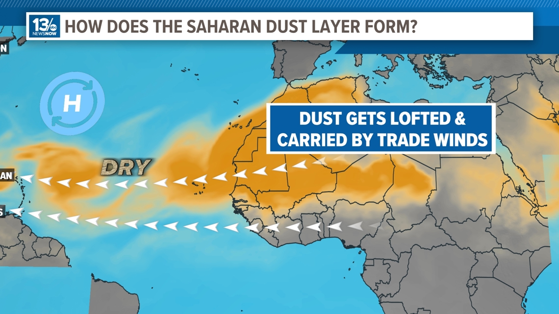
Another large component of the absence of activity is an outbreak of Saharan dust. Yes, dust from the Saharan Desert is a common visitor to the mid-levels above the Atlantic basin this time of year.

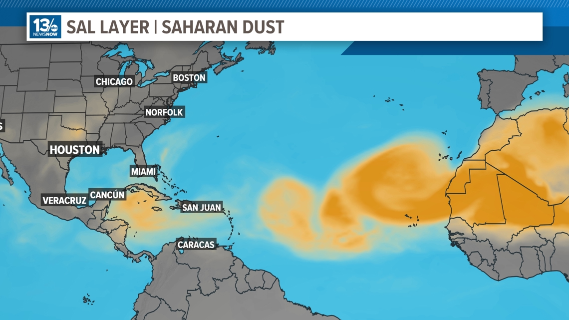
The dust promotes drier than usual layers of the atmosphere which would need to be moist to enable tropical activity. So how does dust from another continent wind up lofted in the air halfway around the world?
This time of the year, it is typical to see an increase in monsoonal thunderstorm activity in an area of Africa south of the Saharan Desert called the Sahel.

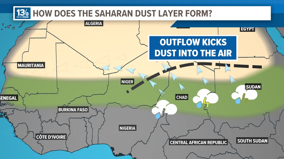
As the storms intensify, the outflow from their collapse kicks up dust into the atmosphere and then that dust hitches a ride on the trade winds that transport it to the west, over the open Atlantic.
The increase in dust levels in the mid-levels is also known to block out the sun’s rays. This usually helps to cool the ocean temperatures where the breakout is the thickest. As you know, this is a good thing, considering ocean temperatures are currently at record highs.

July is known for Saharan dust outbreaks, and they usually come to a sharp end by the end of the month, just before hurricane season really kicks into high gear. Regardless of the dust’s presence now, the season is still expected to be hyperactive.
Remember, hurricane season lasts through late November!
RELATED: How are hurricanes formed?