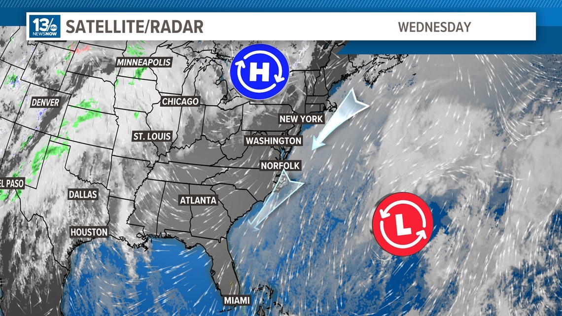
NORFOLK, Va. — With low pressure off the coast of the southeast United States and high pressure over the eastern Great Lakes, northeast winds have been persistent across Hampton Roads and the Chesapeake Bay.
Water has been pushed into the mouth and tides have been building in the lower part of the bay. The result has been higher than normal tides with some flooding in vulnerable areas over the past couple of days.
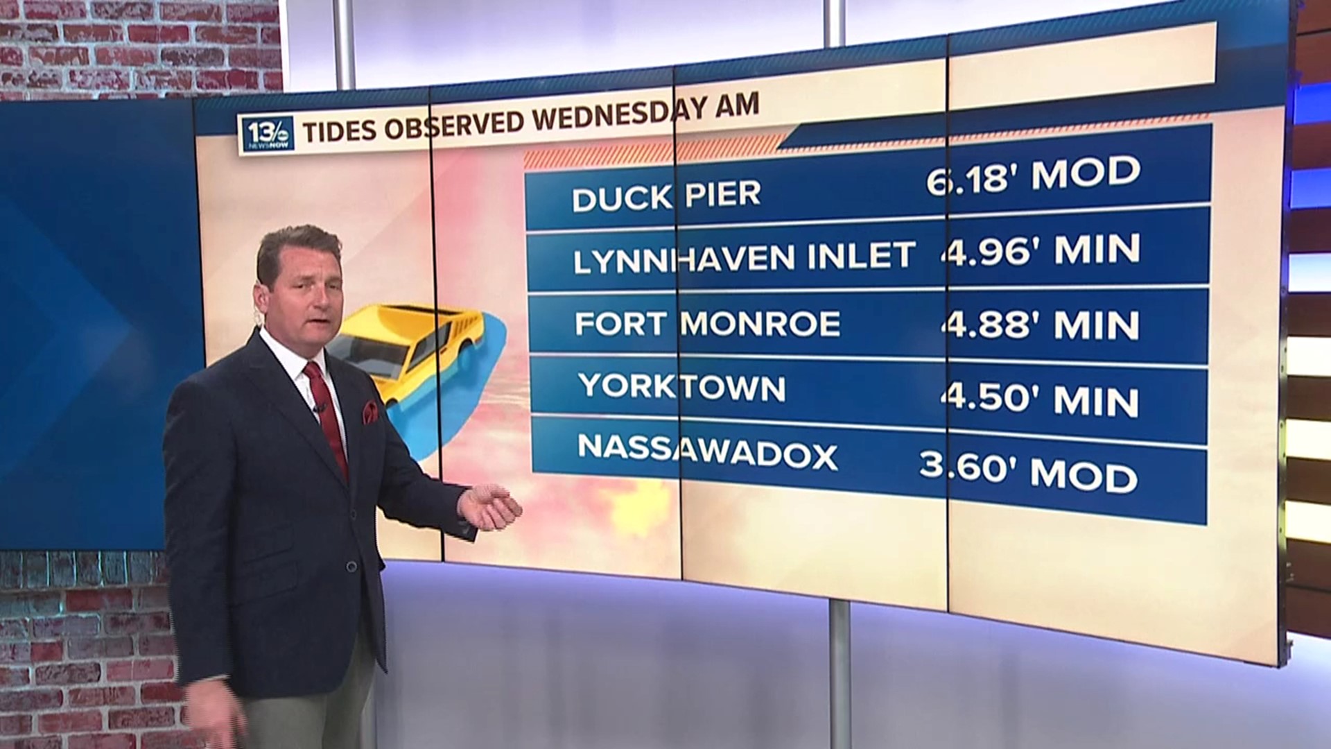
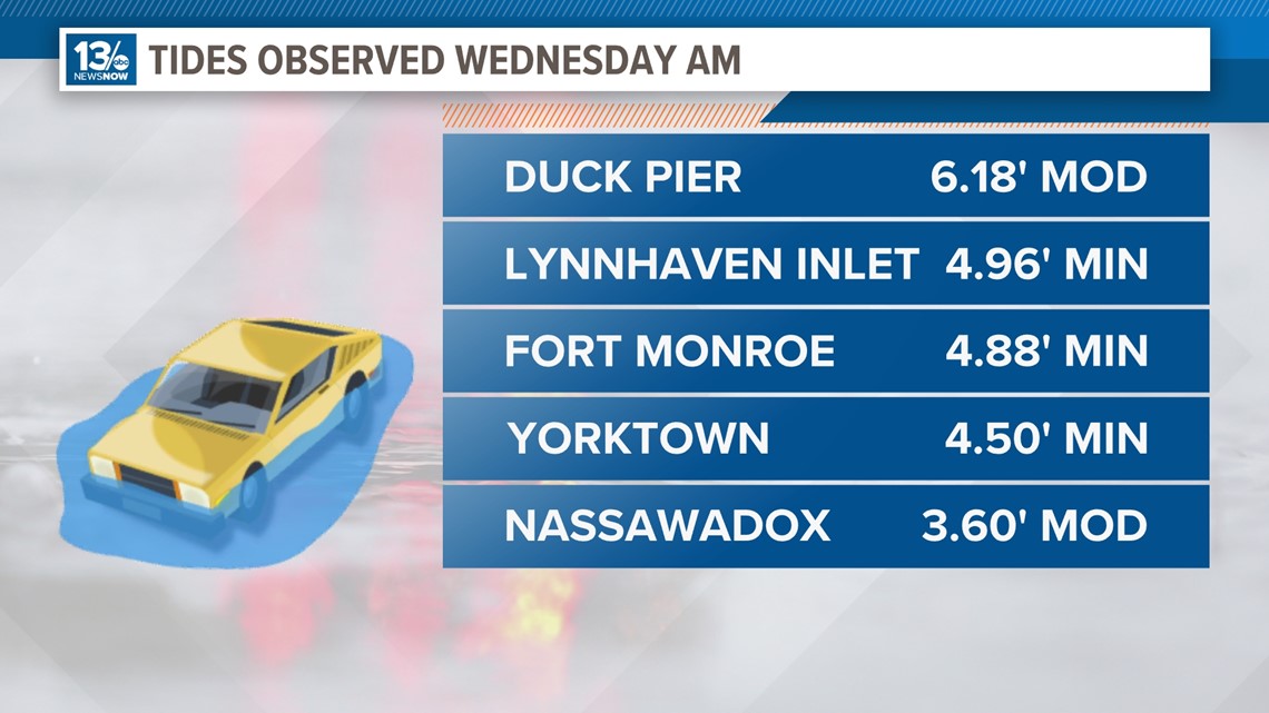
This morning's high tide produced moderate flooding at Duck Pier along the North Carolina Outer Banks and at Nassawadox on Virginia's Eastern Shore. Minor flooding was reported near Fort Monroe, Yorktown, and at the Lynnhaven Inlet.
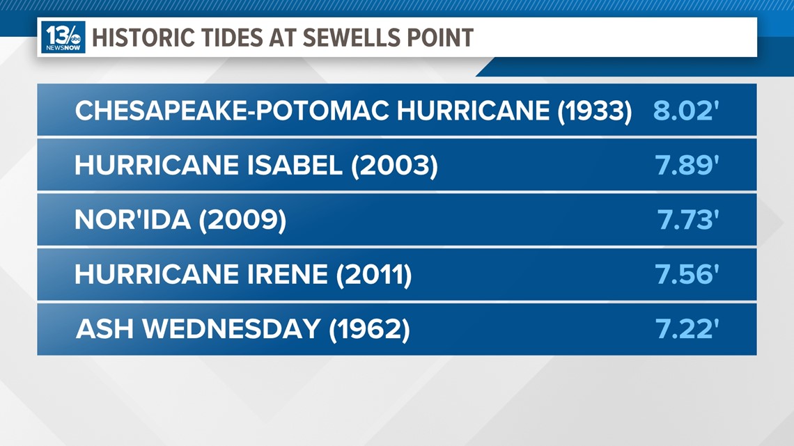
At Sewells Point, the official reporting station for Hampton Roads and Norfolk, the water reached 4.89 inches. While that level produced minor flooding, it came in a little below what some of the tide models projected.


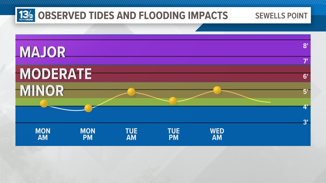
The level this morning for Norfolk was a full 36 inches lower than the peak tide level with Hurricane Isabel back in 2003.

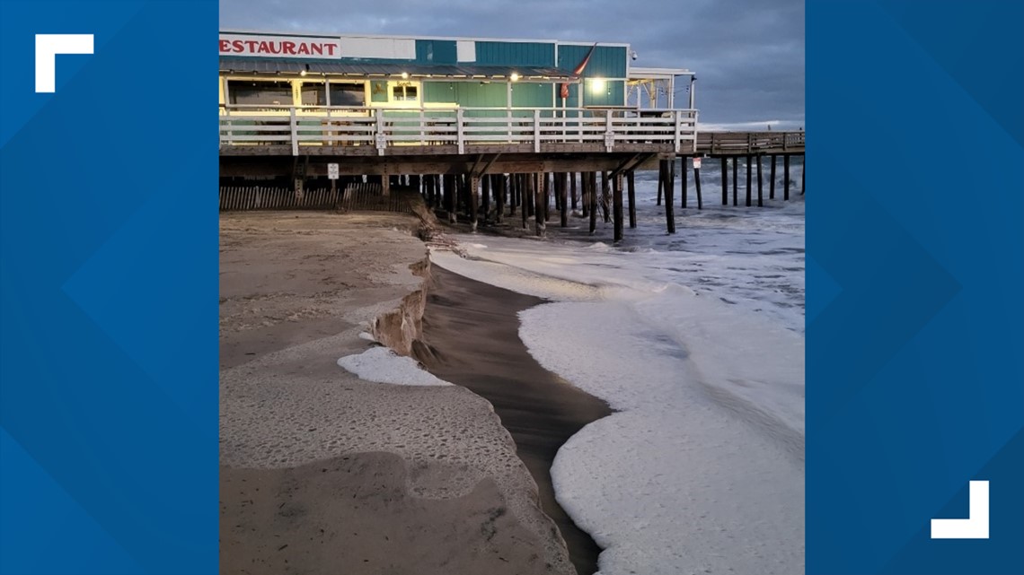
Rough surf pounded the Virginia Beach Oceanfront this morning, causing some minor beach erosion.

Fortunately, the low-pressure system responsible for the higher tides is now moving farther away. If forecast modeling is correct, the worst of this round of tidal flooding is likely behind us.
Tides will still run high later Wednesday and Thursday but are not expected to be as high as levels reported early Wednesday.
For the latest forecast for Hampton Roads, visit 13News Now's Weather page.

