
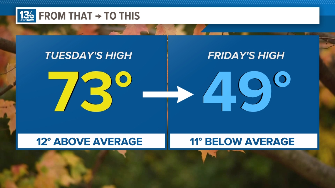
NORFOLK, Va. — What a ride in the temperature department this week. We went from highs in the 70s just a few days ago to not getting out of the 40s today. In fact, Friday afternoon's high was the coldest daytime high since late-March!
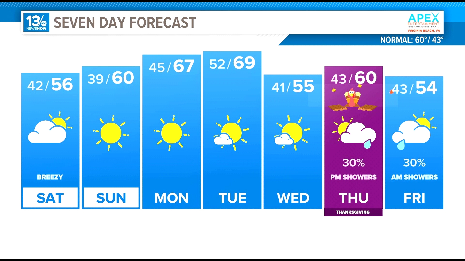
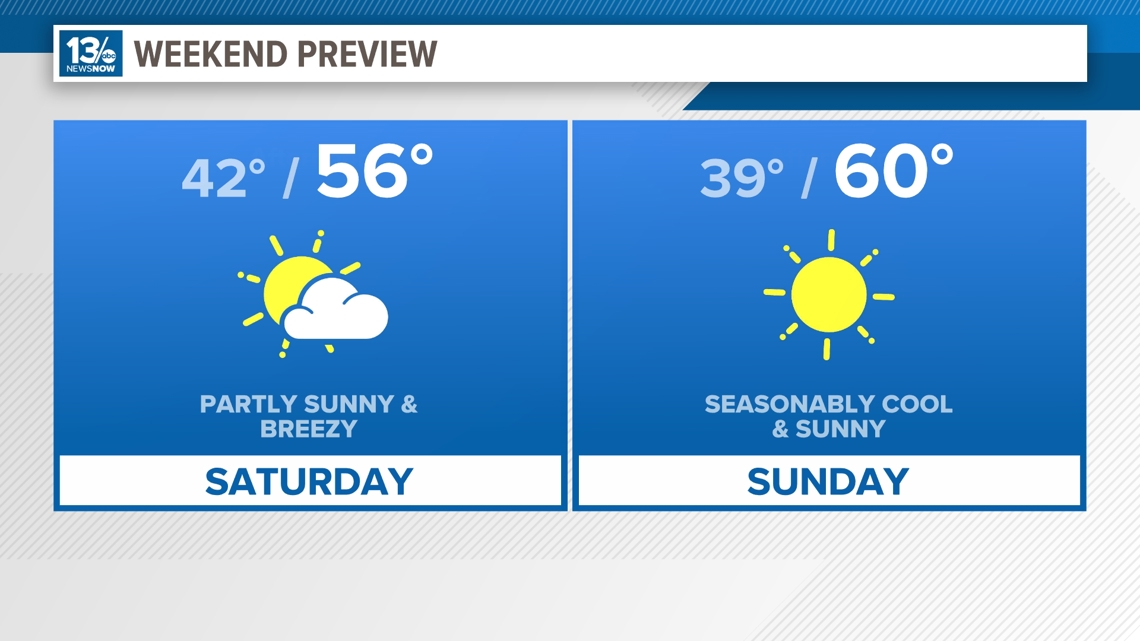
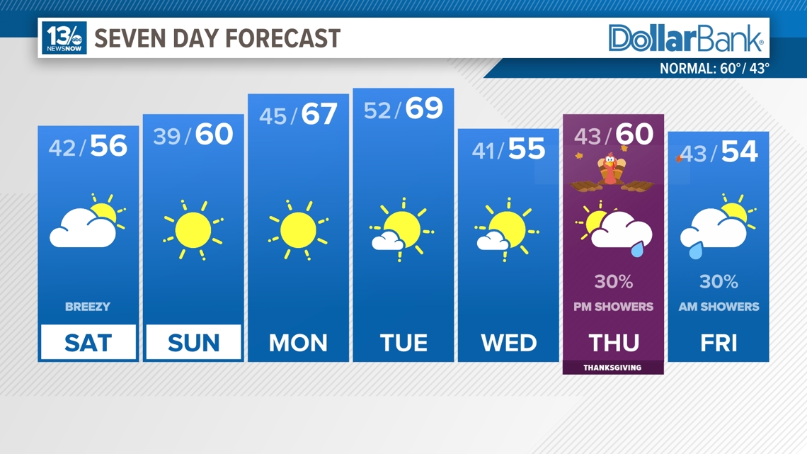
High pressure will build back in this weekend, but it will still be another blustery and cool day Saturday.
Feels like temperatures for Saturday morning will start out in the mid to upper 30s, but the afternoon will be slightly 'warmer' than today, getting back to around average this time of year, near 60°. Skies will stay mostly sunny for the morning, but in the afternoon, we'll see more cloud cover making its way into the area.


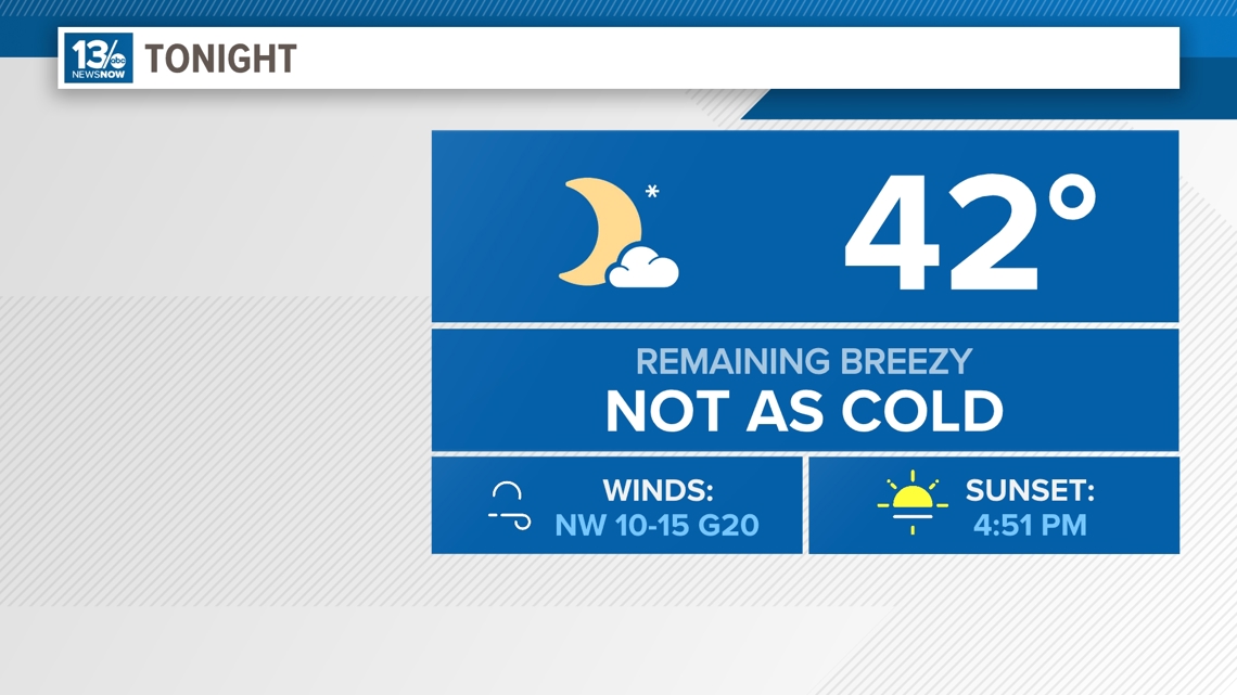
The winds finally die down Saturday night and Sunday, and temperatures tick up slightly into the lower 60s.

A nice warm up is expected next week as the high moves off the coast. Temperatures will be back into the middle 60s by Tuesday.
Then, as we head into the Thanksgiving holiday, a cold front is forecast to move through the area. For Wednesday, which will be a huge travel day, look for partly sunny skies and highs in the middle 50s.
Rain chances will go up slightly on Thanksgiving Day as models are showing a potential system moving into the region. There is still some disagreement on the exactly where this system will be and how strong it will be, but it's something that we will continue to watch evolve. Isolated rain chances will continue into Friday.

In the Tropics...
Tropical development is not expected during the next 7 days. Hurricane season ends on November 30.
Stay connected 24/7 via 13News Now