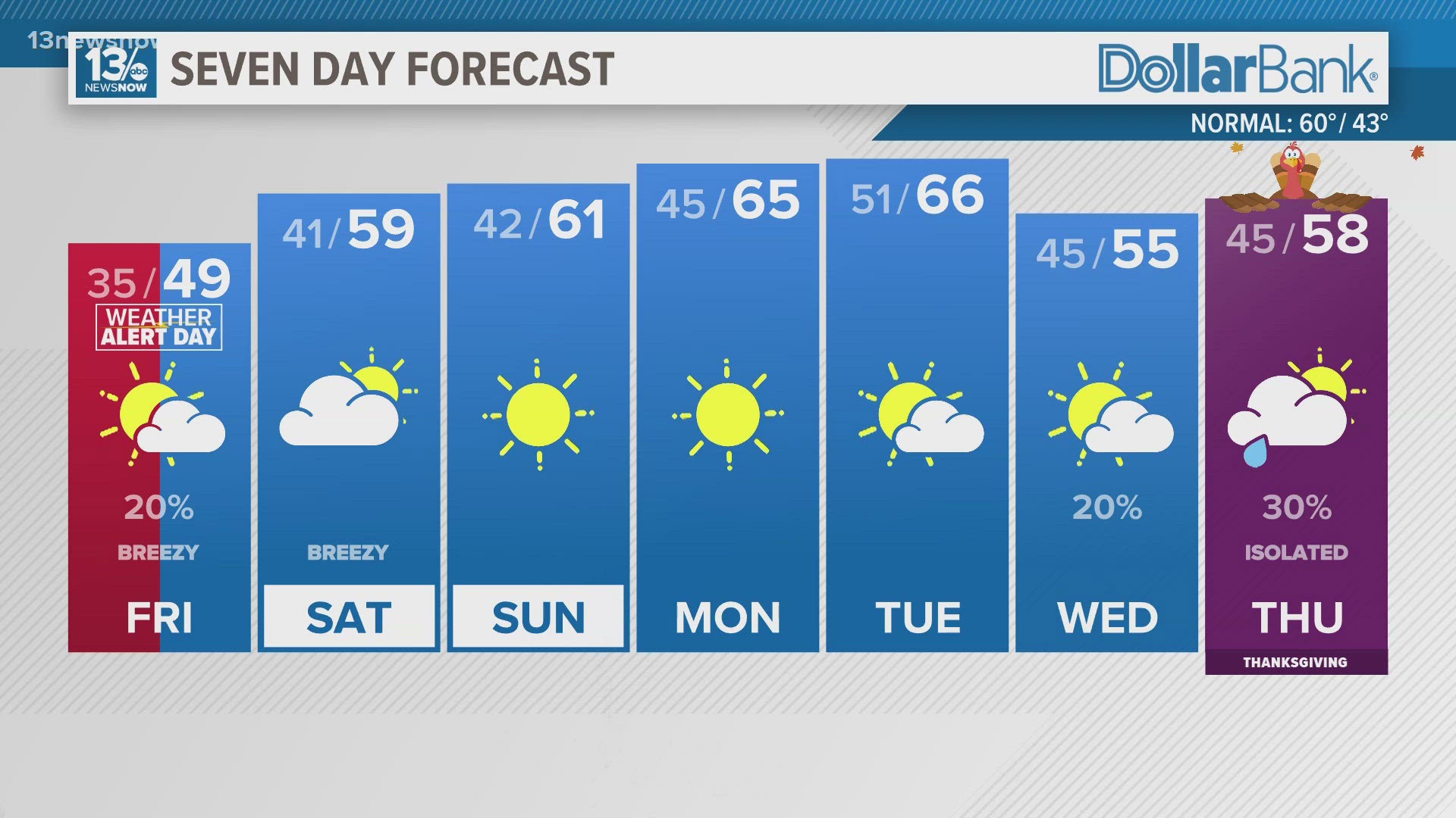
NORFOLK, Va. — The colder weather has settled in across Hampton Roads, and temperatures will continue to tumble tonight, bringing us the coldest weather since March. A couple of weak systems will pass through this evening and tonight, producing some clouds and possibly even an isolated shower. Skies will clear later tonight, allowing temperatures to fall even more. Lows will range from the upper 20s well inland to the lower 30s across the Eastern Shore, southeastern Virginia, and northeastern North Carolina.
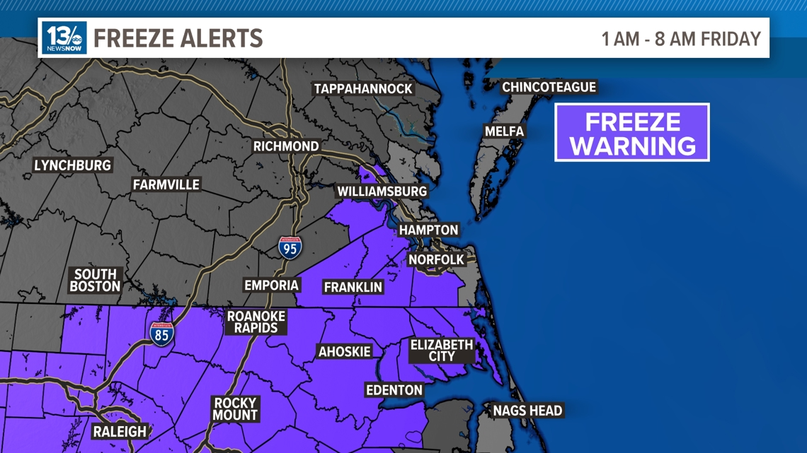
A freeze warning has been issued for interior sections of Hampton Roads and northeastern North Carolina. If you still have tender vegetation outdoors, now is the time to cover it or bring it indoors.

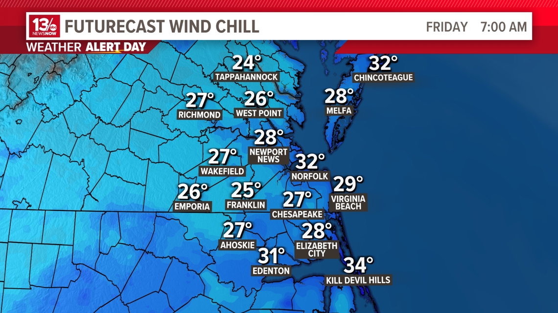
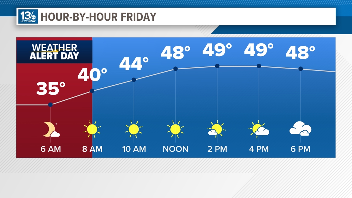
By morning, the combination of a clear sky, a colder airmass, and breezy conditions will promote some of the coldest overnight readings so far this season. Actual air temperatures will be in the middle 30s, but wind chill temperatures will likely be in the 20s area-wide Friday morning. For this reason, a Weather Alert Day has been declared for Friday morning.


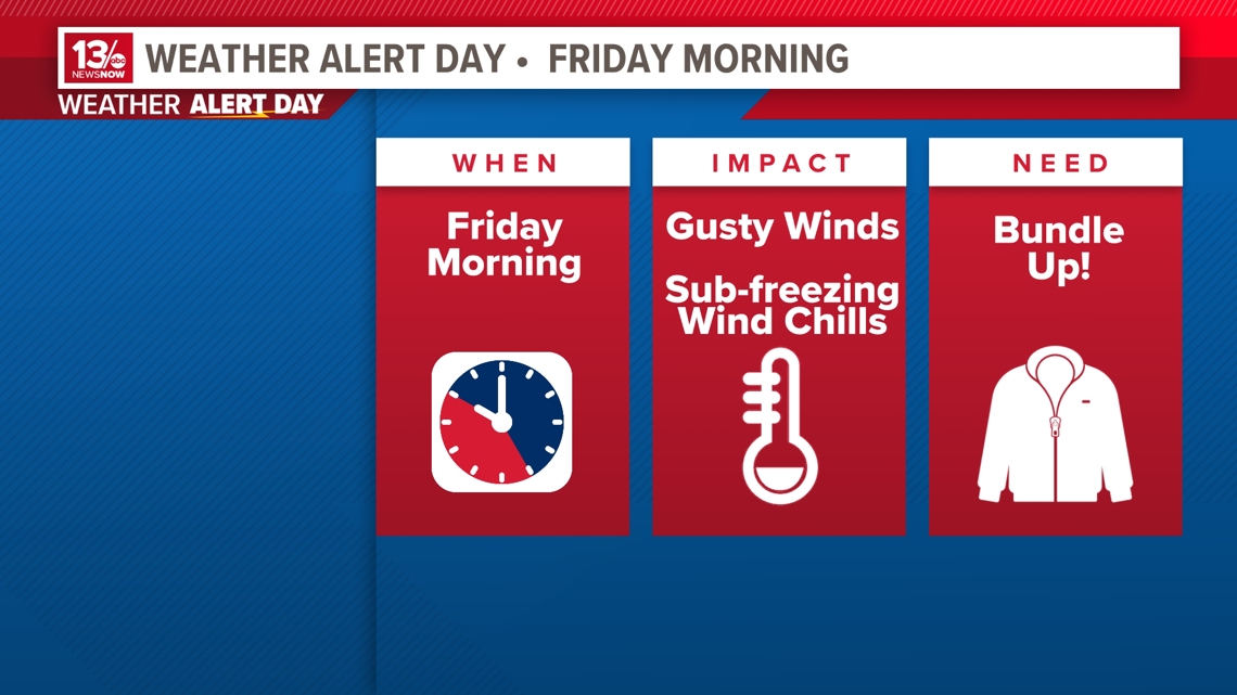
It will be blustery and cold to end the workweek. Despite plentiful sunshine, high temperatures will struggle to make it to 50° on Friday with more northwesterly breezes.

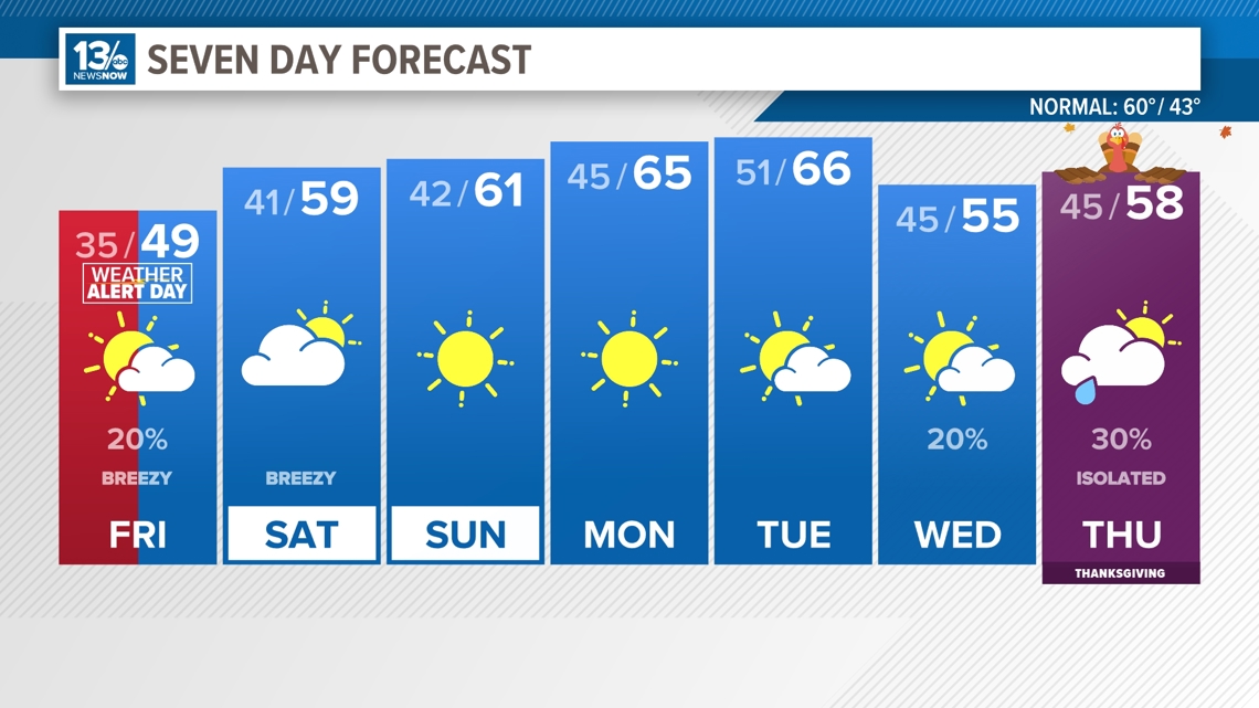
High pressure will build back in this weekend, but it will still be another blustery and cool day Saturday. Temperatures will warm slightly, back to around average this time of year, near 60°. The winds finally die down Saturday night and Sunday. Temperatures will warm a little next week as the high moves off the coast. Temperatures will be back into the middle 60s by Tuesday.
Then, as we head into the Thanksgiving holiday, a cold front is forecast to move through the area. For Wednesday, which will be a huge travel day, look for partly sunny skies and highs in the middle 50s.
Rain chances will go up slightly on Thanksgiving day as models are showing a potential system moving into the region. There is still some disagreement on the exactly where this system will be and how strong it will be, but it's something that we will continue to watch evolve. Isolated rain chances will continue into Friday.

In the Tropics...
Tropical development is not expected during the next 7 days. Hurricane season ends on November 30.
Stay connected 24/7 via 13News Now

