
ATLANTIC BEACH, Fla. — Something is brewing in the tropics, and there is a good chance it will threaten parts of the southeastern United States, and possibly the Mid-Atlantic.
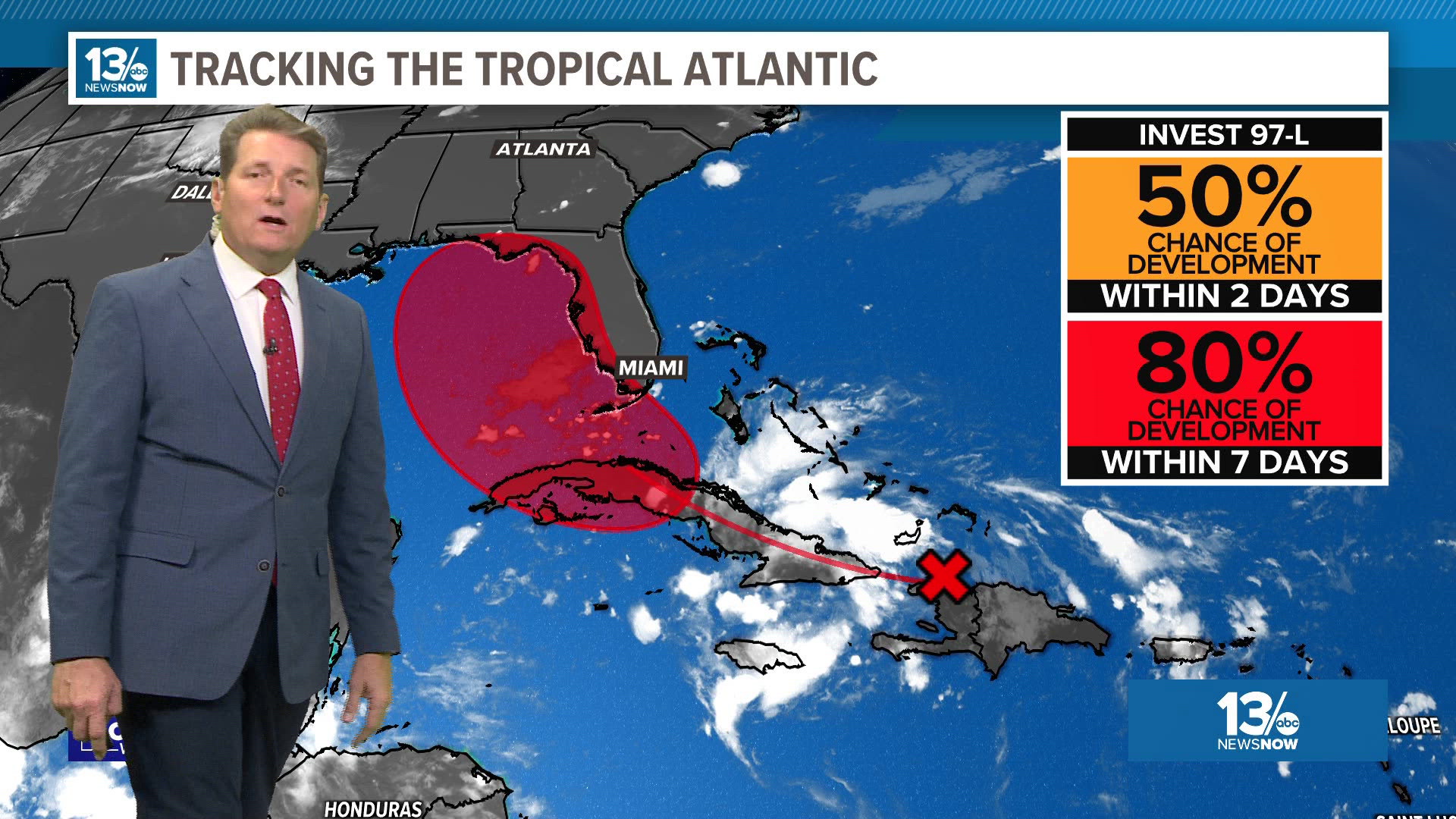
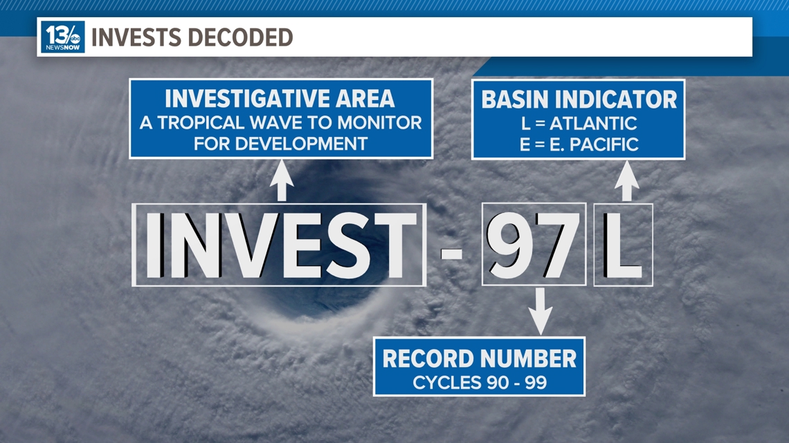
The National Hurricane Center has identified Invest 97-L for potential development as it continues moving westward towards the northern Cuban coast Friday.

The disturbance has difficulty ramping up so far, but that appears to be changing. We are getting more convection Friday morning associated with the tropical wave, and it will likely get better organized in the coming days.
The environment will be more supportive for development, and the National Hurricane Center shows there is a moderate chance of development over the coming 48 hours, and a high chance over the coming week.

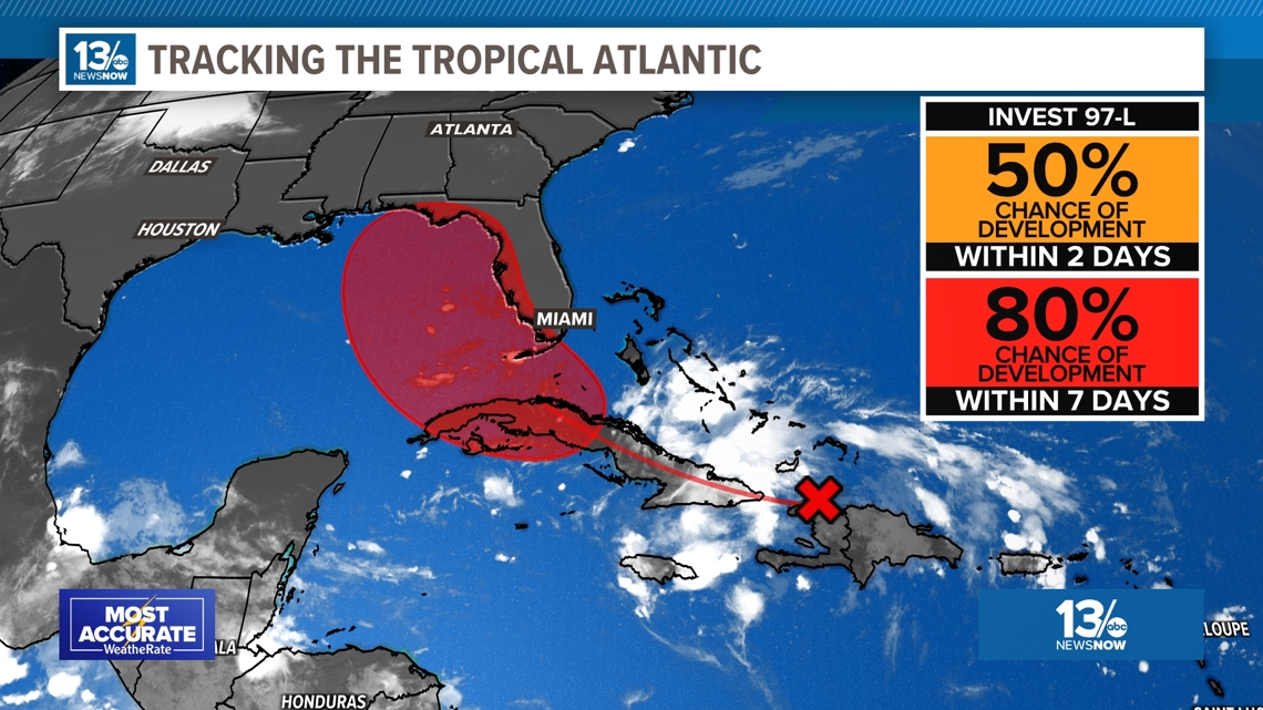
NHC is going with a 80% chance over the next three to seven days. This will continue to head west north-west and if a depression develops, it would most likely be around Cuba or into the eastern Gulf of Mexico.
After that there is still uncertainty. The models are coming into closer agreement with a potential track for the system back over land crossing north Florida and reemerging over the Atlantic Ocean off the southeast coast. Several model solutions move the system to the northeast just off the southeast and Mid-Atlantic coast.

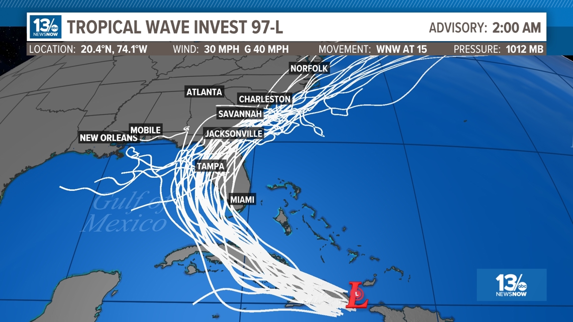
The system could stay off shore with the worst of the system staying out over the water, it could come in over the southeast US and bring more heavy rain to Hampton Roads, it could go elsewhere. These systems and the forecasts typically change quite a bit.
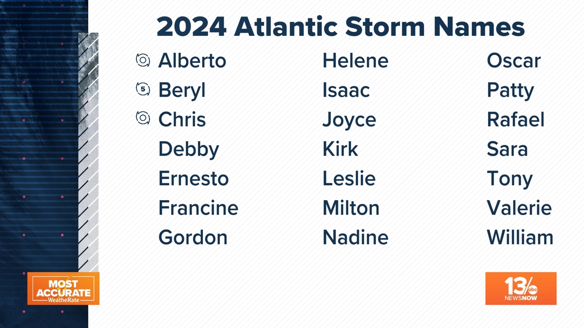
If this storms develops as expected, it will take the name "Debby".

The 13News Now weather team will be monitoring all of this closely. We will be frequently updating the tropical outlooks so check back over the coming days for the latest.