
Meteorologists are watching the tropical Atlantic with extra close attention as the anticipated ramp-up of an already record-setting hurricane season begins, and one budding system is likely to strengthen into the next named storm of 2020 by this weekend.
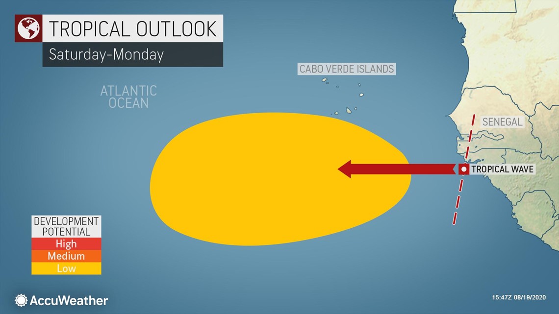
A tropical disturbance located about 1,000 miles to the east of the Lesser Antilles was showing early signs of getting better organized on Wednesday with the development of a high altitude cloud shield spiral.
The spiral of clouds aloft indicates that the upper part of the atmosphere is setting up to "vent" thunderstorms erupting just above the surface of the sea. When thunderstorms are well-vented they can become intense. Forecasters say that when thunderstorms cluster around the center of the system, and that cluster begins to rotate, a tropical depression will be born.
"Since there were still some competing centers of circulation as of Wednesday morning, formation of a tropical depression may not occur until these merge during late Wednesday, Wednesday night or Thursday in this case," said AccuWeather's top hurricane expert, Dan Kottlowski.

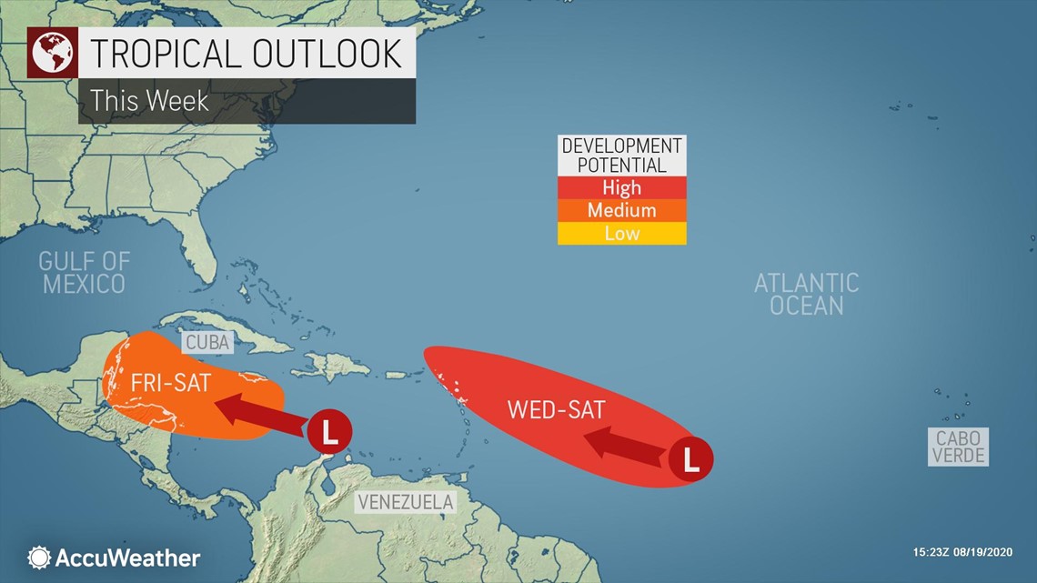
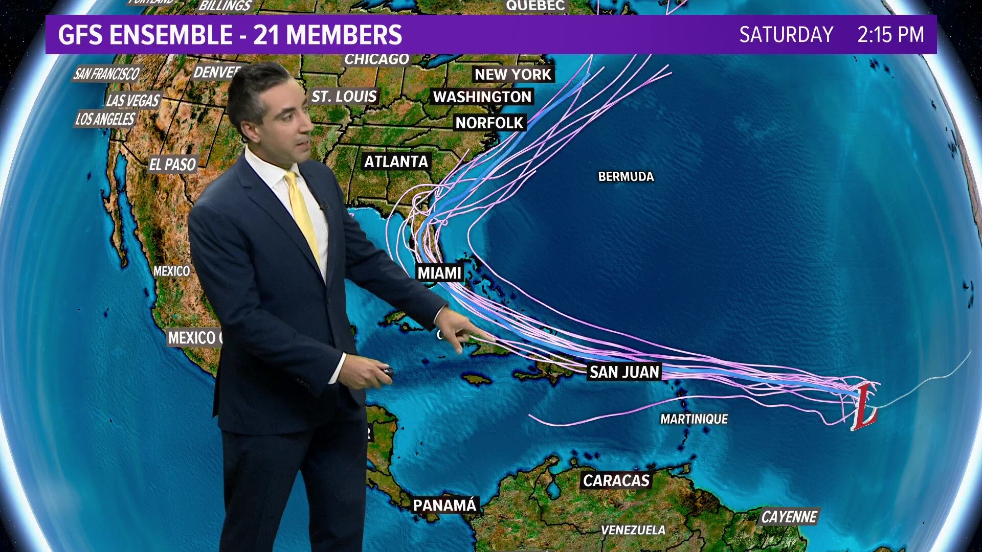
This current mid-ocean feature has a 90% chance of developing into a tropical depression and is most likely to develop first out of the three tropical disturbances now churning over the equatorial Atlantic.
However, even if development does not occur as soon as expected, there will continue to be the risk of development and strengthening this weekend to next week.
Once the circulating winds reach 39 mph or greater, a tropical storm will be given a name. The next name on the 2020 Atlantic list is Laura.
With the likelihood of Laura forming within the next few days, it would shatter the prior "L-storm" early-season formation record, currently held by Luis on Aug. 29, 1995. If the L-storm record is set this season, it would be the ninth early-season formation benchmark set this year with Cristobal, Edouard, Fay, Gonzalo, Hanna, Isaias, Josephine and Kyle now at the top for their designated letters.
Exactly how far north versus south the center forms will, to some extent, determine whether this system passes right over the northern islands of the Caribbean or just to the north or south. But, drenching showers and gusty thunderstorms will extend many miles outward from the center of low pressure.
First in the path of the budding tropical system are the Leeward Islands.

"Regardless of development and exact track, this feature will spread gusty winds and the possibility of periodic heavy rainfall westward over parts of the Leeward Islands from Friday to Saturday," Kottlowski said.
Depending on how quickly the system strengthens will determine whether the conditions are mild, moderate or severe.
People across the northern islands of the Caribbean, as well as the Turks and Caicos, southern Bahamas, the Florida Keys and the southern part of the Florida Peninsula should be prepared for tropical storm conditions, as an average, as the feature moves along with the potential for more significant conditions, depending on exact track and strength of the feature itself.

Should the system track just north of the northern islands of the Caribbean, conditions there may not be severe, but it could allow the center of the storm to strengthen over warm water with minimal impact from the high mountains in Puerto Rico and Hispaniola. Such a scenario could bring damaging conditions to the Turks and Caicos and part of the southern islands of the Bahamas.
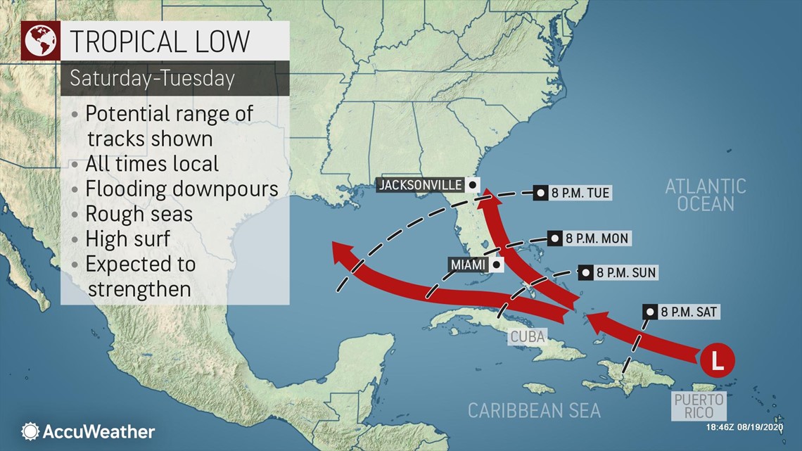
"We expect the system to move across the Florida Straits on Sunday or Monday," Kottlowski said.
"While there is still about a 20 percent chance of the feature turning northward just east of Florida and correspondingly making a run along the Atlantic coast of the United States, the much more likely path at this point is into the Gulf of Mexico next week," Kottlowski stated.
Even though it's not currently predicted, additional strengthening into a hurricane can't be ruled out at this time if it takes a path over the bath-warm waters of the Florida Straits into the Gulf of Mexico.
This forecast is based on the anticipated strengthening and westward extension of the Bermuda-Azores high pressure area. Should the high fail to strengthen and extend westward, there would be room for an earlier northward turn.

There is another player on the long-range weather maps. That is a southward dip in the jet stream over the South Central states and the Gulf of Mexico.
This southern U.S. feature will be at its peak late this week and is forecast to weaken this weekend to next week. How quickly the weakening occurs may determine whether this jet stream dip tugs the tropical system northward or allows it to continue on a west-northwest path through the Gulf.
This same jet stream dip may also play a role in the path of another tropical disturbance that could develop into a tropical depression or storm over the western Caribbean late this week or this weekend.
A third disturbance just emerged from Africa and is forecast to move westward across the Atlantic in the coming days.

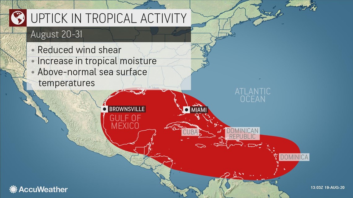
With the 2020 Atlantic hurricane season already way ahead of the average pace and surpassing marks left by the notorious 2005 hurricane season, and the height of the hurricane season looming from the end of August to early October, not only are more records likely to be set, but also there is the likelihood that lives and property will be threatened in the weeks ahead.
The lid could soon come off the Atlantic basin with the potential for multiple named systems spinning at the same time, including multiple threats to lives and property at the same time from the Caribbean to North America.
AccuWeather meteorologists are expecting a hyperactive year for tropical storms and hurricanes -- enough that Greek letters may once again be needed. Due to 2020's record pace and upcoming conditions expected in the basin, AccuWeather meteorologists upped their forecast for the number of tropical storms in late July, with up to 24 now predicted and up to 11 hurricanes projected for the season.
Tropical storms are named for most letters of the alphabet, with the exception of Q, U, X, Y and Z. Beyond that, Greek letters are used to name systems. The infamous 2005 Atlantic hurricane season holds the record for the greatest number of named storms at 28, and 2005 was the only year to use Greek letters.