NORFOLK, Va. — 'Tis the season for crazy temperature swings across Hampton Roads.
Sunday's high at Norfolk International Airport was 43°, while Monday's high reached 69°!
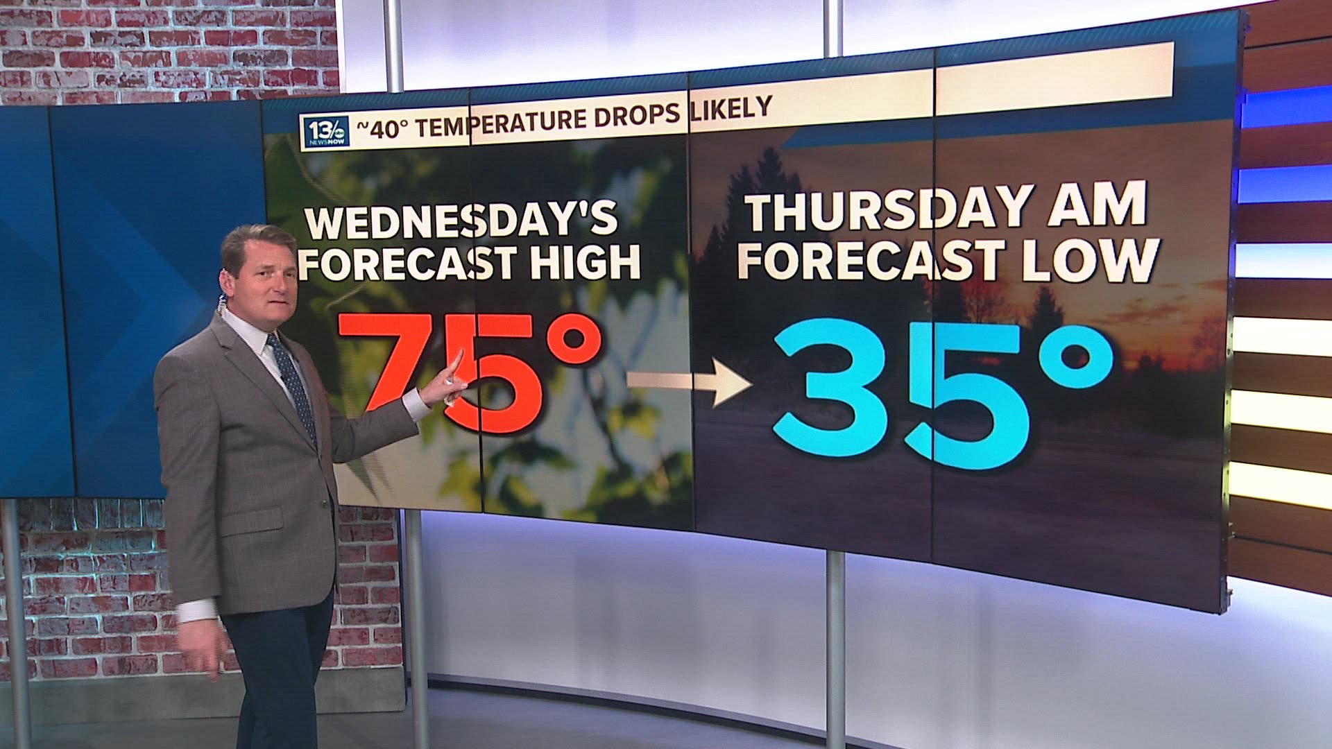
We're enjoying highs in the upper 60s to lower 70s on Tuesday, and many should find highs in the mid-70s for Wednesday. But just as quickly as it warmed up, temperatures are going to tumble into Thursday.
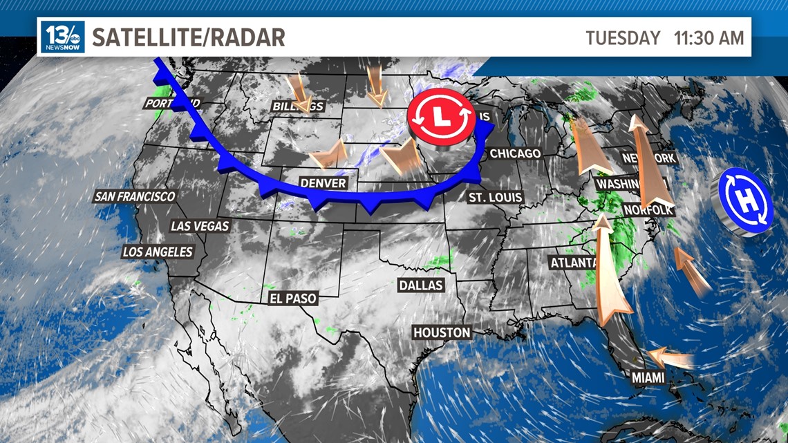
A strong cold front dropped temperatures Tuesday morning by 40-50 degrees across parts of Montana and the Dakotas from what they experienced Monday morning. That front will work eastward through the Mid-Atlantic and eventually drop temperatures from the mid-70s on Wednesday back into the upper 40s on Thursday.
The temperature will likely be around 40° colder Thursday morning than what we reach Wednesday afternoon.


That may sound pretty dramatic, but let's consider the biggest 24-hour temperature drop in U.S. history: that record was set in Browning, Montana, on January 23-24th, 1916. A cold front lowered temperatures from 44° to -56°, a 100° drop!
The biggest 24-hour temperature increase wasn't produced by a passing front, it was caused by a Chinook wind.
On Jan 14, 1972, Loma Montana had a 9 a.m. temperature of -54°. The following morning with a Chinook wind blowing down the mountains, the 8 a.m. temperature warmed to 49°. The 24-hour temperature change at Loma was a jaw-dropping 103°!
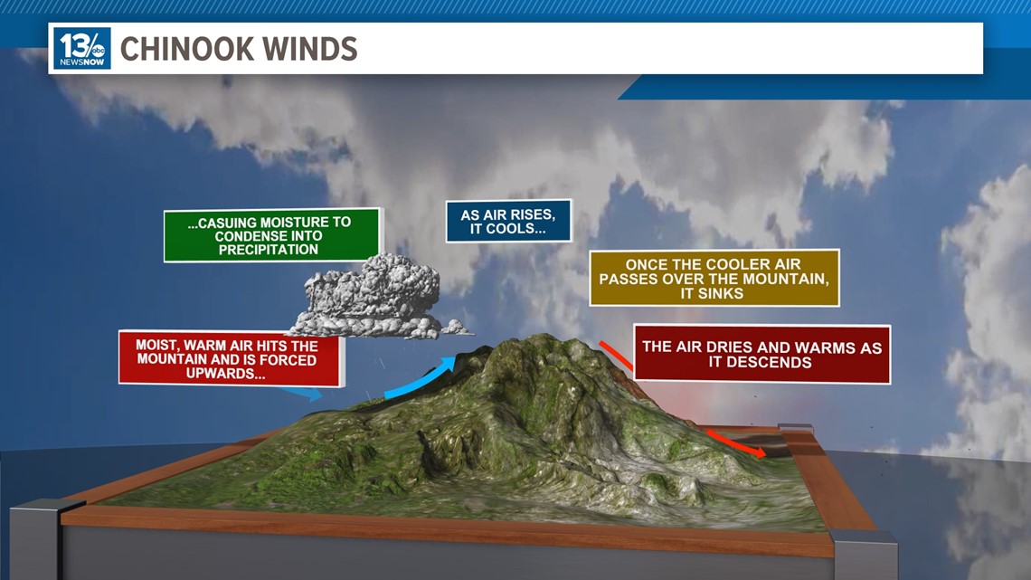
Chinook winds produce warmer conditions on the leeward side of mountains. The dry air descends, compresses, and heats as it moves down into the lower elevations.
A Chinook wind was also responsible for the biggest rapid weather change in the U.S. In January of 1943, Spearfish, South Dakota, had a Chinook wind warm temperatures 49 degrees in two minutes! After the wind passed, cooler air quickly returned. Within the following 27 minutes, the temperature dropped back down 58 degrees.


When you consider these extreme events, our weather changes seem much more manageable.
Stay tuned to 13News Now for updates on the approaching cold front and its impact on our region.

