WASHINGTON — All kinds of misinformation can spread fast on social media. Since the recent devastating wildfires have been a hot topic online, conspiracy theories have come out of the woodwork. That's why the Verify team works to tell fact from fiction.
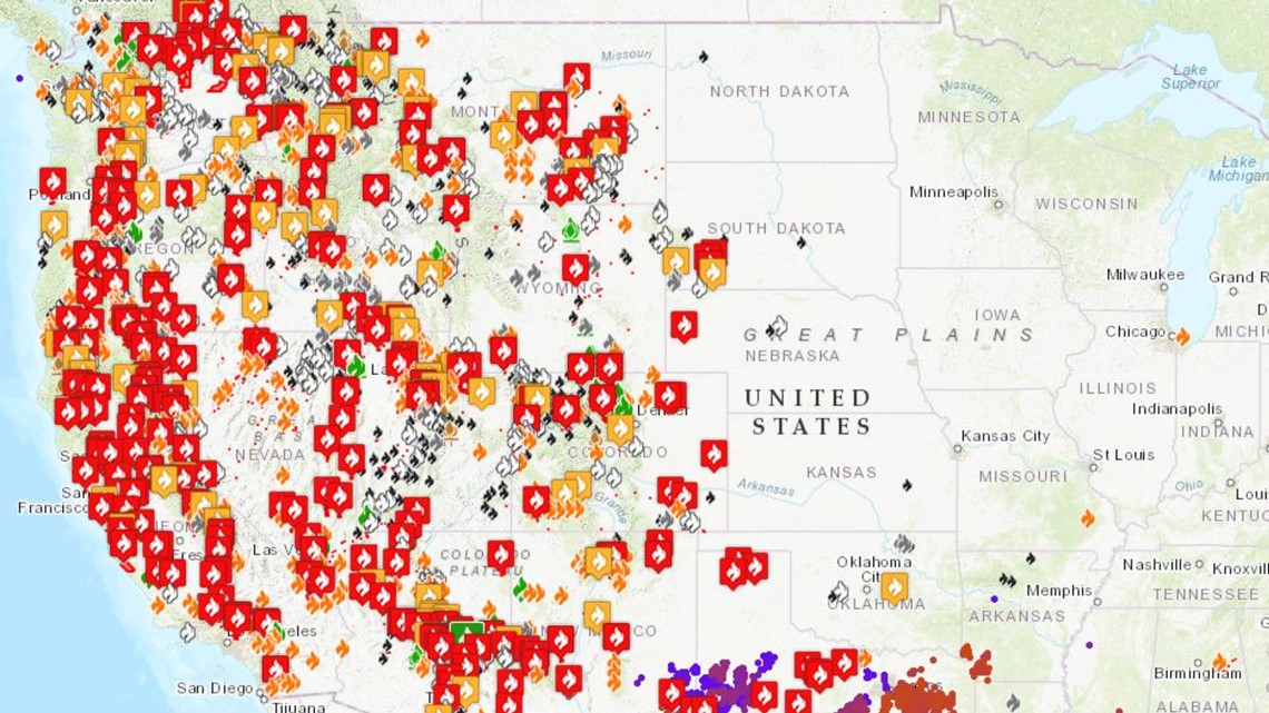
QUESTION: Do these wildfire maps prove that the fires mysteriously vanish north of the United States-Canada border?
ANSWER: No, the fires don't stop at the border.
Many online wildfire maps pull data from government agencies, and therefore only display information for the United States.
SOURCE:
Jennifer Marlon, Ph.D., Research Scientist and Lecturer at Yale's School of Forestry and Environmental Studies and the Yale Program on Climate Change Communication (YPCCC).
A spokesperson for the non-profit FireWeatherAvalanche.org
PROCESS:
A WUSA9 viewer sent us a Facebook post which claims that because this active wildfire map appears to stop at the U.S. border, that means Canada is clear of fires. Many conspiracy theorists online have made this claim as a way to prove that the fires were planned or purposeful.
We tracked down the map that appears in the Facebook post and found it on FireWeatherAvalanche.org, a crisis mapping non-profit that maps various natural disasters.
The Verify team reached out to the organization and was sent a statement through email, which says in part, "our map only maps fires in the 50 US states (excluding Hawaii). Our data is sourced from various governmental agencies only."


Dr. Jennifer Marlon, a forestry researcher at Yale, told us it's very common for mapping databases to only show wildfires in the U.S.
"It depends on where your data set came from," Dr. Marlon says. "You're usually drawing from a data set developed by the government, so it only includes fires burning in the United States."
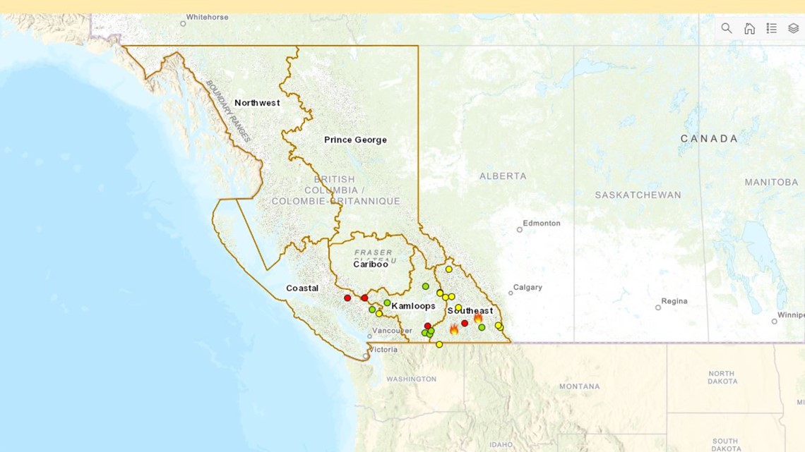
We went a step further and searched out wildfire mapping done by the Canadian government.
The official website of the Province of British Columbia has an interactive wildfire map. They show reports of active wildfires, but notably less than in the western U.S.


So we kept asking questions.
"There can be quite a big difference between temperatures in Canada and temperatures in the U.S., or even between Oregon and Washington," Dr. Marlon explained when we asked why there may be fewer fires blazing over the border. "It's also about the moisture in the air and in the soils, and the moisture in the trees and the vegetation."
Dr. Marlon says that wildfires are fickle. The smallest differences in environments — from temperature to humidity to how dry the leaves are — can have massive effects on how and where fire spreads.
"If you just increase the temperatures locally or you add winds and make them a little bit stronger in a local area, that can actually fan the flames, dry the fuels out and cause the fires to spread further, faster and hotter."
So we can Verify, the claim that these maps prove the western wildfires stop at the Canadian border is false.

