
VIRGINIA BEACH, Va. — Forward-thinking is one way Virginia Beach can be described. City Lead Data Scientist Sridhar Katragadda said the most important part is using next-generation tools.
One of those tools is FloodVISION A-I (Flood Visual Inference of Stage Identification by Observation Networks - Artificial Intelligence), a network of web cameras measuring real-time water levels that started operating in 2022. The cameras are meant to enhance federal flood mitigation efforts.
“We also use sensors to provide water levels," Katragadda said. "All water levels and camera photography is done every six minutes.”
RELATED: Coastal Virginia is sinking about 2 millimeters every year. Could treated wastewater slow it down?
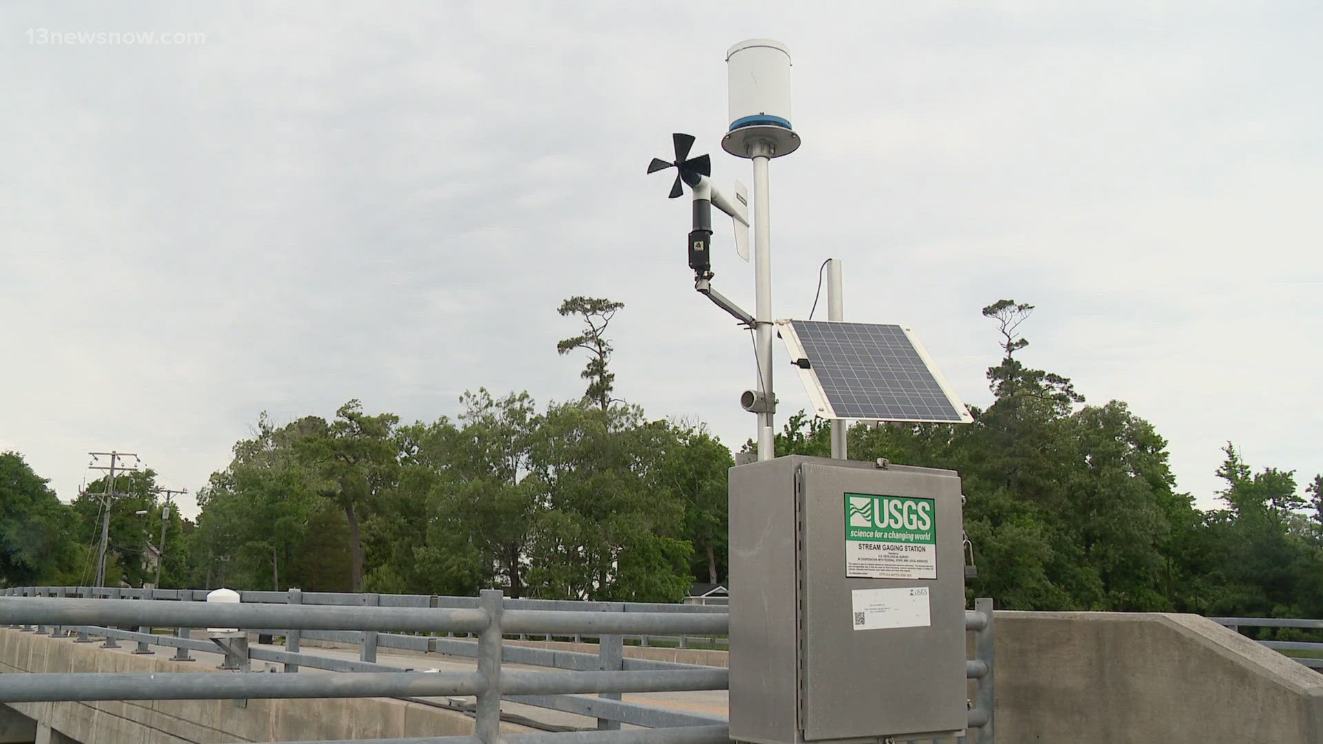
These cameras are located at critical locations to complement existing sensors feeding into StormSense, a network of coastal water-level sensors. Virginia Beach played a key role in establishing StormSense. Since 2017, StormSense has added 50 sensors in addition to the ten United States Geological Survey’s (USGS) tide gauges installed in 2016 in Virginia Beach.
The FloodVISION-AI solution enhances federal flood monitoring efforts with visual confirmation of flooding conditions, helping to translate the visual flood depths to near real-time water level measurements to feed into the USGS National Water Information System (NWIS).
Katragadda said the city has two cameras. One of them sits at the intersection of Pinewood Road and 32nd Street. Incoming data is already painting a clear picture for researchers.
“Over the years, we’re seeing there’s a slow increase in water levels just due to sea level rise but also fluctuations and the impact of the Gulf Stream off coast in the Atlantic,” said Dr. Derek Loftis, a research assistant professor at the College of William & Mary.
This technology helps city officials close down flooded roadways due to storm or rain events. The data helps in developing flood mitigation initiatives.
“It informs long-term city decision-making when they’re looking at future development zones but also potential locations that might be at risk in the future,” Dr. Loftis said.
Recently, the network received state and national awards being seen as a model for innovation. The City was named a winner in the IDC Government Insights’ Smart Cities North America Award (SCNAA) in the Smart Water category for its FloodVISION-AI technology.
FloodVISION-AI was also honored with a 2024 Smart 20 Award by Smart Cities Connect. The Smart 20 Awards annually recognize global smart city projects, honoring the most innovative and influential work.
Katragadda said this network is part of the effort to improve Virginia Beach. He hopes to add weather and pollution sensors soon which would monitor environmental changes.
“So that itself provides us a way to understand the whole urban environment,” he said.