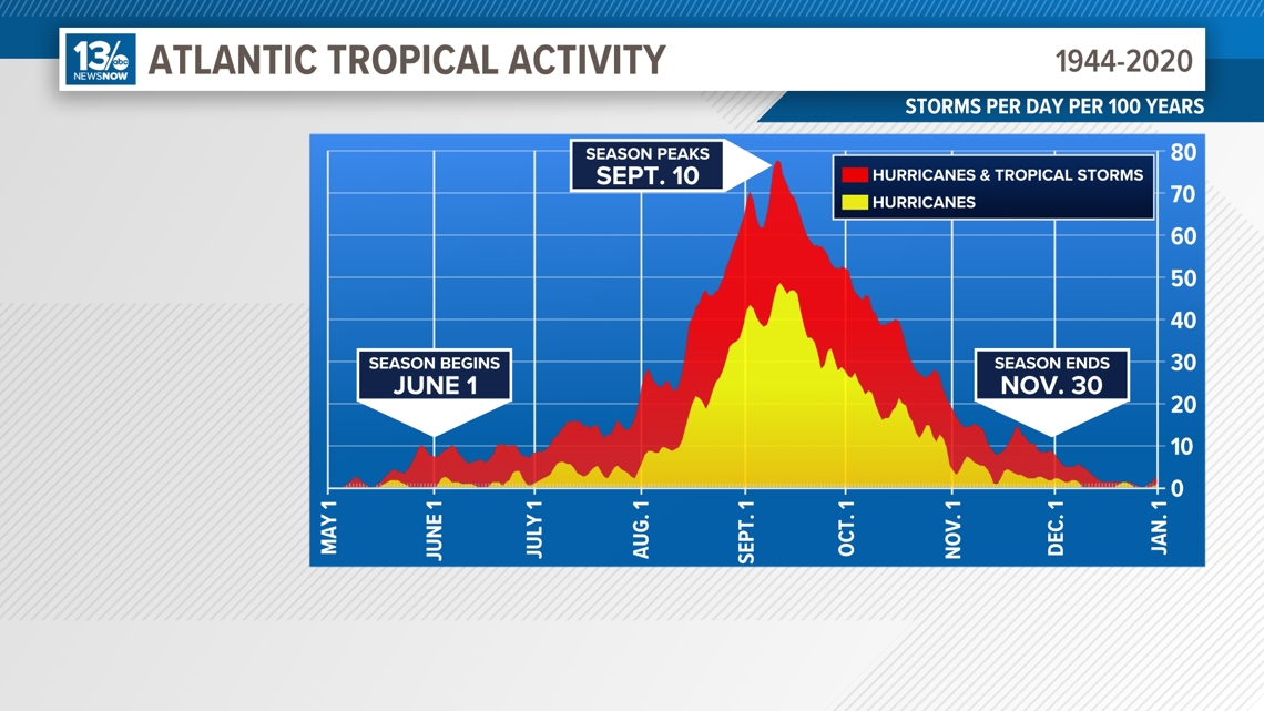
NORFOLK, Va. — The 2024 Atlantic hurricane season is nearing its climatological peak. That's the window of time when the most favorable conditions are present in the Atlantic to produce intense tropical systems.
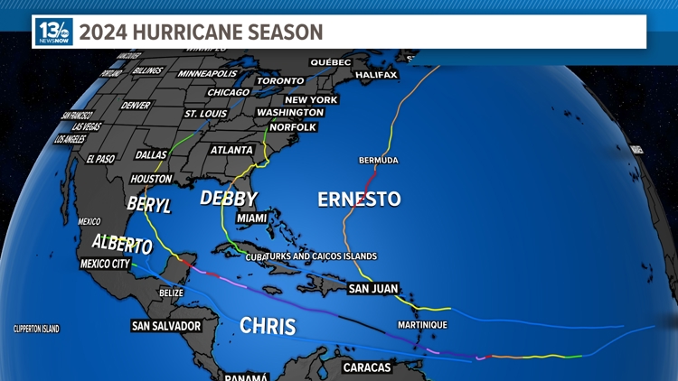
The season got off to a quick start, with Beryl developing out of the deep tropics and strengthening into a Category 5 storm, the earliest on record.
We progressed through the names up to Ernesto, which was named on August 12. Since then, nothing. A prolonged ‘dry’ spell in the Atlantic, literally and figuratively.
So, what’s going on? Is the season a wash? To call a season over when it has only reached its halfway point is silly. There’s still a lot of season to go and climatology tells us that things could turn active quickly in the second half.
Still ... what’s been going on? Where are all the hurricanes? After all, most seasonal outlooks called for a very active season.
Let’s check on the parameters we look at that tend to favor Atlantic tropical development.

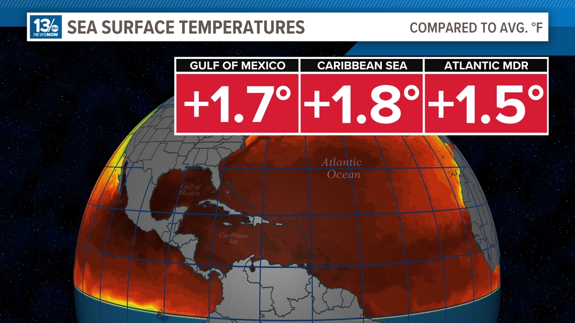
The ocean temperatures we’ve been talking about for months about how they were at record high levels, that remains the case. Plenty of warm water to be used as fuel for developing storms.
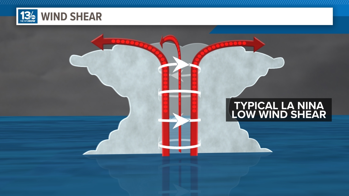
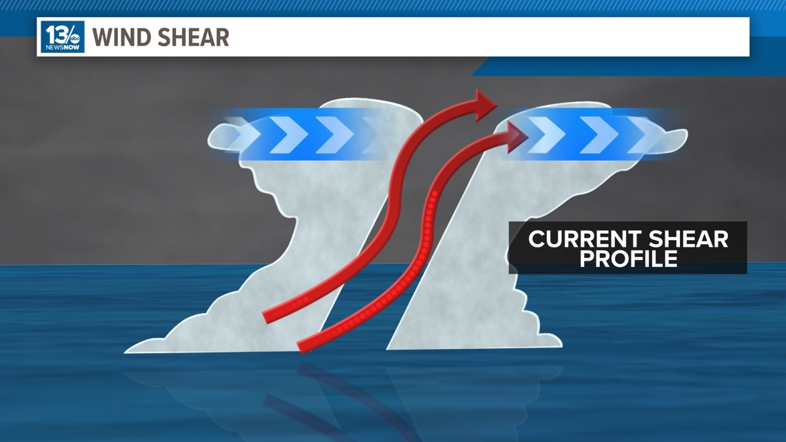
Wind shear, a neutral to developing La Nina ENSO state tends to favor lower wind shear hence keeping storms intact and not disrupting their circulation. However, currently wind shear is running higher than normal.
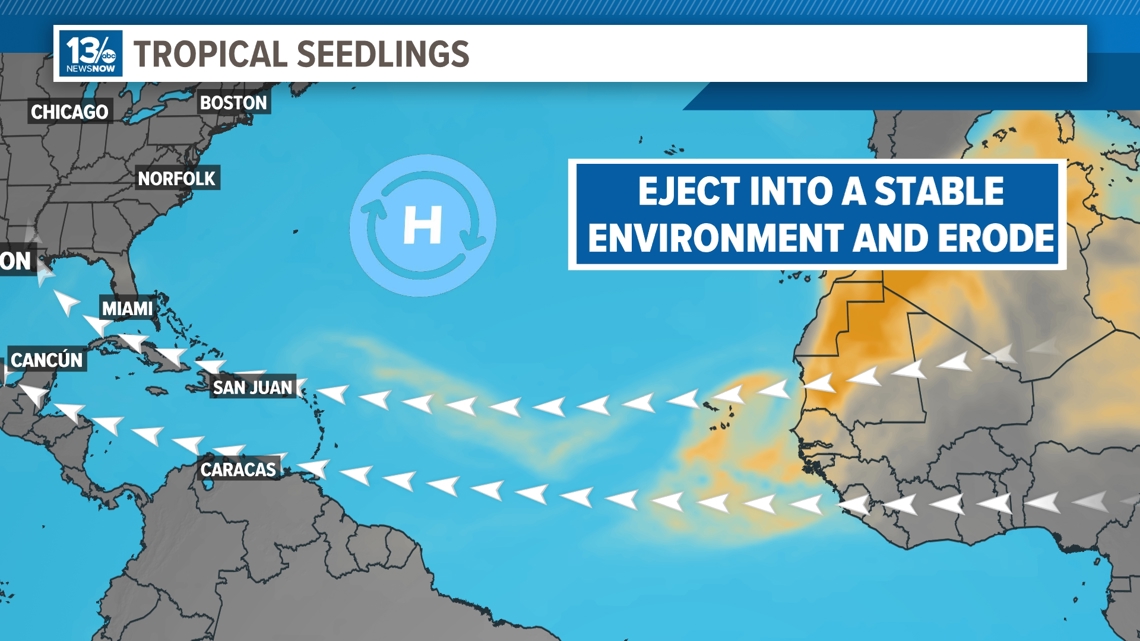
Seeds. We may have a fertile environment for storms, but we need seeds to take advantage of it. Tropical waves emerging off Africa are plentiful but they’re ejecting at too high a latitude, missing the favorable setup farther to the south. They instead are running into dry, stable air that quickly dissipates even the more robust waves.
Lastly, the atmospheric background state. The Madden-Julian Oscillation – this is an atmospheric wave that transits the globe roughly every 2 months, for a while now the Atlantic has been under the waves unfavorable phase, meaning more sinking motion. To sustain tropical waves and develop them the background state needs to be favorable, promoting rising motion. For now, that is not present.
So, there is more working against tropical development in the Atlantic. But for how much longer can that remain the case?
Odds are a favorable MJO phase will build in and the Atlantic will see a period of increased activity. It may happen next week or next month, but as past seasons have shown, we need to stay prepared right through the end of the season, which isn’t until the end of November.