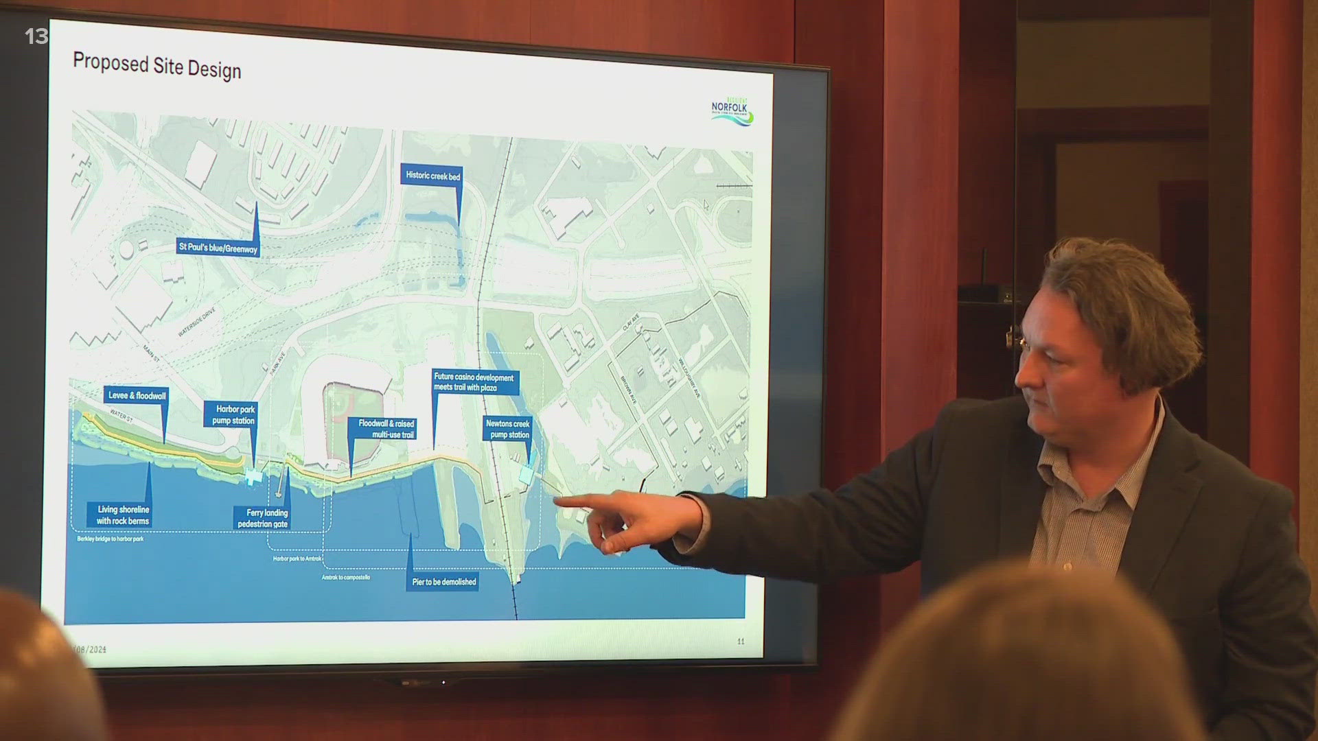
NORFOLK, Va. — Several designs were presented at a public meeting Monday night as part of the Resilient Norfolk Coastal Storm Risk Management Project (CSRM).
The coastal improvements are part of a staggered implementation, with the first section of the city to receive upgrades being the area of Harbor Park and the future casino as well as the South Brambleton area.
Currently, the goal is to build "a system of floodwalls with a levee, surge barriers, and natural and nature-based features, extending from Ghent through downtown connecting to the Ohio Creek Watershed project." Phase 1A focuses on the section of the city from Berkley Bridge to the Chesterfield Heights neighborhood. This section along the Elizabeth River is some of the most vulnerable to storm surges, the U.S. Army Corps of Engineers (USACE) have determined.
The Army Corps proposed raising the existing floodwall by 5.5 feet to 16.5 feet to prepare for intense storm conditions with flood gates that would normally be open but could be closed when needed. There would be elevations in most areas along the Elizabeth River Trail so that runners, bikers and anyone enjoying the trail views would still be able to see the river over the wall.
The future Norfolk casino will also connect to the trail with a plaza, the USACE proposed.
Other additions around the area the USACE proposed include natural berms, living shorelines and potentially pump stations.
You can find the entire slide deck given during the presentation here.

