
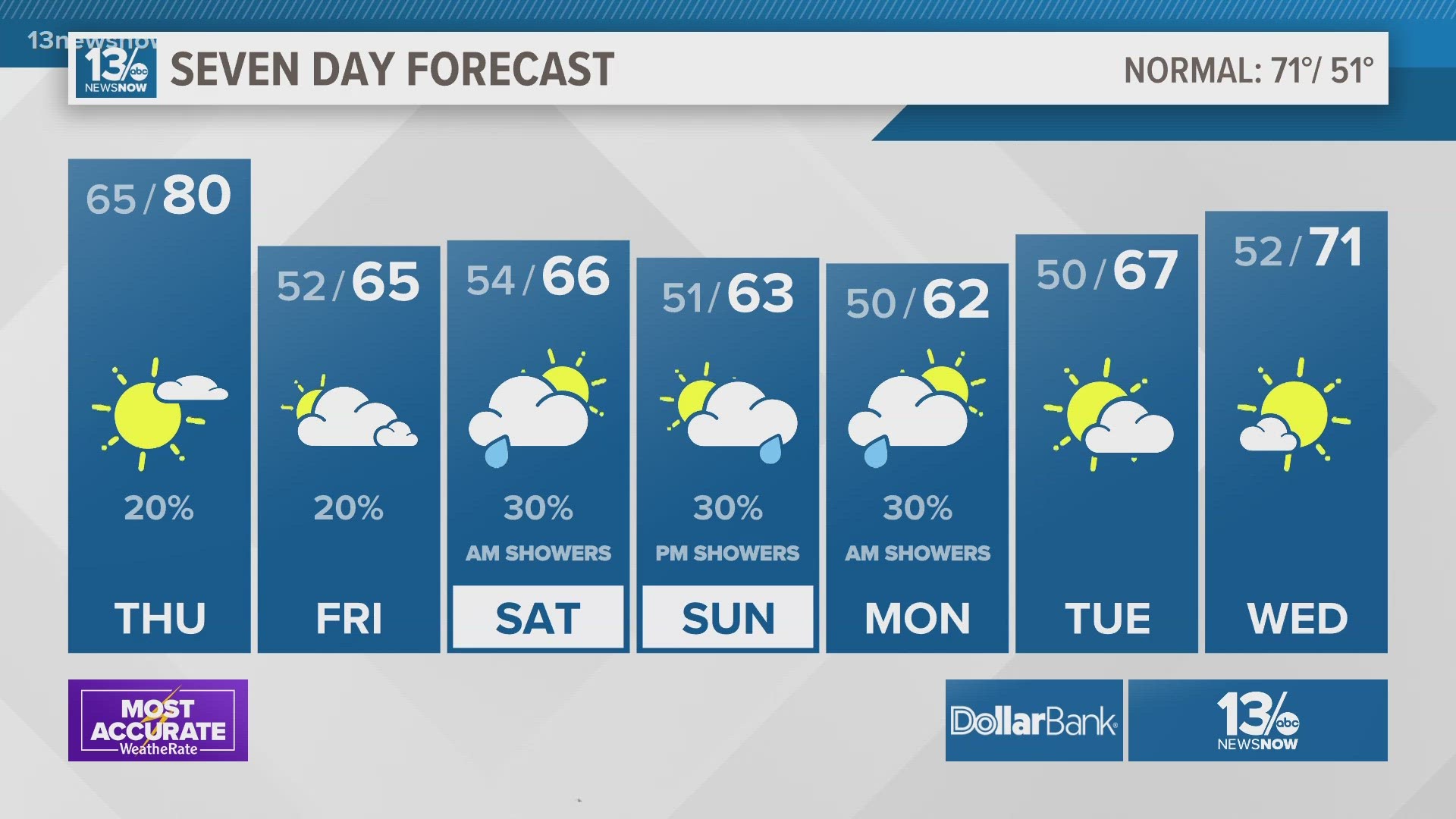
NORFOLK, Va. — The temperature rollercoaster continues for Hampton Roads over the coming days.
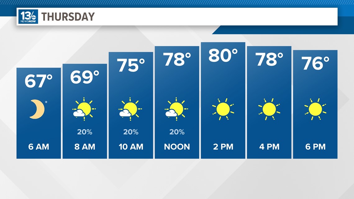
Thick cloud cover will continue through Thursday night with temperatures dropping off to the lower 70s by midnight.
We may squeeze out an isolated shower around dinnertime with slightly higher chances into the overnight. Another mild day is on tap for Thursday with much more sunshine. Highs will climb to upper 70s and lower 80s once again.

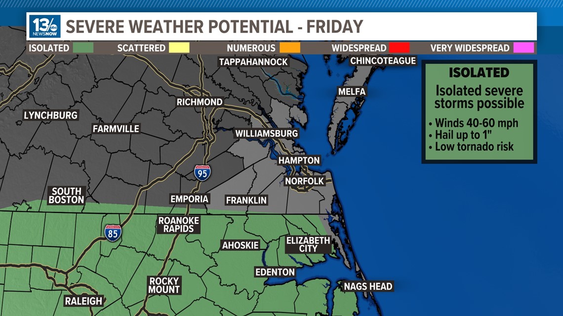
A cold front arrives late Thursday and brings with it a push of cooler air for Friday and into the weekend.
Thunderstorms are possible on Friday, too. A thunderstorm or two could produce some damaging wind gusts and small hail so northeast North Carolina is under a Level 1 (isolated) risk for severe weather to round out the work week.

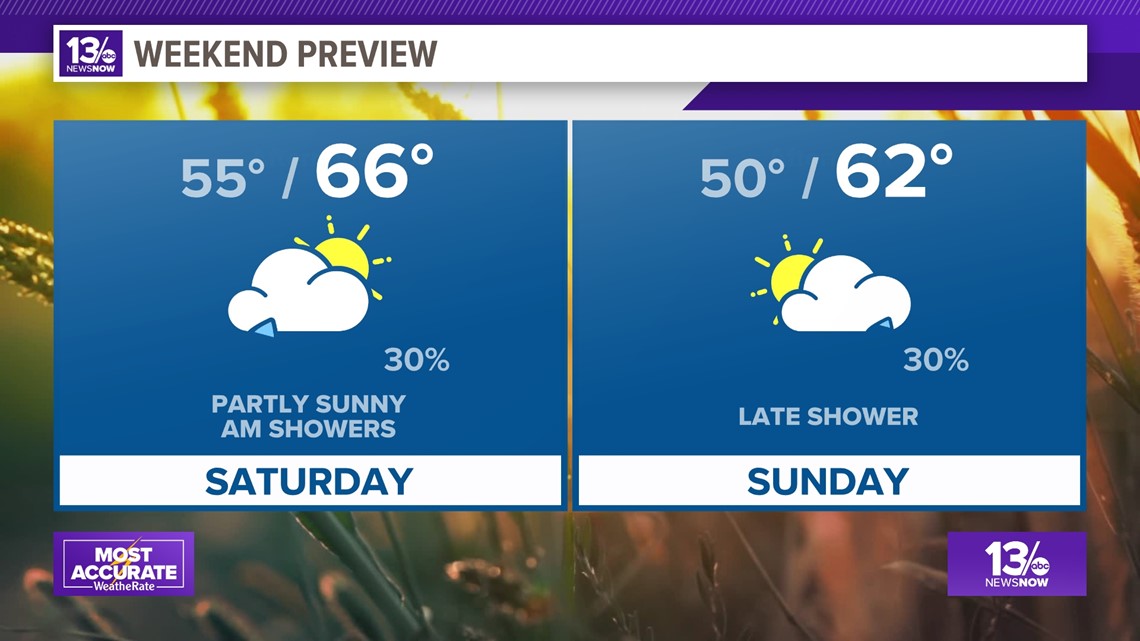
The weekend looks to bring a slightly greater chance of a few showers, and also cooler.

Temperatures really cool down by early next week as highs only make it into the lower 60s, close to 10° below normal. Thankfully on the longer range outlooks, this should be short-lived with a warming trend looming once again.
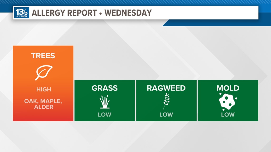
Allergy Report
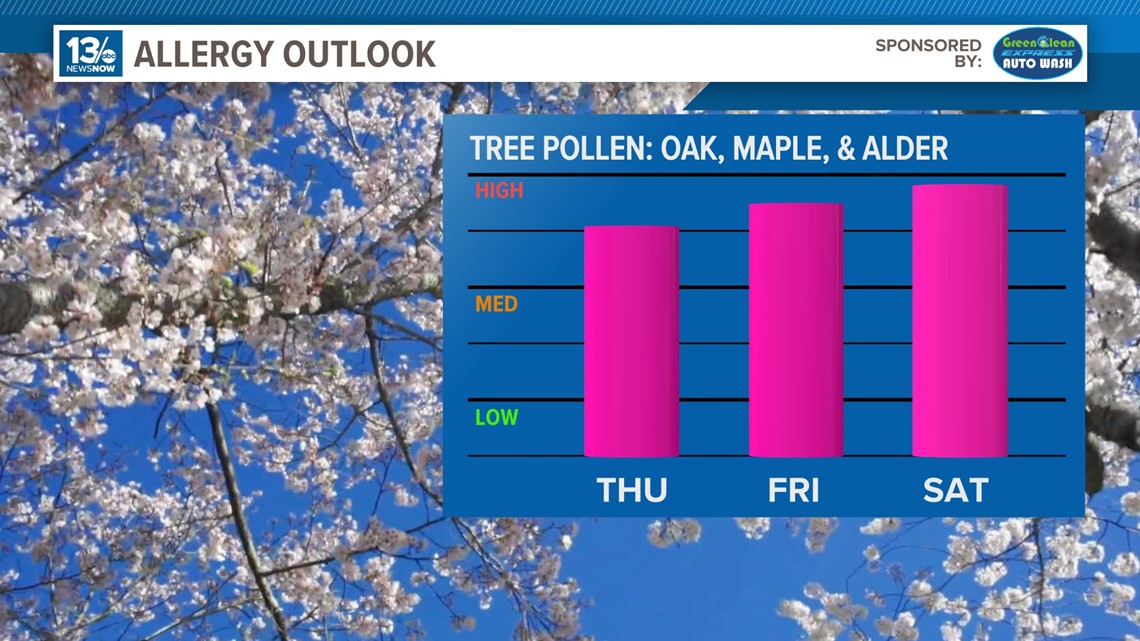
Pollen levels will be high Wednesday with oak, maple, and alder trees as the predominant allergens. Pollen levels are forecast to remain high for the next week.


Stay connected 24/7 via 13News Now